 |
|
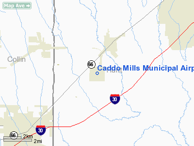
Location & QuickFacts
| FAA Information Effective: | 2008-09-25 |
| Airport Identifier: | 7F3 |
| Airport Status: | Operational |
| Longitude/Latitude: | 096-14-35.3000W/33-02-10.4000N
-96.243139/33.036222 (Estimated) |
| Elevation: | 542 ft / 165.20 m (Surveyed) |
| Land: | 651 acres |
| From nearest city: | 2 nautical miles SW of Caddo Mills, TX |
| Location: | Hunt County, TX |
| Magnetic Variation: | 06E (1985) |
Owner & Manager
| Ownership: | Publicly owned |
| Owner: | City Of Caddo Mills |
| Address: | Po Box 477
Caddo Mills, TX 75135 |
| Phone number: | 903-527-3116 |
| Manager: | Paula Laningham
SOUTHWEST SOARING FBO. |
| Address: | Caddo Mills Municipal Airport
Caddo Mills, TX 75135 |
| Phone number: | 903-527-3124 |
Airport Operations and Facilities
| Airport Use: | Open to public |
| Wind indicator: | Yes |
| Segmented Circle: | Yes |
| Control Tower: | No |
| Lighting Schedule: | DUSK-DAWN
ACTVT MIRL RY 17R/35L - CTAF. |
| Beacon Color: | Clear-Green (lighted land airport) |
| Landing fee charge: | No |
| Sectional chart: | Dallas-ft Worth |
| Region: | ASW - Southwest |
| Boundary ARTCC: | ZFW - Fort Worth |
| Tie-in FSS: | FTW - Fort Worth |
| FSS on Airport: | No |
| FSS Phone: | 817-541-3474 |
| FSS Toll Free: | 1-800-WX-BRIEF |
| NOTAMs Facility: | FTW (NOTAM-d service avaliable) |
| Federal Agreements: | NR |
Airport Communications
| CTAF: | 122.800 |
| Unicom: | 122.800
TRAINING SCHOOL & GLIDER FREQ.- 123.3. |
Airport Services
| Fuel available: | 100LL |
| Airframe Repair: | MAJOR |
| Power Plant Repair: | MAJOR |
| Bottled Oxygen: | NONE |
| Bulk Oxygen: | NONE |
Runway Information
Runway 13/31
| Dimension: | 4000 x 150 ft / 1219.2 x 45.7 m |
| Surface: | CONC, Fair Condition
RY OVERGROWN AND NOT MAINTAINED. |
| Weight Limit: | Single wheel: 26000 lbs. |
| |
Runway 13 |
Runway 31 |
| Longitude: | 096-14-44.0030W | 096-14-11.4180W |
| Latitude: | 33-02-27.1500N | 33-01-58.6390N |
| Elevation: | 542.00 ft | 537.00 ft |
| Alignment: | 127 | 127 |
| Traffic Pattern: | Left | Left |
| Markings: | Basic, Poor Condition
MARKINGS FADED. | Basic, Fair Condition |
| Obstruction: | , 50:1 slope to clear | 30 ft pline, 1145.0 ft from runway, 140 ft left of centerline, 31:1 slope to clear |
|
Runway 17L/35R
| Dimension: | 1400 x 150 ft / 426.7 x 45.7 m |
| Surface: | TURF, Poor Condition
RY OVERGROWN AND NOT MAINTAINED. |
| |
Runway 17L |
Runway 35R |
| Longitude: | 096-14-27.9210W | 096-14-27.9210W |
| Latitude: | 33-02-26.4250N | 33-02-12.5260N |
| Alignment: | 127 | 0 |
| Traffic Pattern: | Left | Left |
| Obstruction: | 15 ft road, 500.0 ft from runway, 33:1 slope to clear | , 50:1 slope to clear |
|
Runway 17R/35L
| Dimension: | 4000 x 75 ft / 1219.2 x 22.9 m |
| Surface: | CONC, Fair Condition
RY OVERGROWN AND NOT MAINTAINED. |
| Weight Limit: | Single wheel: 26000 lbs. |
| Edge Lights: | Medium |
| |
Runway 17R |
Runway 35L |
| Longitude: | 096-14-42.4890W | 096-14-43.3860W |
| Latitude: | 33-02-27.6540N | 33-01-48.0830N |
| Elevation: | 541.00 ft | 535.00 ft |
| Alignment: | 127 | 1 |
| Traffic Pattern: | Left | Left |
| Markings: | Non-precision instrument, Poor Condition
MARKINGS TOTALLY FADED. | Non-precision instrument, Poor Condition
MARKINGS TOTALLY FADED. |
| Obstruction: | 22 ft tree, 660.0 ft from runway, 140 ft left of centerline, 20:1 slope to clear | 10 ft road, 600.0 ft from runway, 40:1 slope to clear |
|
Radio Navigation Aids
| ID |
Type |
Name |
Ch |
Freq |
Var |
Dist |
| MII | NDB | Caddo Mills | | 316.00 | 06E | 0.4 nm |
| SYW | NDB | Cash | | 428.00 | 05E | 9.4 nm |
| AVZ | NDB | Travis | | 260.00 | 06E | 16.6 nm |
| PQF | NDB | Mesquite | | 248.00 | 06E | 19.9 nm |
| JUG | NDB | Jecca | | 388.00 | 06E | 26.5 nm |
| HJM | NDB | Rayburn | | 415.00 | 06E | 34.9 nm |
| LNC | NDB | Lancaster | | 239.00 | 06E | 36.7 nm |
| RBD | NDB | Redbird | | 287.00 | 06E | 38.4 nm |
| XQH | NDB | Cedar Hill | | 353.00 | 08E | 45.7 nm |
| MJF | TACAN | Arvilla | 033X | | 05E | 9.3 nm |
| CVE | VOR/DME | Cowboy | 109X | 116.20 | 06E | 34.5 nm |
| SLR | VOR/DME | Sulphur Springs | 027X | 109.00 | 08E | 36.6 nm |
| TTT | VOR/DME | Maverick | 078X | 113.10 | 06E | 41.5 nm |
| UIM | VOR/DME | Quitman | 087X | 114.00 | 08E | 45.2 nm |
| BYP | VORTAC | Bonham | 093X | 114.60 | 06E | 30.1 nm |
| FUZ | VORTAC | Ranger | 104X | 115.70 | 06E | 48.0 nm |
| DAL | VOT | Dallas Love Field | | 113.30 | | 32.7 nm |
Remarks
- FOR AIRFRAME & POWER PLANT REPAIRS CALL 903-527-3124.
- TURF RY VERY HARD TO DISTINGUISH.
- SAILPLANES USE RY 17L (LEFT TFC) AND RY 35R (RIGHT TFC). POWERED ACFT USE RIGHT TFC FOR RYS 13 & 17R.
- EXTENSIVE GLIDER ACTIVITY ON ARPT.
- RYS 13/31 & 17R/35L HAS GRASS/WEEDS IN CRACKS IN PAVEMENT.
Images and information placed above are from
http://www.airport-data.com/airport/7F3/
We thank them for the data!
| General Info
|
| Country |
United States
|
| State |
TEXAS
|
| FAA ID |
7F3
|
| Latitude |
33-02-10.400N
|
| Longitude |
096-14-35.300W
|
| Elevation |
542 feet
|
| Near City |
CADDO MILLS
|
We don't guarantee the information is fresh and accurate. The data may
be wrong or outdated.
For more up-to-date information please refer to other sources.
|
|


