 |
|
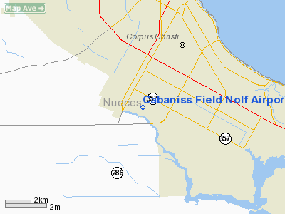
Cabaniss Field Nolf Airport |
Location & QuickFacts
| FAA Information Effective: | 2008-09-25 |
| Airport Identifier: | NGW |
| Airport Status: | Operational |
| Longitude/Latitude: | 097-26-04.0000W/27-42-01.0000N
-97.434444/27.700278 (Estimated) |
| Elevation: | 30 ft / 9.14 m (Estimated) |
| Land: | 0 acres |
| From nearest city: | 3 nautical miles SW of Corpus Christi, TX |
| Location: | Nueces County, TX |
| Magnetic Variation: | 07E (1985) |
Owner & Manager
| Ownership: | Navy owned |
| Owner: | Us Navy |
| Address: | Oceanographic Ofc - Code 3142
Washington, DC 20373 |
| Address: |
|
Airport Operations and Facilities
| Airport Use: | Private |
| Segmented Circle: | No |
| Control Tower: | Yes |
| Sectional chart: | Brownsville |
| Region: | ASW - Southwest |
| Boundary ARTCC: | ZHU - Houston |
| Tie-in FSS: | SJT - San Angelo |
| FSS on Airport: | No |
| FSS Toll Free: | 1-800-WX-BRIEF |
| NOTAMs Facility: | SJT (NOTAM-d service avaliable) |
Airport Services
| Bottled Oxygen: | NONE |
| Bulk Oxygen: | NONE |
Runway Information
Runway 13/31
| Dimension: | 5000 x 150 ft / 1524.0 x 45.7 m |
| Surface: | ASPH-CONC, |
| Pavement Class: | 13 /F/C/W/T |
| Edge Lights: | High |
| |
Runway 13 |
Runway 31 |
| Traffic Pattern: | Left | Left |
| Arresting: | E5 | |
|
Runway 17/35
| Dimension: | 5000 x 150 ft / 1524.0 x 45.7 m |
| Surface: | ASPH-CONC, |
| Pavement Class: | 9 /F/C/W/T |
| Edge Lights: | High |
| |
Runway 17 |
Runway 35 |
| Traffic Pattern: | Left | Left |
| Arresting: | E5 | |
| Displaced threshold: | 500.00 ft | 0.00 ft |
|
Radio Navigation Aids
| ID |
Type |
Name |
Ch |
Freq |
Var |
Dist |
| RKP | NDB | Rockport | | 391.00 | 06E | 31.2 nm |
| TKB | NDB | Kleberg County | | 347.00 | 06E | 35.1 nm |
| MNO | NDB | Mellon Ranch | | 375.00 | 06E | 36.9 nm |
| BEA | NDB | Beeville | | 284.00 | 07E | 44.5 nm |
| BKS | NDB | Brooks County | | 353.00 | 06E | 47.2 nm |
| NQI | TACAN | Kingsville | 125X | | 09E | 23.2 nm |
| NOG | TACAN | Orange Grove | 063X | | 09E | 34.4 nm |
| ALI | VOR | Alice | | 114.50 | 06E | 31.3 nm |
| NGP | VORTAC | Truax | 087X | 114.00 | 06E | 7.5 nm |
| CRP | VORTAC | Corpus Christi | 102X | 115.50 | 09E | 12.2 nm |
Remarks
- RSTD: NAVY TRNG ONLY.
- MISC: TWY UNLGT 1400-0500Z++ MON-FRI.
- CAUTION: IF EQUIPPED ALL ACFT SHALL UTILIZE UHF ATC FREQS UNLESS ASSIGNED VHF.
Images and information placed above are from
http://www.airport-data.com/airport/NGW/
We thank them for the data!
| General Info
|
| Country |
United States
|
| State |
TEXAS
|
| FAA ID |
NGW
|
| Latitude |
27-42-01.000N
|
| Longitude |
097-26-04.000W
|
| Elevation |
30 feet
|
| Near City |
CORPUS CHRISTI
|
We don't guarantee the information is fresh and accurate. The data may
be wrong or outdated.
For more up-to-date information please refer to other sources.
|
|


