 |
|
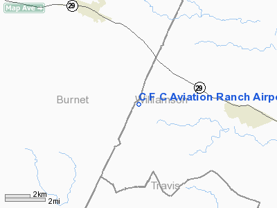
C F C Aviation Ranch Airport |
Location & QuickFacts
| FAA Information Effective: | 2008-09-25 |
| Airport Identifier: | XS12 |
| Airport Status: | Operational |
| Longitude/Latitude: | 098-01-03.0670W/30-40-33.6760N
-98.017519/30.676021 (Estimated) |
| Elevation: | 1161 ft / 353.87 m (Estimated) |
| Land: | 0 acres |
| From nearest city: | 5 nautical miles SE of Liberty Hill, TX |
| Location: | Burnet County, TX |
| Magnetic Variation: | 07E (1985) |
Owner & Manager
| Ownership: | Privately owned |
| Owner: | Crystal Fingers Corp. (usa) |
| Address: | Rt 2 Box 127f
Liberty Hill, TX 78642 |
| Phone number: | 512-355-3156 |
| Manager: | Susan Nilsson |
| Address: | Rt 2 Box 127f
Liberty Hill, TX 78642 |
| Phone number: | 512-355-3156 |
Airport Operations and Facilities
| Airport Use: | Private |
| Segmented Circle: | No |
| Control Tower: | No |
| Sectional chart: | San Antonio |
| Region: | ASW - Southwest |
| Boundary ARTCC: | ZHU - Houston |
| Tie-in FSS: | SJT - San Angelo |
| FSS on Airport: | No |
| FSS Toll Free: | 1-800-WX-BRIEF |
Runway Information
Runway 10/28
| Dimension: | 3000 x 25 ft / 914.4 x 7.6 m |
| Surface: | ASPH, |
| |
Runway 10 |
Runway 28 |
| Traffic Pattern: | Left | Left |
| Obstruction: | 50 ft wire, 100.0 ft from runway | 50 ft wire, 100.0 ft from runway |
|
Helipad H1
| Dimension: | 200 x 40 ft / 61.0 x 12.2 m |
| Surface: | DIRT, |
| |
Runway H1 |
Runway |
| Traffic Pattern: | Left | Left |
|
Radio Navigation Aids
| ID |
Type |
Name |
Ch |
Freq |
Var |
Dist |
| BMQ | NDB | Burnet | | 341.00 | 07E | 11.9 nm |
| GUO | NDB | Georgetown | | 332.00 | 06E | 17.5 nm |
| MFS | NDB | Horseshoe Bay Resort | | 403.00 | 07E | 19.9 nm |
| IL | NDB | Iresh | | 278.00 | 07E | 26.3 nm |
| GR | NDB | Starn | | 323.00 | 07E | 30.4 nm |
| HLR | NDB | Hood | | 347.00 | 07E | 31.5 nm |
| GRK | VOR/DME | Gray | 055X | 111.80 | 07E | 23.9 nm |
| TPL | VOR/DME | Temple | 041X | 110.40 | 09E | 44.3 nm |
| CWK | VORTAC | Centex | 075X | 112.80 | 06E | 30.9 nm |
| LZZ | VORTAC | Lampasas | 072X | 112.50 | 08E | 31.3 nm |
| LLO | VORTAC | Llano | 019X | 108.20 | 08E | 40.4 nm |
| STV | VORTAC | Stonewall | 085X | 113.80 | 08E | 45.5 nm |
Images and information placed above are from
http://www.airport-data.com/airport/XS12/
We thank them for the data!
| General Info
|
| Country |
United States
|
| State |
TEXAS
|
| FAA ID |
XS12
|
| Latitude |
30-40-33.676N
|
| Longitude |
098-01-03.067W
|
| Elevation |
1161 feet
|
| Near City |
LIBERTY HILL
|
We don't guarantee the information is fresh and accurate. The data may
be wrong or outdated.
For more up-to-date information please refer to other sources.
|
|


