 |
|
Burnet Muni Kate Craddock Field Airport |
Burnet Municipal Airport
Kate Craddock Field |
| IATA: none – ICAO: KBMQ – FAA LID: BMQ |
| Summary |
| Airport type |
Public |
| Owner |
City of Burnet |
| Serves |
Burnet, Texas |
| Elevation AMSL |
1,284 ft / 391 m |
| Coordinates |
30°44′20″N 098°14′19″W / 30.73889°N 98.23861°W / 30.73889; -98.23861 |
| Website |
www.cityofburnet.com/... |
| Runways |
| Direction |
Length |
Surface |
| ft |
m |
| 1/19 |
5,000 |
1,524 |
Asphalt |
| Statistics (2007) |
| Aircraft operations |
31,200 |
| Based aircraft |
43 |
| Source: Federal Aviation Administration |
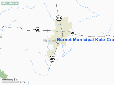
Burnet Municipal Airport (ICAO: KBMQ, FAA LID: BMQ), also known as Kate Craddock Field, is a city-owned public-use airport located one nautical mile (1.85 km) southwest of the central business district of Burnet, a city in Burnet County, Texas, United States.
Although most U.S. airports use the same three-letter location identifier for the FAA and IATA, this airport is assigned BMQ by the FAA but has no designation from the IATA (which assigned BMQ to Bamburi, Kenya).
Facilities and aircraft
Burnet Municipal Airport covers an area of 143 acres (58 ha) at an elevation of 1,284 feet (391 m) above mean sea level. It has one asphalt paved runway designated 1/19 which measures 5,000 by 75 feet (1,524 x 23 m).
The lighted runway, with a full length taxiway, has two instrument approaches and can accommodate aircraft with up to 30,000 pounds (14,000 kg) per wheel. Faulkner's Air Shop is the fixed base operator (FBO). Avgas and jet fuel are available.
For the 12-month period ending September 5, 2007, the airport had 31,200 aircraft operations, an average of 85 per day: 98% general aviation and 2% military. At that time there were 43 aircraft based at this airport: 93% single-engine and 7% multi-engine.
The above content comes from Wikipedia and is published under free licenses – click here to read more.
Location & QuickFacts
| FAA Information Effective: | 2008-09-25 |
| Airport Identifier: | BMQ |
| Airport Status: | Operational |
| Longitude/Latitude: | 098-14-18.9968W/30-44-20.1410N
-98.238610/30.738928 (Estimated) |
| Elevation: | 1284 ft / 391.36 m (Surveyed) |
| Land: | 143 acres |
| From nearest city: | 1 nautical miles SW of Burnet, TX |
| Location: | Burnet County, TX |
| Magnetic Variation: | 07E (1985) |
Owner & Manager
| Ownership: | Publicly owned |
| Owner: | City Of Burnet |
| Address: | Po Box 1369
Burnet, TX 78611 |
| Phone number: | 512-756-6093 |
| Manager: | Crista Bromley |
| Address: | Po Box 1369
Burnet, TX 78611 |
| Phone number: | 512-756-6093
EXT 217. |
Airport Operations and Facilities
| Airport Use: | Open to public |
| Wind indicator: | Yes |
| Segmented Circle: | Yes |
| Control Tower: | No |
| Lighting Schedule: | DUSK-DAWN
MIRL RY 01/19 PRESET LOW INTST; TO INCR INTST & ACTVT PAPI & REIL RYS 01 & 19 - CTAF. |
| Beacon Color: | Clear-Green (lighted land airport) |
| Landing fee charge: | No |
| Sectional chart: | San Antonio |
| Region: | ASW - Southwest |
| Boundary ARTCC: | ZHU - Houston |
| Tie-in FSS: | SJT - San Angelo |
| FSS on Airport: | No |
| FSS Toll Free: | 1-800-WX-BRIEF |
| NOTAMs Facility: | BMQ (NOTAM-d service avaliable) |
| Federal Agreements: | NGY |
Airport Communications
| CTAF: | 122.800 |
| Unicom: | 122.800 |
Airport Services
| Fuel available: | 100LLA |
| Airframe Repair: | MAJOR |
| Power Plant Repair: | MAJOR |
| Bottled Oxygen: | NONE |
| Bulk Oxygen: | NONE |
Runway Information
Runway 01/19
| Dimension: | 5000 x 75 ft / 1524.0 x 22.9 m |
| Surface: | ASPH, Good Condition |
| Weight Limit: | Single wheel: 30000 lbs. |
| Edge Lights: | Medium |
| |
Runway 01 |
Runway 19 |
| Longitude: | 098-14-26.9586W | 098-14-11.0340W |
| Latitude: | 30-43-56.3742N | 30-44-43.9076N |
| Elevation: | 1259.00 ft | 1284.00 ft |
| Alignment: | 16 | 127 |
| Traffic Pattern: | Right | Left |
| Markings: | Non-precision instrument, Good Condition | Non-precision instrument, Good Condition |
| VASI: | 4-light PAPI on left side | 4-light PAPI on left side |
| Runway End Identifier: | Yes | Yes |
| Obstruction: | 32 ft pline, 1300.0 ft from runway, 34:1 slope to clear | 50 ft trees, 970.0 ft from runway, 250 ft right of centerline, 15:1 slope to clear |
|
Radio Navigation Aids
| ID |
Type |
Name |
Ch |
Freq |
Var |
Dist |
| BMQ | NDB | Burnet | | 341.00 | 07E | 0.1 nm |
| MFS | NDB | Horseshoe Bay Resort | | 403.00 | 07E | 14.4 nm |
| GUO | NDB | Georgetown | | 332.00 | 06E | 29.1 nm |
| GR | NDB | Starn | | 323.00 | 07E | 31.8 nm |
| IL | NDB | Iresh | | 278.00 | 07E | 32.3 nm |
| HLR | NDB | Hood | | 347.00 | 07E | 35.9 nm |
| GRK | VOR/DME | Gray | 055X | 111.80 | 07E | 28.2 nm |
| LZZ | VORTAC | Lampasas | 072X | 112.50 | 08E | 27.3 nm |
| LLO | VORTAC | Llano | 019X | 108.20 | 08E | 28.6 nm |
| STV | VORTAC | Stonewall | 085X | 113.80 | 08E | 40.1 nm |
| CWK | VORTAC | Centex | 075X | 112.80 | 06E | 42.6 nm |
Remarks
Images and information placed above are from
http://www.airport-data.com/airport/BMQ/
We thank them for the data!
| General Info
|
| Country |
United States
|
| State |
TEXAS
|
| FAA ID |
BMQ
|
| Latitude |
30-44-20.200N
|
| Longitude |
098-14-18.900W
|
| Elevation |
1283 feet
|
| Near City |
BURNET
|
We don't guarantee the information is fresh and accurate. The data may
be wrong or outdated.
For more up-to-date information please refer to other sources.
|
|


