 |
|
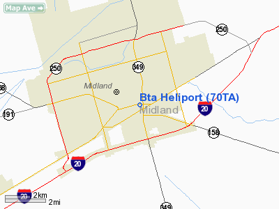
Location & QuickFacts
| FAA Information Effective: | 2008-09-25 |
| Airport Identifier: | 70TA |
| Airport Status: | Operational |
| Longitude/Latitude: | 102-04-50.4940W/31-59-48.4440N
-102.080693/31.996790 (Estimated) |
| Elevation: | 2815 ft / 858.01 m (Estimated) |
| Land: | 0 acres |
| From nearest city: | 0 nautical miles N of Midland, TX |
| Location: | Midland County, TX |
| Magnetic Variation: | 09E (1985) |
Owner & Manager
| Ownership: | Privately owned |
| Owner: | Bta Oil Producers |
| Address: | 104 S. Pecos
Midland, TX 79701 |
| Phone number: | 915-682-3753 |
| Manager: | Midland Helicopter Inc. |
| Address: | 104 S. Pecos
Midland, TX 79701 |
| Phone number: | 915-682-3753 |
Airport Operations and Facilities
| Airport Use: | Private |
| Wind indicator: | No |
| Segmented Circle: | No |
| Control Tower: | No |
| Landing fee charge: | No |
| Sectional chart: | San Antonio |
| Region: | ASW - Southwest |
| Boundary ARTCC: | ZFW - Fort Worth |
| Tie-in FSS: | SJT - San Angelo |
| FSS on Airport: | No |
| FSS Toll Free: | 1-800-WX-BRIEF |
Runway Information
Helipad H1
| Dimension: | 150 x 150 ft / 45.7 x 45.7 m |
| Surface: | MATS,
STEEL ROOFTOP. |
| |
Runway H1 |
Runway |
| Traffic Pattern: | Left | Left |
|
Radio Navigation Aids
| ID |
Type |
Name |
Ch |
Freq |
Var |
Dist |
| MA | NDB | Farly | | 326.00 | 09E | 12.5 nm |
| ANR | NDB | Andrews | | 245.00 | 09E | 31.4 nm |
| LSA | NDB | Lamesa | | 338.00 | 09E | 46.5 nm |
| OHE | NDB | Monahans | | 214.00 | 09E | 49.1 nm |
| GNC | NDB | Gaines County | | 344.00 | 09E | 49.7 nm |
| MAF | VORTAC | Midland | 095X | 114.80 | 11E | 5.6 nm |
| BGS | VORTAC | Big Spring | 090X | 114.30 | 11E | 38.3 nm |
| MAF | VOT | Midland International | | 108.20 | | 7.3 nm |
Remarks
- PRVDD ALL OPNS ARE CONDUCTED BY MULTI-ENGINE HEL AT A GWT WHICH PROVIDES SINGLE-ENGINE STAY-UP CAPABILITY; ALL OPNS ARE CONDUCTED DURING DALGT VFR WEATHER CONDS UTILIZING MIDLAND REGIONAL AIR TERMINAL ARPT CTLZ WEATHER REPORTS; ALL LNDGS ARE ON ROOFTOP; NO APCH OR DEP ARE CONDUCTED TO THE EAST.
Images and information placed above are from
http://www.airport-data.com/airport/70TA/
We thank them for the data!
| General Info
|
| Country |
United States
|
| State |
TEXAS
|
| FAA ID |
70TA
|
| Latitude |
31-59-48.444N
|
| Longitude |
102-04-50.494W
|
| Elevation |
2815 feet
|
| Near City |
MIDLAND
|
We don't guarantee the information is fresh and accurate. The data may
be wrong or outdated.
For more up-to-date information please refer to other sources.
|
|


