 |
|
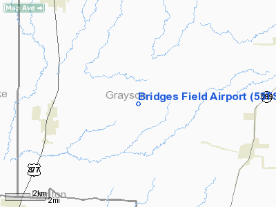
Location & QuickFacts
| FAA Information Effective: | 2008-09-25 |
| Airport Identifier: | 53TS |
| Airport Status: | Operational |
| Longitude/Latitude: | 096-50-20.9940W/33-29-02.3970N
-96.839165/33.483999 (Estimated) |
| Elevation: | 715 ft / 217.93 m (Estimated) |
| Land: | 24 acres |
| From nearest city: | 4 nautical miles E of Tioga, TX |
| Location: | Grayson County, TX |
| Magnetic Variation: | 07E (1980) |
Owner & Manager
| Ownership: | Privately owned |
| Owner: | James N. Bridges |
| Address: | 445 Airport Road
Tioga, TX 76271 |
| Phone number: | 817-437-2216 |
| Manager: | James N. Bridges |
| Address: | 445 Airport Road
Tioga, TX 76271 |
| Phone number: | 817-437-2216 |
Airport Operations and Facilities
| Airport Use: | Private |
| Wind indicator: | Yes |
| Segmented Circle: | No |
| Control Tower: | No |
| Lighting Schedule: | RDO-CTL
ACTVT LIRL RY 17/35 - 122.750. |
| Sectional chart: | Dallas-ft Worth |
| Region: | ASW - Southwest |
| Boundary ARTCC: | ZFW - Fort Worth |
| Tie-in FSS: | FTW - Fort Worth |
| FSS Phone: | 817-541-3474 |
| FSS Toll Free: | 1-800-WX-BRIEF |
Airport Services
Runway Information
Runway 17/35
| Dimension: | 3200 x 65 ft / 975.4 x 19.8 m |
| Surface: | TURF, |
| Edge Lights: | Low |
| |
Runway 17 |
Runway 35 |
| Traffic Pattern: | Left | Left |
| Displaced threshold: | 480.00 ft | 0.00 ft |
| Obstruction: | 28 ft pline, 80.0 ft from runway | 28 ft pline, 560.0 ft from runway |
|
Radio Navigation Aids
| ID |
Type |
Name |
Ch |
Freq |
Var |
Dist |
| DNI | NDB | Denison | | 341.00 | 06E | 22.1 nm |
| GLE | NDB | Gainesville | | 330.00 | 06E | 22.9 nm |
| HJM | NDB | Rayburn | | 415.00 | 06E | 34.1 nm |
| DUA | NDB | Durant | | 359.00 | 05E | 35.2 nm |
| MII | NDB | Caddo Mills | | 316.00 | 06E | 39.9 nm |
| AUV | NDB | Arbuckle | | 284.00 | 07E | 42.5 nm |
| PQF | NDB | Mesquite | | 248.00 | 06E | 43.4 nm |
| GMZ | NDB | Grindstone Mountain | | 356.00 | 07E | 47.4 nm |
| RBD | NDB | Redbird | | 287.00 | 06E | 48.5 nm |
| SYW | NDB | Cash | | 428.00 | 05E | 49.2 nm |
| MJF | TACAN | Arvilla | 033X | | 05E | 46.5 nm |
| URH | VOR/DME | Texoma | 090X | 114.30 | 05E | 35.6 nm |
| CVE | VOR/DME | Cowboy | 109X | 116.20 | 06E | 35.8 nm |
| TTT | VOR/DME | Maverick | 078X | 113.10 | 06E | 38.3 nm |
| BYP | VORTAC | Bonham | 093X | 114.60 | 06E | 30.5 nm |
| FUZ | VORTAC | Ranger | 104X | 115.70 | 06E | 39.6 nm |
| ADM | VORTAC | Ardmore | 114X | 116.70 | 06E | 46.7 nm |
| UKW | VORTAC | Bowie | 071X | 112.40 | 06E | 49.3 nm |
| DAL | VOT | Dallas Love Field | | 113.30 | | 38.3 nm |
| FTW | VOT | Fort Worth Meacham | | 108.20 | | 47.8 nm |
Images and information placed above are from
http://www.airport-data.com/airport/53TS/
We thank them for the data!
| General Info
|
| Country |
United States
|
| State |
TEXAS
|
| FAA ID |
53TS
|
| Latitude |
33-29-02.397N
|
| Longitude |
096-50-20.994W
|
| Elevation |
715 feet
|
| Near City |
TIOGA
|
We don't guarantee the information is fresh and accurate. The data may
be wrong or outdated.
For more up-to-date information please refer to other sources.
|
|


