 |
|
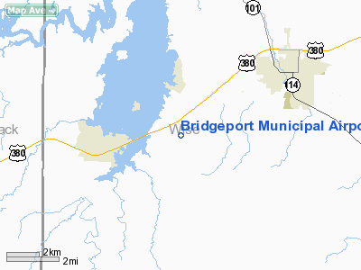
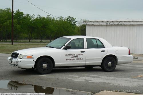
| Bridgeport Municipal Airport |
| IATA: none – ICAO: KXBP – FAA LID: XBP |
| Summary |
| Airport type |
Public |
| Owner |
City of Bridgeport |
| Location |
Bridgeport, Texas |
| Elevation AMSL |
852 ft / 260 m |
| Coordinates |
33°10′31″N 097°49′42″W / 33.17528°N 97.82833°W / 33.17528; -97.82833 |
| Runways |
| Direction |
Length |
Surface |
| ft |
m |
| 17/35 |
4,004 |
1,220 |
Asphalt |
| Statistics (2005) |
| Aircraft operations |
12,300 |
| Based aircraft |
49 |
| Source: Federal Aviation Administration |
Bridgeport Municipal Airport (ICAO: KXBP, FAA LID: XBP) is a public airport located four miles (6 km) southwest of the central business district of Bridgeport, a city in Wise County, Texas, United States. It is owned by the City of Bridgeport.
Although most U.S. airports use the same three-letter location identifier for the FAA and IATA, Bridgeport Municipal Airport is assigned XBP (formerly 1F9) by the FAA but has no designation from the IATA.
Facilities and aircraft
Bridgeport Municipal Airport covers an area of 117 acres (47 ha) which contains one asphalt paved runway (17/35) measuring 4,004 x 60 ft (1,220 x 18 m).
For the 12-month period ending June 23, 2005, the airport had 12,300 aircraft operations, 100% of which were general aviation. There are 49 aircraft based at this airport: 70% single engine, 14% multi-engine, 12% ultralight and 4% helicopters.
The above content comes from Wikipedia and is published under free licenses – click here to read more.
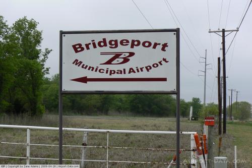 |
(Click on the photo to enlarge) |
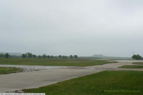 |
(Click on the photo to enlarge) |
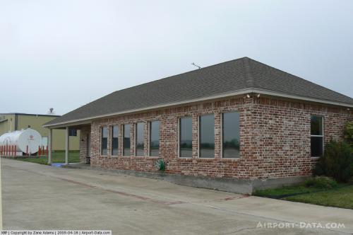 |
(Click on the photo to enlarge) |
 |
(Click on the photo to enlarge) |
Location & QuickFacts
| FAA Information Effective: | 2008-09-25 |
| Airport Identifier: | XBP |
| Airport Status: | Operational |
| Longitude/Latitude: | 097-49-42.2000W/33-10-31.2000N
-97.828389/33.175333 (Estimated) |
| Elevation: | 852 ft / 259.69 m (Surveyed) |
| Land: | 117 acres |
| From nearest city: | 4 nautical miles SW of Bridgeport, TX |
| Location: | Wise County, TX |
| Magnetic Variation: | 09E (1965) |
Owner & Manager
| Ownership: | Publicly owned |
| Owner: | City Of Bridgeport |
| Address: | 812 Halsell St
Bridgeport, TX 76426 |
| Phone number: | 940-683-5906 |
| Manager: | Jim Cowell |
| Address: | 900 Thompson
Bridgeport, TX 76426 |
| Phone number: | 940-683-5906
OR 940-683-4880. |
Airport Operations and Facilities
| Airport Use: | Open to public |
| Wind indicator: | Yes |
| Segmented Circle: | Yes |
| Control Tower: | No |
| Lighting Schedule: | DUSK-DAWN |
| Beacon Color: | Clear-Green (lighted land airport) |
| Landing fee charge: | No |
| Sectional chart: | Dallas-ft Worth |
| Region: | ASW - Southwest |
| Boundary ARTCC: | ZFW - Fort Worth |
| Tie-in FSS: | FTW - Fort Worth |
| FSS on Airport: | No |
| FSS Phone: | 817-541-3474 |
| FSS Toll Free: | 1-800-WX-BRIEF |
| NOTAMs Facility: | XBP (NOTAM-d service avaliable) |
| Federal Agreements: | NGY |
Airport Communications
| CTAF: | 123.000 |
| Unicom: | 123.000 |
Airport Services
| Fuel available: | 100LL
FUEL AVBL 24 HRS SELF SERVICE WITH MAJOR CREDIT CARD. |
| Airframe Repair: | MAJOR |
| Power Plant Repair: | MAJOR |
| Bottled Oxygen: | NONE |
| Bulk Oxygen: | NONE |
Runway Information
Runway 17/35
| Dimension: | 4004 x 60 ft / 1220.4 x 18.3 m |
| Surface: | ASPH, Good Condition |
| Weight Limit: | Single wheel: 12500 lbs. |
| Edge Lights: | Medium |
| |
Runway 17 |
Runway 35 |
| Longitude: | 097-49-41.7339W | 097-49-42.7200W |
| Latitude: | 33-10-51.0030N | 33-10-11.4037N |
| Elevation: | 809.00 ft | 852.00 ft |
| Alignment: | 127 | 1 |
| Traffic Pattern: | Left | Left |
| Markings: | Non-precision instrument, Good Condition | Non-precision instrument, Good Condition |
| VASI: | | 2-light PAPI on left side |
| Obstruction: | 44 ft tree, 1213.0 ft from runway, 23:1 slope to clear | 20 ft trees, 390.0 ft from runway, 260 ft right of centerline, 9:1 slope to clear |
|
Radio Navigation Aids
| ID |
Type |
Name |
Ch |
Freq |
Var |
Dist |
| GMZ | NDB | Grindstone Mountain | | 356.00 | 07E | 26.0 nm |
| MWL | NDB | Mineral Wells | | 266.00 | 06E | 26.1 nm |
| GZV | NDB | Brazos River | | 280.00 | 07E | 32.4 nm |
| GHX | NDB | Graham | | 371.00 | 07E | 33.6 nm |
| GLE | NDB | Gainesville | | 330.00 | 06E | 45.4 nm |
| SKB | NDB | Scotland | | 344.00 | 08E | 49.5 nm |
| NFW | TACAN | Nas Jrb Fort Worth | 024X | | 07E | 31.2 nm |
| TTT | VOR/DME | Maverick | 078X | 113.10 | 06E | 43.8 nm |
| CVE | VOR/DME | Cowboy | 109X | 116.20 | 06E | 49.6 nm |
| UKW | VORTAC | Bowie | 071X | 112.40 | 06E | 21.7 nm |
| MQP | VORTAC | Millsap | 124X | 117.70 | 09E | 28.3 nm |
| FUZ | VORTAC | Ranger | 104X | 115.70 | 06E | 36.9 nm |
| FTW | VOT | Fort Worth Meacham | | 108.20 | | 32.0 nm |
Images and information placed above are from
http://www.airport-data.com/airport/XBP/
We thank them for the data!
| General Info
|
| Country |
United States
|
| State |
TEXAS
|
| FAA ID |
XBP
|
| Latitude |
33.175333
33° 10' 31.20" N
|
| Longitude |
-97.828389
097° 49' 42.20" W
|
| Elevation |
852 feet
260 meters
|
| Type |
Civil
|
| Magnetic Variation |
005° E (01/06)
|
| Beacon |
Yes
|
| Operating Agency |
U.S.CIVIL AIRPORT WHEREIN PERMIT COVERS USE BY TRANSIT MILITARY AIRCRAFT
|
| Daylight Saving Time |
Second Sunday in March at 0200 to first Sunday in November at 0200 local time (Exception Arizona and that portion of Indiana in the Eastern Time Zone)
|
We don't guarantee the information is fresh and accurate. The data may
be wrong or outdated.
For more up-to-date information please refer to other sources.
|
|


