|
 |
|
||||
|
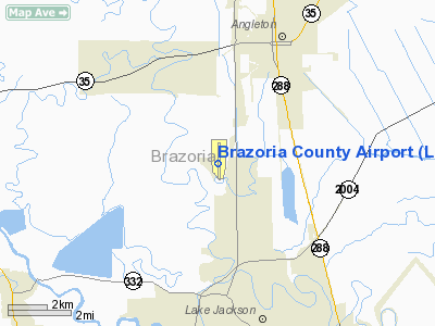
Topographical map of the Brazoria County Airport and the Retrieve Unit (Wayne Scott Unit), July 1, 1984 - U.S. Geological Survey Brazoria County Airport (IATA: LJN, ICAO: KLBX, FAA LID: LBX) is a county-owned public-use airport located four miles (6 km) southwest of the central business district of Angleton and north of Lake Jackson, both cities in Brazoria County, Texas, United States. Although most U.S. airports use the same three-letter location identifier for the FAA and IATA, Brazoria County Airport is assigned LBX by the FAA and LJN by the IATA (which assigned LBX to Lubang in the Philippines). On March 24, 2010, the Brazoria County Commissioners' Court voted to change the name of the airport to Texas Gulf Coast Regional Airport, effective October 1, 2010. Facilities and aircraftBrazoria County Airport covers an area of 674 acres (273 ha) which contains one concrete paved runway (17/35) measuring 7,000 x 100 ft (2,134 x 30 m). For the 12-month period ending July 31, 2006, the airport had 60,000 aircraft operations, an average of 164 per day: 97% general aviation, 3% air taxi and 1% military. There are 92 aircraft based at this airport: 77% single-engine, 8% multi-engine, 7% jet and 9% helicopter. The airport's runway was closed in December 2009 for a major reconstruction project, in which the runway's former asphalt surface was replaced with concrete. During the runway closure, aircraft temporarily used the airport's main taxiway for takeoffs and landings. Larger aircraft, such as the Aerodynamics (ADI) Dynajet Airbus ACJ operated as a shuttle service for Dow Chemical, were diverted to William P. Hobby Airport in Houston during the runway closure. The runway reconstruction project was completed in July 2010, and the airport is fully operational once again. Airline HistoryBrazoria County Airport in the late 1970's and early 80's once was linked to the national airway grid with regularly scheduled airline service. Among some of the more unusual routes were Victoria, Texas and the Clear Lake City STOLport [1] served in between the regular schedules from Brazoria County to Houston Intercontinental Airport (IAH) as this airport was called prior to airline deregulation. In the 1980's the airport was moved from the older shorter runway facilities close to Lake Jackson's town center to an area just north of the city limits of Lake Jackson. It is to this original former airport, in which the largest commercial airliner to visit the area a National Airlines (NA) Boeing 727[2] was hijacked in the early years of the 1970's. After the airport was moved to its present location, Metro Airlines occasionally briefly used Shorts 330 later to be supplanted by Twin Otters on "commuter" routes linking "Brazosport" to IAH. Other sorts of regional aircraft seen occasionally at LBX in scheduled airline serve were Royale Airlines Embraer EMB 110 Bandeirantes and Beechcraft Model 99s. Royale functioned as a feeder airline for Continental Airlines to IAH prior to its bankruptcy and the difficulties which small communities suffered affected by the post deregulation airline industry. Other airlines which more recently are seen regularly at the Brazoria County KLBX, were Comairs CRJ Regional jets and Aerodynamics Inc. (ADI), Fokker F28s.[3] Both of these airlines had contracts doing scheduled corporate charters shuttling employees to Dow Chemicals Midland Michigan facilities. Currently, Dow Chemical uses the services of Aerodynamics (ADI)- Dynajet and their European built Airbus 319 Airbus equipment for the corporate shuttle to Michigan. At present, no regularly scheduled commercial passenger service is offered from this underused airfield. The above content comes from Wikipedia and is published under free licenses – click here to read more.
Location & QuickFacts
Owner & Manager
Airport Operations and Facilities
Airport Communications
Airport Services
Runway InformationRunway 17/35
Radio Navigation Aids
Remarks
Images and information placed above are from We thank them for the data!
We don't guarantee the information is fresh and accurate. The data may
be wrong or outdated.
|
|||||||||||||||||||||||||||||||||||||||||||||||||||||||||||||||||||||||||||||||||||||||||||||||||||||||||||||||||||||||||||||||||||||||||||||||||||||||||||||||||||||||||||||||||||||||||||||||||||||||||||||||||||||||||||||||||||||||||||||||||||||||||||||||||||||||||||||||||||||||||||||||||||||||||||||||||||||||||||||||||||||||||||||||||||||

 |
|
Copyright 2004-2024 © by Airports-Worldwide.com, Vyshenskoho st. 36, Lviv 79010, Ukraine Legal Disclaimer |