 |
|
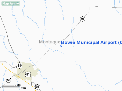
Location & QuickFacts
| FAA Information Effective: | 2008-09-25 |
| Airport Identifier: | 0F2 |
| Airport Status: | Operational |
| Longitude/Latitude: | 097-46-32.0160W/33-36-06.0000N
-97.775560/33.601667 (Estimated) |
| Elevation: | 1101 ft / 335.58 m (Surveyed) |
| Land: | 52 acres |
| From nearest city: | 4 nautical miles NE of Bowie, TX |
| Location: | Montague County, TX |
| Magnetic Variation: | 07E (1990) |
Owner & Manager
| Ownership: | Publicly owned |
| Owner: | City Of Bowie |
| Address: | 304 Lindsey
Bowie, TX 76230 |
| Phone number: | 940-872-1114 |
| Manager: | Don Bishop |
| Address: | 522 Pr 227
Bowie, TX 76230 |
| Phone number: | 940-872-6357 |
Airport Operations and Facilities
| Airport Use: | Open to public |
| Wind indicator: | Yes |
| Segmented Circle: | Yes |
| Control Tower: | No |
| Lighting Schedule: | DUSK-DAWN
ACTVT MIRL RY 17/35 - CTAF. |
| Beacon Color: | Clear-Green (lighted land airport) |
| Landing fee charge: | No |
| Sectional chart: | Dallas-ft Worth |
| Region: | ASW - Southwest |
| Boundary ARTCC: | ZFW - Fort Worth |
| Tie-in FSS: | FTW - Fort Worth |
| FSS on Airport: | No |
| FSS Phone: | 817-541-3474 |
| FSS Toll Free: | 1-800-WX-BRIEF |
| NOTAMs Facility: | FTW (NOTAM-d service avaliable) |
| Federal Agreements: | NGY |
Airport Communications
| CTAF: | 122.800 |
| Unicom: | 122.800 |
Airport Services
| Fuel available: | 100LLA |
| Airframe Repair: | MAJOR |
| Power Plant Repair: | MAJOR |
| Bottled Oxygen: | NONE |
| Bulk Oxygen: | NONE |
Runway Information
Runway 17/35
| Dimension: | 3603 x 60 ft / 1098.2 x 18.3 m |
| Surface: | ASPH, Good Condition |
| Weight Limit: | Single wheel: 12500 lbs. |
| Edge Lights: | Medium |
| |
Runway 17 |
Runway 35 |
| Longitude: | 097-46-34.1320W | 097-46-29.9530W |
| Latitude: | 33-36-23.7120N | 33-35-48.2460N |
| Elevation: | 1101.00 ft | 1083.00 ft |
| Alignment: | 127 | 127 |
| Traffic Pattern: | Left | Left |
| Markings: | Non-precision instrument, Good Condition | Non-precision instrument, Good Condition |
| Crossing Height: | 35.00 ft | 40.00 ft |
| VASI: | 2-light PAPI on left side | 2-light PAPI on left side |
| Visual Glide Angle: | 3.00° | 3.00° |
| Obstruction: | 23 ft trees, 372.0 ft from runway, 260 ft right of centerline, 7:1 slope to clear | 11 ft trees, 745.0 ft from runway, 200 ft left of centerline, 49:1 slope to clear |
|
Radio Navigation Aids
| ID |
Type |
Name |
Ch |
Freq |
Var |
Dist |
| GMZ | NDB | Grindstone Mountain | | 356.00 | 07E | 0.2 nm |
| GLE | NDB | Gainesville | | 330.00 | 06E | 29.7 nm |
| SKB | NDB | Scotland | | 344.00 | 08E | 37.3 nm |
| GHX | NDB | Graham | | 371.00 | 07E | 44.7 nm |
| AUV | NDB | Arbuckle | | 284.00 | 07E | 46.3 nm |
| SHP | TACAN | Sheppard | 045X | | 10E | 42.3 nm |
| DUC | VOR/DME | Duncan | 047X | 111.00 | 09E | 47.6 nm |
| UKW | VORTAC | Bowie | 071X | 112.40 | 06E | 4.6 nm |
| SPS | VORTAC | Wichita Falls | 074X | 112.70 | 10E | 47.0 nm |
| ADM | VORTAC | Ardmore | 114X | 116.70 | 06E | 47.6 nm |
Remarks
- RY 17/35 SFC ADJ TO THE PAVEMENT IS MORE THAN 1.5 INCHES BELOW RY IN VARIOUS PLACES.
Images and information placed above are from
http://www.airport-data.com/airport/0F2/
We thank them for the data!
| General Info
|
| Country |
United States
|
| State |
TEXAS
|
| FAA ID |
0F2
|
| Latitude |
33-36-06.000N
|
| Longitude |
097-46-32.016W
|
| Elevation |
1101 feet
|
| Near City |
BOWIE
|
We don't guarantee the information is fresh and accurate. The data may
be wrong or outdated.
For more up-to-date information please refer to other sources.
|
|


