 |
|
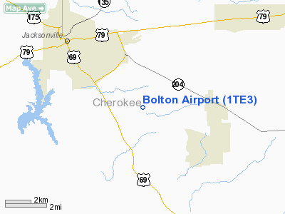
Location & QuickFacts
| FAA Information Effective: | 2008-09-25 |
| Airport Identifier: | 1TE3 |
| Airport Status: | Operational |
| Longitude/Latitude: | 095-12-25.8060W/31-55-02.6070N
-95.207168/31.917391 (Estimated) |
| Elevation: | 450 ft / 137.16 m (Estimated) |
| Land: | 25 acres |
| From nearest city: | 5 nautical miles SE of Jacksonville, TX |
| Location: | Cherokee County, TX |
| Magnetic Variation: | 06E (1986) |
Owner & Manager
| Ownership: | Privately owned |
| Owner: | Russell Bolton |
| Address: | Rte 1 Box 75
Jacksonville, TX 75766 |
| Phone number: | 903-586-8305 |
| Manager: | Russell Bolton |
| Address: | Rt.1 Box 75
Jacksonville, TX 75766 |
| Phone number: | 903-586-8305 |
Airport Operations and Facilities
| Airport Use: | Private |
| Segmented Circle: | No |
| Control Tower: | No |
| Sectional chart: | Houston |
| Region: | ASW - Southwest |
| Boundary ARTCC: | ZFW - Fort Worth |
| Tie-in FSS: | FTW - Fort Worth |
| FSS Phone: | 817-541-3474 |
| FSS Toll Free: | 1-800-WX-BRIEF |
Runway Information
Runway 11/29
| Dimension: | 1960 x 30 ft / 597.4 x 9.1 m |
| Surface: | TURF, Good Condition |
| |
Runway 11 |
Runway 29 |
| Traffic Pattern: | Left | Left |
| Obstruction: | 20 ft pline, 100 ft left of centerline | 25 ft trees, 800.0 ft from runway, 32:1 slope to clear |
|
Radio Navigation Aids
| ID |
Type |
Name |
Ch |
Freq |
Var |
Dist |
| JSO | NDB | Cherokee County | | 263.00 | 05E | 2.9 nm |
| HNO | NDB | Henderson | | 371.00 | 06E | 24.0 nm |
| PSN | NDB | Palestine | | 375.00 | 04E | 26.5 nm |
| GXD | NDB | Nacogdoches | | 391.00 | 05E | 30.3 nm |
| TY | NDB | Tyler | | 320.00 | 06E | 32.8 nm |
| AHX | NDB | Athens | | 269.00 | 06E | 34.9 nm |
| OC | NDB | Nados | | 253.00 | 05E | 36.0 nm |
| LIQ | NDB | Lochridge Ranch | | 335.00 | 09E | 38.4 nm |
| CSZ | NDB | Crossroads | | 215.00 | 08E | 39.3 nm |
| ABG | NDB | Ambassador | | 404.00 | 07E | 40.4 nm |
| RPF | NDB | Carthage | | 332.00 | 04E | 49.0 nm |
| FZT | VOR/DME | Frankston | 051X | 111.40 | 06E | 19.0 nm |
| TYR | VOR/DME | Tyler | 089X | 114.20 | 06E | 28.2 nm |
| GGG | VORTAC | Gregg County | 070X | 112.30 | 07E | 37.9 nm |
Remarks
- PRVDD THRS ARE LCTD TO PROVIDE 20:1 APCH CLEARANCE.
Images and information placed above are from
http://www.airport-data.com/airport/1TE3/
We thank them for the data!
| General Info
|
| Country |
United States
|
| State |
TEXAS
|
| FAA ID |
1TE3
|
| Latitude |
31-55-02.607N
|
| Longitude |
095-12-25.806W
|
| Elevation |
450 feet
|
| Near City |
JACKSONVILLE
|
We don't guarantee the information is fresh and accurate. The data may
be wrong or outdated.
For more up-to-date information please refer to other sources.
|
|


