 |
|
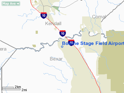
Boerne Stage Field Airport |
Location & QuickFacts
| FAA Information Effective: | 2008-09-25 |
| Airport Identifier: | 5C1 |
| Airport Status: | Operational |
| Longitude/Latitude: | 098-41-40.7100W/29-43-26.1460N
-98.694642/29.723929 (Estimated) |
| Elevation: | 1385 ft / 422.15 m (Surveyed) |
| Land: | 100 acres |
| From nearest city: | 20 nautical miles NW of San Antonio, TX |
| Location: | Bexar County, TX |
| Magnetic Variation: | 08E (1985) |
Owner & Manager
| Ownership: | Privately owned |
| Owner: | Robert & Nancy Bruce |
| Address: | 100 Boerne Stage Airfield
Boerne, TX 78006 |
| Phone number: | 830-981-2345 |
| Manager: | Robert & Nancy Bruce |
| Address: | 100 Boerne Stage Airfield
Boerne, TX 78006 |
| Phone number: | 830-981-2345 |
Airport Operations and Facilities
| Airport Use: | Open to public |
| Wind indicator: | Yes |
| Segmented Circle: | No |
| Control Tower: | No |
| Lighting Schedule: | DUSK-DAWN
ACTVT LIRL RY 17/35 - CTAF. |
| Beacon Color: | Clear-Green (lighted land airport) |
| Sectional chart: | San Antonio |
| Region: | ASW - Southwest |
| Traffic Pattern Alt: | 820 ft |
| Boundary ARTCC: | ZHU - Houston |
| Tie-in FSS: | SJT - San Angelo |
| FSS on Airport: | No |
| FSS Toll Free: | 1-800-WX-BRIEF |
| NOTAMs Facility: | SJT (NOTAM-d service avaliable) |
Airport Communications
| CTAF: | 123.000 |
| Unicom: | 123.000
UNICOM UNMONITORED. |
Airport Services
| Fuel available: | 100LLA |
| Airframe Repair: | MAJOR |
| Power Plant Repair: | MAJOR |
Runway Information
Runway 17/35
| Dimension: | 4340 x 60 ft / 1322.8 x 18.3 m
NORTHERN 555 FT OF RY IS 40 FT WIDE, REMAINDER IS 60 FT WIDE. |
| Surface: | ASPH, Good Condition |
| Edge Lights: | Low |
| |
Runway 17 |
Runway 35 |
| Longitude: | 098-41-43.2910W | 098-41-38.1400W |
| Latitude: | 29-43-47.4870N | 29-43-04.7700N |
| Elevation: | 1381.00 ft | 1376.00 ft |
| Traffic Pattern: | Right | Left |
| Markings: | Non-precision instrument, Good Condition | Non-precision instrument, Good Condition |
| Displaced threshold: | 555.00 ft | 500.00 ft |
| Obstruction: | 35 ft trees, 200.0 ft from runway, 90 ft right of centerline
APCH SLOPE 20:1 FM DSPLCD THLD TO 35 FT TREE 88 FT FM DSPLD THLD 90 FT R.
+35 FT TREES 90 FT R FM 140 FT TO 200 FT FM THLD. | 30 ft tree, 200.0 ft from runway, 210 ft left of centerline
APCH SLOPE 0:1 FM DSPLCD THLD TO 30 FT TREE 0 FT FM DSPLCD THLD 210 FT R.
+20 FT TREES 210 FT L 184 FT FM THLD. |
|
Radio Navigation Aids
| ID |
Type |
Name |
Ch |
Freq |
Var |
Dist |
| ER | NDB | Shein | | 263.00 | 08E | 20.0 nm |
| CVB | NDB | Castroville | | 338.00 | 08E | 24.1 nm |
| HMA | NDB | Hondo | | 329.00 | 08E | 32.7 nm |
| HHH | NDB | Devine | | 359.00 | 07E | 37.5 nm |
| PEZ | NDB | Pleasanton | | 275.00 | 07E | 47.1 nm |
| KSY | TACAN | Kelly | 057X | | 07E | 20.8 nm |
| DHK | TACAN | Randolph | 036X | | 09E | 25.0 nm |
| SSF | VOR | Stinson | | 108.40 | 09E | 30.9 nm |
| HDO | VOR/DME | Hondo | 31X | 109.40 | 08E | 33.9 nm |
| SAT | VORTAC | San Antonio | 115X | 116.80 | 08E | 13.1 nm |
| RND | VORTAC | Randolph | 70X | 112.30 | 09E | 24.7 nm |
| STV | VORTAC | Stonewall | 085X | 113.80 | 08E | 29.0 nm |
| CSI | VORTAC | Center Point | 122X | 117.50 | 08E | 29.6 nm |
| SAT | VOT | San Antonio Intl | | 110.40 | | 16.4 nm |
Remarks
- NOISE ABATEMENT PROCEDURES IN EFFECT CTC AMGR 830-981-2345.
- NO TOUCH & GO; STOP & GO; OR LOW APROACHES.
- GLIDER ACTIVITY ON & INVOF ARPT.
- SOUTH RY EXIT CLSD INDEFLY; BACKTAXI TO EXIT RY.
Images and information placed above are from
http://www.airport-data.com/airport/5C1/
We thank them for the data!
| General Info
|
| Country |
United States
|
| State |
TEXAS
|
| FAA ID |
5C1
|
| Latitude |
29-43-24.800N
|
| Longitude |
098-41-41.086W
|
| Elevation |
1380 feet
|
| Near City |
SAN ANTONIO
|
We don't guarantee the information is fresh and accurate. The data may
be wrong or outdated.
For more up-to-date information please refer to other sources.
|
|


