 |
|
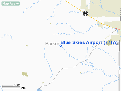
Location & QuickFacts
| FAA Information Effective: | 2008-09-25 |
| Airport Identifier: | 77TA |
| Airport Status: | Operational |
| Longitude/Latitude: | 097-39-41.0960W/32-52-26.4520N
-97.661416/32.874014 (Estimated) |
| Elevation: | 960 ft / 292.61 m (Estimated) |
| Land: | 0 acres |
| From nearest city: | 6 nautical miles SW of Azle, TX |
| Location: | Parker County, TX |
| Magnetic Variation: | 07E (1985) |
Owner & Manager
| Ownership: | Privately owned |
| Owner: | Charles & Jeanne Bullock
& LEWIS CROSSWELL (ALSO CO-MGR), 3520 BANDERA ROAD, FT. WORTH, TX 76116; 817-244-0227. |
| Address: | 555 Little Cat Track
Weatherford, TX 76086 |
| Phone number: | 817-599-9286 |
| Manager: | Charles C. Bullock |
| Address: | 555 Little Cat Track
Weatherford, TX 76086 |
| Phone number: | 817-599-9286 |
Airport Operations and Facilities
| Airport Use: | Private |
| Wind indicator: | Yes |
| Segmented Circle: | No |
| Control Tower: | No |
| Landing fee charge: | No |
| Sectional chart: | Dallas-ft Worth |
| Region: | ASW - Southwest |
| Boundary ARTCC: | ZFW - Fort Worth |
| Tie-in FSS: | FTW - Fort Worth |
| FSS on Airport: | No |
| FSS Phone: | 817-541-3474 |
| FSS Toll Free: | 1-800-WX-BRIEF |
Runway Information
Runway 12/30
| Dimension: | 2600 x 100 ft / 792.5 x 30.5 m |
| Surface: | TURF, |
| |
Runway 12 |
Runway 30 |
| Traffic Pattern: | Left | Left |
| Obstruction: | 30 ft trees, 100.0 ft from runway | |
|
Radio Navigation Aids
| ID |
Type |
Name |
Ch |
Freq |
Var |
Dist |
| MWL | NDB | Mineral Wells | | 266.00 | 06E | 20.7 nm |
| GZV | NDB | Brazos River | | 280.00 | 07E | 38.2 nm |
| XQH | NDB | Cedar Hill | | 353.00 | 08E | 38.6 nm |
| RBD | NDB | Redbird | | 287.00 | 06E | 41.7 nm |
| GMZ | NDB | Grindstone Mountain | | 356.00 | 07E | 44.3 nm |
| GHX | NDB | Graham | | 371.00 | 07E | 45.6 nm |
| NFW | TACAN | Nas Jrb Fort Worth | 024X | | 07E | 12.8 nm |
| TTT | VOR/DME | Maverick | 078X | 113.10 | 06E | 31.3 nm |
| CVE | VOR/DME | Cowboy | 109X | 116.20 | 06E | 38.2 nm |
| MQP | VORTAC | Millsap | 124X | 117.70 | 09E | 19.2 nm |
| FUZ | VORTAC | Ranger | 104X | 115.70 | 06E | 24.3 nm |
| UKW | VORTAC | Bowie | 071X | 112.40 | 06E | 40.6 nm |
| JEN | VORTAC | Glen Rose | 097X | 115.00 | 06E | 44.3 nm |
| FTW | VOT | Fort Worth Meacham | | 108.20 | | 15.7 nm |
| DAL | VOT | Dallas Love Field | | 113.30 | | 40.9 nm |
Images and information placed above are from
http://www.airport-data.com/airport/77TA/
We thank them for the data!
| General Info
|
| Country |
United States
|
| State |
TEXAS
|
| FAA ID |
77TA
|
| Latitude |
32-52-26.452N
|
| Longitude |
097-39-41.096W
|
| Elevation |
960 feet
|
| Near City |
AZLE
|
We don't guarantee the information is fresh and accurate. The data may
be wrong or outdated.
For more up-to-date information please refer to other sources.
|
|


