 |
|
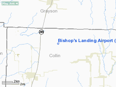
Location & QuickFacts
| FAA Information Effective: | 2008-09-25 |
| Airport Identifier: | T80 |
| Airport Status: | Operational |
| Longitude/Latitude: | 096-43-43.9700W/33-22-38.4000N
-96.728881/33.377333 (Estimated) |
| Elevation: | 750 ft / 228.60 m (Estimated) |
| Land: | 32 acres |
| From nearest city: | 5 nautical miles NE of Celina, TX |
| Location: | Collin County, TX |
| Magnetic Variation: | 06E (1995) |
Owner & Manager
| Ownership: | Privately owned |
| Owner: | Bobby Bishop |
| Address: | 8955 Cr 135
Celina, TX 75009 |
| Phone number: | 972-382-4408 |
| Manager: | Bobby Bishop |
| Address: | 8955 Cr 135
Celina, TX 75009 |
| Phone number: | 972-382-4402 |
Airport Operations and Facilities
| Airport Use: | Open to public |
| Wind indicator: | Yes |
| Segmented Circle: | No |
| Control Tower: | No |
| Sectional chart: | Dallas-ft Worth |
| Region: | ASW - Southwest |
| Boundary ARTCC: | ZFW - Fort Worth |
| Tie-in FSS: | FTW - Fort Worth |
| FSS Phone: | 817-541-3474 |
| FSS Toll Free: | 1-800-WX-BRIEF |
| NOTAMs Facility: | FTW (NOTAM-d service avaliable) |
Airport Communications
Runway Information
Runway 17/35
| Dimension: | 1580 x 80 ft / 481.6 x 24.4 m |
| Surface: | TURF, Good Condition |
| |
Runway 17 |
Runway 35 |
| Traffic Pattern: | Left | Left |
| Obstruction: | 30 ft pole, 10.0 ft from runway, 30 ft left of centerline | 40 ft trees, 30.0 ft from runway, 60 ft right of centerline |
|
Radio Navigation Aids
| ID |
Type |
Name |
Ch |
Freq |
Var |
Dist |
| DNI | NDB | Denison | | 341.00 | 06E | 27.0 nm |
| HJM | NDB | Rayburn | | 415.00 | 06E | 31.1 nm |
| GLE | NDB | Gainesville | | 330.00 | 06E | 31.2 nm |
| MII | NDB | Caddo Mills | | 316.00 | 06E | 31.5 nm |
| PQF | NDB | Mesquite | | 248.00 | 06E | 35.6 nm |
| DUA | NDB | Durant | | 359.00 | 05E | 37.7 nm |
| SYW | NDB | Cash | | 428.00 | 05E | 40.9 nm |
| RBD | NDB | Redbird | | 287.00 | 06E | 42.7 nm |
| JUG | NDB | Jecca | | 388.00 | 06E | 43.8 nm |
| AVZ | NDB | Travis | | 260.00 | 06E | 44.3 nm |
| LNC | NDB | Lancaster | | 239.00 | 06E | 48.1 nm |
| XQH | NDB | Cedar Hill | | 353.00 | 08E | 48.9 nm |
| MJF | TACAN | Arvilla | 033X | | 05E | 38.4 nm |
| CVE | VOR/DME | Cowboy | 109X | 116.20 | 06E | 30.6 nm |
| TTT | VOR/DME | Maverick | 078X | 113.10 | 06E | 34.3 nm |
| URH | VOR/DME | Texoma | 090X | 114.30 | 05E | 38.0 nm |
| BYP | VORTAC | Bonham | 093X | 114.60 | 06E | 26.6 nm |
| FUZ | VORTAC | Ranger | 104X | 115.70 | 06E | 37.1 nm |
| DAL | VOT | Dallas Love Field | | 113.30 | | 32.5 nm |
| FTW | VOT | Fort Worth Meacham | | 108.20 | | 46.2 nm |
Remarks
- PRVDD PLINES ON NORTH END BURIED.
Images and information placed above are from
http://www.airport-data.com/airport/T80/
We thank them for the data!
| General Info
|
| Country |
United States
|
| State |
TEXAS
|
| FAA ID |
T80
|
| Latitude |
27-33-03.100N
|
| Longitude |
098-01-51.306W
|
| Elevation |
131 feet
|
| Near City |
KINGSVILLE
|
We don't guarantee the information is fresh and accurate. The data may
be wrong or outdated.
For more up-to-date information please refer to other sources.
|
|


