 |
|
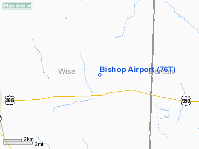
Location & QuickFacts
| FAA Information Effective: | 2008-09-25 |
| Airport Identifier: | 76T |
| Airport Status: | Operational |
| Longitude/Latitude: | 097-27-06.0870W/33-15-59.4200N
-97.451691/33.266506 (Estimated) |
| Elevation: | 875 ft / 266.70 m (Estimated) |
| Land: | 0 acres |
| From nearest city: | 6 nautical miles E of Decatur, TX |
| Location: | Wise County, TX |
| Magnetic Variation: | 07E (1985) |
Owner & Manager
| Ownership: | Privately owned |
| Owner: | Tom Bishop |
| Address: | 192 Pr 2506
Decatur, TX 76234 |
| Phone number: | 940-627-6267 |
| Manager: | Billy Goodwin |
| Address: | 330 Pr 2506
Decatur, TX 76234 |
| Phone number: | 940-627-7901 |
Airport Operations and Facilities
| Airport Use: | Open to public |
| Wind indicator: | Yes |
| Segmented Circle: | No |
| Control Tower: | No |
| Sectional chart: | Dallas-ft Worth |
| Region: | ASW - Southwest |
| Boundary ARTCC: | ZFW - Fort Worth |
| Tie-in FSS: | FTW - Fort Worth |
| FSS on Airport: | No |
| FSS Phone: | 817-541-3474 |
| FSS Toll Free: | 1-800-WX-BRIEF |
| NOTAMs Facility: | FTW (NOTAM-d service avaliable) |
Airport Communications
Airport Services
| Fuel available: | 100LLA |
| Airframe Repair: | MINOR |
| Power Plant Repair: | MINOR |
Runway Information
Runway 17/35
| Dimension: | 3730 x 170 ft / 1136.9 x 51.8 m |
| Surface: | TURF, Fair Condition |
| |
Runway 17 |
Runway 35 |
| Traffic Pattern: | Left | Left |
| Obstruction: | 15 ft road, 10.0 ft from runway | 4 ft fence, 0.0 ft from runway |
|
Radio Navigation Aids
| ID |
Type |
Name |
Ch |
Freq |
Var |
Dist |
| GMZ | NDB | Grindstone Mountain | | 356.00 | 07E | 26.0 nm |
| GLE | NDB | Gainesville | | 330.00 | 06E | 30.0 nm |
| MWL | NDB | Mineral Wells | | 266.00 | 06E | 42.1 nm |
| RBD | NDB | Redbird | | 287.00 | 06E | 46.0 nm |
| XQH | NDB | Cedar Hill | | 353.00 | 08E | 47.1 nm |
| NFW | TACAN | Nas Jrb Fort Worth | 024X | | 07E | 29.8 nm |
| TTT | VOR/DME | Maverick | 078X | 113.10 | 06E | 31.6 nm |
| CVE | VOR/DME | Cowboy | 109X | 116.20 | 06E | 35.7 nm |
| UKW | VORTAC | Bowie | 071X | 112.40 | 06E | 24.6 nm |
| FUZ | VORTAC | Ranger | 104X | 115.70 | 06E | 26.5 nm |
| MQP | VORTAC | Millsap | 124X | 117.70 | 09E | 42.6 nm |
| FTW | VOT | Fort Worth Meacham | | 108.20 | | 27.4 nm |
| DAL | VOT | Dallas Love Field | | 113.30 | | 39.4 nm |
Remarks
- RY MAY BE ROUGH DUE TO DROUGHT CONDS.
- RY SOFT AFT HVY RAIN.
Images and information placed above are from
http://www.airport-data.com/airport/76T/
We thank them for the data!
| General Info
|
| Country |
United States
|
| State |
TEXAS
|
| FAA ID |
76T
|
| Latitude |
33-15-59.420N
|
| Longitude |
097-27-06.087W
|
| Elevation |
875 feet
|
| Near City |
DECATUR
|
We don't guarantee the information is fresh and accurate. The data may
be wrong or outdated.
For more up-to-date information please refer to other sources.
|
|


