|
 |
|
||||
|
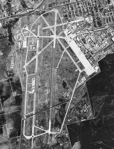
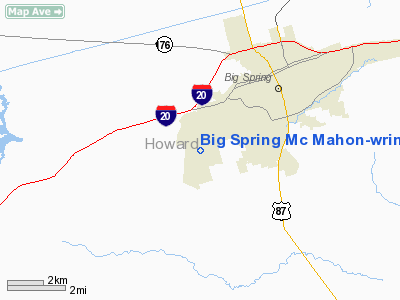
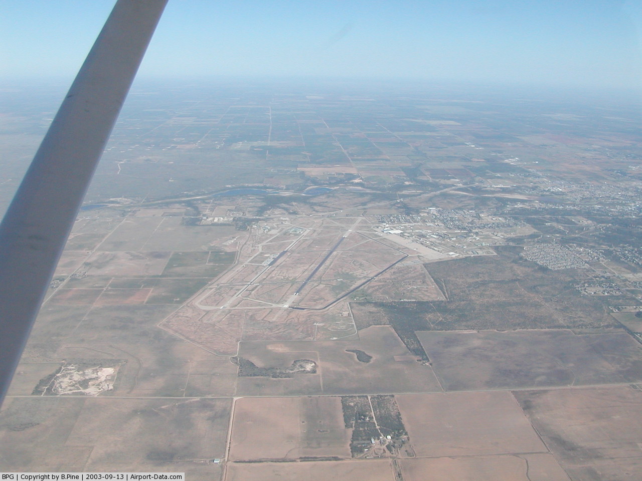
Big Spring McMahon-Wrinkle Airport (ICAO: KBPG, FAA LID: BPG) is a city-owned, public-use airport located two nautical miles (3.7 km) southwest of the central business district of Big Spring, a city in Howard County, Texas, United States. According to the FAA's National Plan of Integrated Airport Systems for 2009–2013, it is categorized as a general aviation airport. Although many U.S. airports use the same three-letter location identifier for the FAA and IATA, this airport is assigned BPG by the FAA but has no designation from the IATA (which assigned BPG to Barra do Garças Airport in Barra do Garças, Mato Grosso, Brazil). HistoryWorld War IIThe facility was first used by the United States Army Air Force as Big Spring Army Air Field, opening on 28 April 1942 as part of the Central Flying Training Command. The mission of Big Spring AAF was to train aviation cadets in high altitude precision bombing as bombardiers. The airfield had received its first class of cadets in September 1942. The AT-11 (Beechcraft Model 18 and the B-18 Bolo were the primary aircraft flown for training. The 79th Bombardier Training Group continued operations until the surrender of Japan, when the cadets who agreed to remain in postwar service were transferred to Midland AAF, Texas. The last class graduated on 26 September 1945. The base was declared surplus and reverted to city control in November 1945, and it served as the Big Spring Municipal Airport for six years. Webb Air Force BaseAs a result of the Korean War, and the need for trained pilots, the airfield was reopened on October 1, 1951. The base was renamed Webb Air Force Base in 1952 to memorialize Lt. James L. Webb, a Big Spring native and World War II combat pilot, who was killed off the Japanese coast in 1949. The 3560th Pilot Training Wing (later redesignated the Seventy-eighth Flying Training Wing) was stationed at the base, and instruction of the first class began in April 1952. The base population soon passed the 2,000 mark. By the end of 1968 almost 9,000 pilots had been trained at Webb. In 1956 the 331st Fighter Interceptor Squadron was transferred to Webb from Stewart Air Force Base in New York to defend the southern United States border on air intercept missions. In March 1967 the 331st was redesignated the 4760th Combat Crew Training Squadron and charged with training Jordanian Air Force students. It was inactivated when the Jordanians were recalled because of the war with Israel in the summer of 1967. Webb was also the site of annual summer training for ROTC (Reserve Officers' Training Corps) cadets throughout the 1950s and most of the 1960s. In 1977 the end of the Vietnam War meant a decrease in the need for Air Force pilots. Webb was formally deactivated, and the property it had occupied was turned over to the Big Spring Industrial Park. Facilities and aircraftBig Spring McMahon-Wrinkle Airport covers an area of 2,086 acres (844 ha) which contains two paved runways: 17/35 measuring 8,802 x 100 ft (2,683 x 30 m) and 6/24 measuring 4,601 x 75 ft (1,402 x 23 m). For the 12-month period ending January 30, 2009, the airport had 12,195 aircraft operations, an average of 33 per day: 91% general aviation and 9% military. At that time there were 48 aircraft based at this airport: 73% single-engine, 13% multi-engine, 6% jet, 6% ultralight and 2% helicopter. Other tenantsThree units of the Big Spring Correctional Center (a federal prison privately operated by Cornell Companies) are located on the base grounds (as well as FCI Big Spring, which is a separate facility operated directly by the Bureau of Prisons). The above content comes from Wikipedia and is published under free licenses – click here to read more.
Location & QuickFacts
Owner & Manager
Airport Operations and Facilities
Airport Communications
Airport Services
Runway InformationRunway 06/24
Runway 17/35
Radio Navigation Aids
Remarks
Images and information placed above are from We thank them for the data!
We don't guarantee the information is fresh and accurate. The data may
be wrong or outdated.
|
|||||||||||||||||||||||||||||||||||||||||||||||||||||||||||||||||||||||||||||||||||||||||||||||||||||||||||||||||||||||||||||||||||||||||||||||||||||||||||||||||||||||||||||||||||||||||||||||||||||||||||||||||||||||||||||||||||||||||||||||||||||||||||||||||||||||||||||||||||||||||||||||||||||||||||||||||||||||||||||||||||||||||||||||||||||||||||

 |
|
Copyright 2004-2026 © by Airports-Worldwide.com, Vyshenskoho st. 36, Lviv 79010, Ukraine Legal Disclaimer |