 |
|
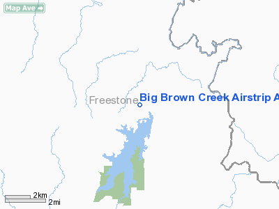
Big Brown Creek Airstrip Airport |
Location & QuickFacts
| FAA Information Effective: | 2008-09-25 |
| Airport Identifier: | TX73 |
| Airport Status: | Operational |
| Longitude/Latitude: | 096-03-07.8810W/31-49-51.5960N
-96.052189/31.830999 (Estimated) |
| Elevation: | 323 ft / 98.45 m (Estimated) |
| Land: | 0 acres |
| From nearest city: | 9 nautical miles NE of Fairfield, TX |
| Location: | Freestone County, TX |
| Magnetic Variation: | 06E (1985) |
Owner & Manager
| Ownership: | Privately owned |
| Owner: | Tu Electric |
| Address: | 7515 Lemmon Ave
Dallas, TX 75209 |
| Phone number: | 903-389-6001 |
| Manager: | Joe Kenneth Holmes |
| Address: | 7515 Lemmon Ave
Dallas, TX 75209 |
| Phone number: | 214-350-0992 |
Airport Operations and Facilities
| Airport Use: | Private |
| Wind indicator: | Yes |
| Segmented Circle: | No |
| Control Tower: | No |
| Landing fee charge: | No |
| Sectional chart: | Houston |
| Region: | ASW - Southwest |
| Boundary ARTCC: | ZFW - Fort Worth |
| Tie-in FSS: | FTW - Fort Worth |
| FSS on Airport: | No |
| FSS Phone: | 817-541-3474 |
| FSS Toll Free: | 1-800-WX-BRIEF |
Airport Services
| Airframe Repair: | NONE |
| Power Plant Repair: | NONE |
Runway Information
Runway 15/33
| Dimension: | 3300 x 40 ft / 1005.8 x 12.2 m |
| Surface: | ASPH, |
| |
Runway 15 |
Runway 33 |
| Traffic Pattern: | Right | Right |
|
Radio Navigation Aids
| ID |
Type |
Name |
Ch |
Freq |
Var |
Dist |
| PYF | NDB | Pyramid | | 418.00 | 06E | 7.7 nm |
| LIQ | NDB | Lochridge Ranch | | 335.00 | 09E | 11.9 nm |
| CSZ | NDB | Crossroads | | 215.00 | 08E | 14.8 nm |
| PSN | NDB | Palestine | | 375.00 | 04E | 18.2 nm |
| CRS | NDB | Corsicana | | 396.00 | 06E | 21.1 nm |
| AHX | NDB | Athens | | 269.00 | 06E | 22.7 nm |
| CGQ | NDB | Powell | | 344.00 | 06E | 23.7 nm |
| LXY | NDB | Mexia | | 329.00 | 07E | 26.2 nm |
| JSO | NDB | Cherokee County | | 263.00 | 05E | 42.8 nm |
| TY | NDB | Tyler | | 320.00 | 06E | 46.0 nm |
| GNL | VOR/DME | Groesbeck | 025X | 108.80 | 05E | 29.5 nm |
| FZT | VOR/DME | Frankston | 051X | 111.40 | 06E | 30.4 nm |
| TYR | VOR/DME | Tyler | 089X | 114.20 | 06E | 45.7 nm |
| CQY | VORTAC | Cedar Creek | 095X | 114.80 | 06E | 22.9 nm |
| LOA | VORTAC | Leona | 045X | 110.80 | 08E | 42.7 nm |
Images and information placed above are from
http://www.airport-data.com/airport/TX73/
We thank them for the data!
| General Info
|
| Country |
United States
|
| State |
TEXAS
|
| FAA ID |
TX73
|
| Latitude |
31-49-51.596N
|
| Longitude |
096-03-07.881W
|
| Elevation |
323 feet
|
| Near City |
FAIRFIELD
|
We don't guarantee the information is fresh and accurate. The data may
be wrong or outdated.
For more up-to-date information please refer to other sources.
|
|


