 |
|
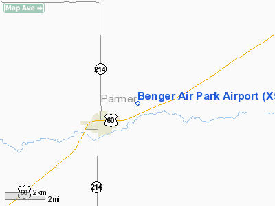
Location & QuickFacts
| FAA Information Effective: | 2008-09-25 |
| Airport Identifier: | X54 |
| Airport Status: | Operational |
| Longitude/Latitude: | 102-41-30.7720W/34-39-15.2410N
-102.691881/34.654234 (Estimated) |
| Elevation: | 4003 ft / 1220.11 m (Estimated) |
| Land: | 122 acres |
| From nearest city: | 2 nautical miles NE of Friona, TX |
| Location: | Parmer County, TX |
| Magnetic Variation: | 09E (1985) |
Owner & Manager
| Ownership: | Privately owned |
| Owner: | Rick Jennings |
| Address: | Box 326
Friona, TX 79035 |
| Phone number: | 806-265-7577 |
| Manager: | Rick Jennings |
| Address: | Box 326
Friona, TX 79035 |
| Phone number: | 806-250-2861 |
Airport Operations and Facilities
| Airport Use: | Open to public |
| Wind indicator: | Yes |
| Segmented Circle: | No |
| Control Tower: | No |
| Landing fee charge: | No |
| Sectional chart: | Albuquerque |
| Region: | ASW - Southwest |
| Boundary ARTCC: | ZAB - Albuquerque |
| Tie-in FSS: | FTW - Fort Worth |
| FSS on Airport: | No |
| FSS Phone: | 817-541-3474 |
| FSS Toll Free: | 1-800-WX-BRIEF |
| NOTAMs Facility: | FTW (NOTAM-d service avaliable) |
Airport Communications
Airport Services
| Fuel available: | 100LLA |
| Airframe Repair: | NONE |
| Power Plant Repair: | NONE |
| Bottled Oxygen: | NONE |
| Bulk Oxygen: | NONE |
Runway Information
Runway 04/22
| Dimension: | 3013 x 60 ft / 918.4 x 18.3 m |
| Surface: | ASPH, Fair Condition |
| Weight Limit: | Single wheel: 13000 lbs. |
| |
Runway 04 |
Runway 22 |
| Traffic Pattern: | Left | Left |
| Obstruction: | 193 ft bldg, 3100.0 ft from runway, 380 ft left of centerline, 15:1 slope to clear | , 50:1 slope to clear
ROAD AT THLD 85 FT LEFT; +5 FT STEEL CORNER POST 156 FT FM THLD 107 FT RIGHT. |
|
Runway 17/35
| Dimension: | 2700 x 135 ft / 823.0 x 41.1 m |
| Surface: | TURF, Fair Condition |
| |
Runway 17 |
Runway 35 |
| Traffic Pattern: | Left | Left |
| Obstruction: | 10 ft trees, 46.0 ft from runway, 63 ft right of centerline, 4:1 slope to clear | , 50:1 slope to clear |
|
Radio Navigation Aids
| ID |
Type |
Name |
Ch |
Freq |
Var |
Dist |
| HRX | NDB | Hereford | | 341.00 | 09E | 21.9 nm |
| PRZ | NDB | Portales | | 407.00 | 09E | 46.6 nm |
| LIU | NDB | Littlefield | | 212.00 | 10E | 46.7 nm |
| CVS | TACAN | Cannon | 053X | | 10E | 35.3 nm |
| TXO | VORTAC | Texico | 059X | 112.20 | 11E | 12.0 nm |
Images and information placed above are from
http://www.airport-data.com/airport/X54/
We thank them for the data!
| General Info
|
| Country |
United States
|
| State |
TEXAS
|
| FAA ID |
X54
|
| Latitude |
34.654232
34° 39' 15.24" N
|
| Longitude |
-102.691880
102° 41' 30.77" W
|
| Elevation |
4003 feet
1220 meters
|
| Magnetic Variation |
008° E (01/06)
|
| Operating Agency |
PRIVATE
|
| Daylight Saving Time |
Second Sunday in March at 0200 to first Sunday in November at 0200 local time (Exception Arizona and that portion of Indiana in the Eastern Time Zone)
|
We don't guarantee the information is fresh and accurate. The data may
be wrong or outdated.
For more up-to-date information please refer to other sources.
|
|


