 |
|
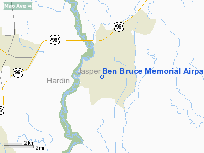
Ben Bruce Memorial Airpark Airport |
Location & QuickFacts
| FAA Information Effective: | 2008-09-25 |
| Airport Identifier: | 4TE8 |
| Airport Status: | Operational |
| Longitude/Latitude: | 094-04-24.6490W/30-19-15.7500N
-94.073514/30.321042 (Estimated) |
| Elevation: | 44 ft / 13.41 m (Estimated) |
| Land: | 0 acres |
| From nearest city: | 2 nautical miles S of Evadale, TX |
| Location: | Jasper County, TX |
| Magnetic Variation: | 05E (1985) |
Owner & Manager
| Ownership: | Privately owned |
| Owner: | Mike Bruce |
| Address: | P.o. Box 148
Evadale, TX 77615 |
| Phone number: | 409-276-2288 |
| Manager: | Mike Bruce |
| Address: | P.o. Box 148
Evadale, TX 77615 |
| Phone number: | 409-276-2288 |
Airport Operations and Facilities
| Airport Use: | Private |
| Wind indicator: | Yes |
| Segmented Circle: | No |
| Control Tower: | No |
| Landing fee charge: | No |
| Sectional chart: | Houston |
| Region: | ASW - Southwest |
| Boundary ARTCC: | ZHU - Houston |
| Tie-in FSS: | CXO - Montgomery County |
| FSS on Airport: | No |
| FSS Toll Free: | 1-800-WX-BRIEF |
| NOTAMs Facility: | (NOTAM-d service avaliable) |
Airport Services
| Airframe Repair: | NONE |
| Power Plant Repair: | NONE |
Runway Information
Runway 15/33
| Dimension: | 6000 x 75 ft / 1828.8 x 22.9 m |
| Surface: | ASPH, |
| |
Runway 15 |
Runway 33 |
| Traffic Pattern: | Left | Left |
| Obstruction: | 70 ft trees, 1000.0 ft from runway | 70 ft trees, 1000.0 ft from runway |
|
Radio Navigation Aids
| ID |
Type |
Name |
Ch |
Freq |
Var |
Dist |
| HRD | NDB | Hardin County | | 524.00 | 04E | 9.7 nm |
| GDE | NDB | Goodhue | | 368.00 | 07E | 16.5 nm |
| ORG | NDB | Orange | | 211.00 | 05E | 20.9 nm |
| DQU | NDB | De Quincy | | 410.00 | 05E | 32.2 nm |
| UX | NDB | Sulfy | | 278.00 | 04E | 34.7 nm |
| JAS | NDB | Jasper | | 344.00 | 04E | 38.1 nm |
| CBC | NDB | Anahuac | | 413.00 | 05E | 45.0 nm |
| DR | NDB | Idder | | 385.00 | 04E | 46.2 nm |
| BPT | VOR/DME | Beaumont | 092X | 114.50 | 07E | 22.7 nm |
| SBI | VOR/DME | Sabine Pass | 101X | 115.40 | 07E | 38.2 nm |
| DAS | VORTAC | Daisetta | 116X | 116.90 | 05E | 30.7 nm |
Images and information placed above are from
http://www.airport-data.com/airport/4TE8/
We thank them for the data!
| General Info
|
| Country |
United States
|
| State |
TEXAS
|
| FAA ID |
4TE8
|
| Latitude |
30-19-15.750N
|
| Longitude |
094-04-24.649W
|
| Elevation |
44 feet
|
| Near City |
EVADALE
|
We don't guarantee the information is fresh and accurate. The data may
be wrong or outdated.
For more up-to-date information please refer to other sources.
|
|


