 |
|
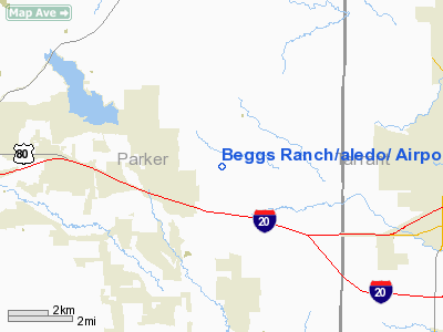
Beggs Ranch/aledo/ Airport |
Location & QuickFacts
| FAA Information Effective: | 2008-09-25 |
| Airport Identifier: | TX15 |
| Airport Status: | Operational |
| Longitude/Latitude: | 097-36-46.0910W/32-45-05.4640N
-97.612803/32.751518 (Estimated) |
| Elevation: | 1060 ft / 323.09 m (Estimated) |
| Land: | 0 acres |
| From nearest city: | 3 nautical miles N of Aledo, TX |
| Location: | Parker County, TX |
| Magnetic Variation: | 07E (1985) |
Owner & Manager
| Ownership: | Privately owned |
| Owner: | George Beggs, Iii |
| Address: | 621 Ft Worth Club Bldg,
Ft Worth, TX 76102 |
| Address: |
|
Airport Operations and Facilities
| Airport Use: | Private |
| Wind indicator: | No |
| Segmented Circle: | No |
| Control Tower: | No |
| Landing fee charge: | No |
| Sectional chart: | Dallas-ft Worth |
| Region: | ASW - Southwest |
| Boundary ARTCC: | ZFW - Fort Worth |
| Tie-in FSS: | FTW - Fort Worth |
| FSS on Airport: | No |
| FSS Phone: | 817-541-3474 |
| FSS Toll Free: | 1-800-WX-BRIEF |
Airport Services
| Airframe Repair: | NONE |
| Power Plant Repair: | NONE |
Runway Information
Runway 08/26
| Dimension: | 2675 x 90 ft / 815.3 x 27.4 m |
| Surface: | TURF, |
| |
Runway 08 |
Runway 26 |
| Traffic Pattern: | Left | Left |
|
Runway 16/34
| Dimension: | 2465 x 70 ft / 751.3 x 21.3 m |
| Surface: | TURF, |
| |
Runway 16 |
Runway 34 |
| Traffic Pattern: | Left | Left |
|
Radio Navigation Aids
| ID |
Type |
Name |
Ch |
Freq |
Var |
Dist |
| MWL | NDB | Mineral Wells | | 266.00 | 06E | 22.6 nm |
| XQH | NDB | Cedar Hill | | 353.00 | 08E | 33.6 nm |
| RBD | NDB | Redbird | | 287.00 | 06E | 37.8 nm |
| GZV | NDB | Brazos River | | 280.00 | 07E | 42.2 nm |
| LNC | NDB | Lancaster | | 239.00 | 06E | 46.3 nm |
| NFW | TACAN | Nas Jrb Fort Worth | 024X | | 07E | 8.8 nm |
| TTT | VOR/DME | Maverick | 078X | 113.10 | 06E | 29.8 nm |
| CVE | VOR/DME | Cowboy | 109X | 116.20 | 06E | 36.8 nm |
| MQP | VORTAC | Millsap | 124X | 117.70 | 09E | 19.5 nm |
| FUZ | VORTAC | Ranger | 104X | 115.70 | 06E | 23.4 nm |
| JEN | VORTAC | Glen Rose | 097X | 115.00 | 06E | 38.0 nm |
| UKW | VORTAC | Bowie | 071X | 112.40 | 06E | 48.3 nm |
| FTW | VOT | Fort Worth Meacham | | 108.20 | | 13.5 nm |
| DAL | VOT | Dallas Love Field | | 113.30 | | 38.9 nm |
Remarks
- CAUTION, CATTLE ON FLD.
- PRE DATES THE ACT.
Images and information placed above are from
http://www.airport-data.com/airport/TX15/
We thank them for the data!
| General Info
|
| Country |
United States
|
| State |
TEXAS
|
| FAA ID |
TX15
|
| Latitude |
32-45-05.464N
|
| Longitude |
097-36-46.091W
|
| Elevation |
1060 feet
|
| Near City |
ALEDO
|
We don't guarantee the information is fresh and accurate. The data may
be wrong or outdated.
For more up-to-date information please refer to other sources.
|
|


