 |
|
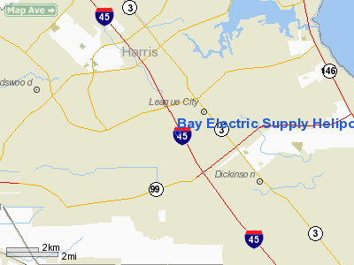
Bay Electric Supply Heliport |
Location & QuickFacts
| FAA Information Effective: | 2008-09-25 |
| Airport Identifier: | T95 |
| Airport Status: | Operational |
| Longitude/Latitude: | 095-06-26.7490W/29-29-17.8360N
-95.107430/29.488288 (Estimated) |
| Elevation: | 26 ft / 7.92 m (Estimated) |
| Land: | 1 acres |
| From nearest city: | 3 nautical miles SW of League City, TX |
| Location: | Galveston County, TX |
| Magnetic Variation: | 06E (1985) |
Owner & Manager
| Ownership: | Privately owned |
| Owner: | Bay Electric Supply Inc |
| Address: | Po Box 38
League, TX 77573 |
| Phone number: | 281-332-3466 |
| Manager: | Mark Puryear |
| Address: | Po Box 38
League, TX 77573 |
| Phone number: | 281-332-3466 |
Airport Operations and Facilities
| Airport Use: | Open to public |
| Wind indicator: | Yes |
| Segmented Circle: | No |
| Control Tower: | No |
| Lighting Schedule: | DUSK-DAWN |
| Sectional chart: | Houston |
| Region: | ASW - Southwest |
| Boundary ARTCC: | ZHU - Houston |
| Tie-in FSS: | CXO - Montgomery County |
| FSS Toll Free: | 1-800-WX-BRIEF
FOR FP FILING CALL CXO FSS 1-800-992-7433. |
| NOTAMs Facility: | CXO (NOTAM-d service avaliable) |
Airport Communications
Runway Information
Helipad H1
| Dimension: | 90 x 90 ft / 27.4 x 27.4 m |
| Surface: | CONC, Good Condition |
| |
Runway H1 |
Runway |
| Traffic Pattern: | Left | Left |
|
Radio Navigation Aids
| ID |
Type |
Name |
Ch |
Freq |
Var |
Dist |
| JPA | NDB | Sanjac | | 347.00 | 05E | 11.0 nm |
| SYG | NDB | Sandy Point | | 402.00 | 05E | 18.9 nm |
| GLS | NDB | Galveston | | 206.00 | 08E | 20.6 nm |
| CBC | NDB | Anahuac | | 413.00 | 05E | 28.9 nm |
| SGR | NDB | Hull | | 388.00 | 05E | 30.0 nm |
| BVP | NDB | Nixin | | 326.00 | 05E | 30.9 nm |
| LYD | NDB | Lakeside | | 249.00 | 05E | 35.7 nm |
| EYQ | NDB | Weiser | | 286.00 | 06E | 38.6 nm |
| DWH | NDB | David Hooks | | 521.00 | 05E | 45.2 nm |
| EFD | TACAN | Ellington | 031X | | 05E | 7.6 nm |
| HUB | VOR/DME | Hobby | 118X | 117.10 | 05E | 13.4 nm |
| MHF | VOR/DME | Trinity | 083X | 113.60 | 07E | 19.1 nm |
| VUH | VORTAC | Scholes | 077X | 113.00 | 06E | 18.2 nm |
| IAH | VORTAC | Humble | 113X | 116.60 | 05E | 30.8 nm |
| DAS | VORTAC | Daisetta | 116X | 116.90 | 05E | 48.6 nm |
| HOU | VOT | Houston Wm P Hobby | | 108.40 | | 13.0 nm |
Images and information placed above are from
http://www.airport-data.com/airport/T95/
We thank them for the data!
| General Info
|
| Country |
United States
|
| State |
TEXAS
|
| FAA ID |
T95
|
| Latitude |
29-29-17.836N
|
| Longitude |
095-06-26.749W
|
| Elevation |
26 feet
|
| Near City |
LEAGUE CITY
|
We don't guarantee the information is fresh and accurate. The data may
be wrong or outdated.
For more up-to-date information please refer to other sources.
|
|


