 |
|
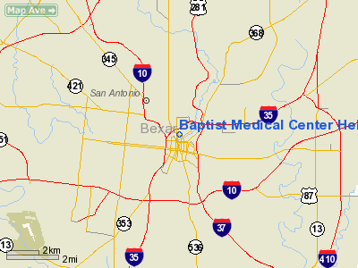
Baptist Medical Center Heliport |
Location & QuickFacts
| FAA Information Effective: | 2008-09-25 |
| Airport Identifier: | 09XS |
| Airport Status: | Operational |
| Longitude/Latitude: | 098-29-32.0610W/29-25-58.8370N
-98.492239/29.433010 (Estimated) |
| Elevation: | 710 ft / 216.41 m (Estimated) |
| Land: | 0 acres |
| From nearest city: | 0 nautical miles N of San Antonio, TX |
| Location: | Bexar County, TX |
| Magnetic Variation: | 07E (1985) |
Owner & Manager
| Ownership: | Privately owned |
| Owner: | Baptist Meml Hosp System |
| Address: | C/o Airlife, 111 Dallas St
San Antonio, TX 78205-1230 |
| Phone number: | 512-554-2891 |
| Manager: | Robert W. Hilliard |
| Address: | 111 Dallas St
San Antonio, TX 78205-1230 |
| Phone number: | 512-554-2891 |
Airport Operations and Facilities
| Airport Use: | Private
MEDICAL. |
| Wind indicator: | Yes |
| Segmented Circle: | No |
| Control Tower: | No |
| Landing fee charge: | No |
| Sectional chart: | San Antonio |
| Region: | ASW - Southwest |
| Boundary ARTCC: | ZHU - Houston |
| Tie-in FSS: | SJT - San Angelo |
| FSS on Airport: | No |
| FSS Toll Free: | 1-800-WX-BRIEF |
Airport Communications
Airport Services
| Airframe Repair: | NONE |
| Power Plant Repair: | NONE |
Runway Information
Helipad H1
| Dimension: | 90 x 90 ft / 27.4 x 27.4 m |
| Surface: | CONC,
HELISTOP IS AN ELEVATED CONC AND STEEL STRUCTURE LCTD APRXLY 63' ABOVE GROUND LEVEL. |
| |
Runway H1 |
Runway |
| Traffic Pattern: | Left | Left |
|
Radio Navigation Aids
| ID |
Type |
Name |
Ch |
Freq |
Var |
Dist |
| CVB | NDB | Castroville | | 338.00 | 08E | 19.4 nm |
| PEZ | NDB | Pleasanton | | 275.00 | 07E | 28.8 nm |
| HHH | NDB | Devine | | 359.00 | 07E | 29.4 nm |
| HMA | NDB | Hondo | | 329.00 | 08E | 35.8 nm |
| ER | NDB | Shein | | 263.00 | 08E | 39.6 nm |
| KSY | TACAN | Kelly | 057X | | 07E | 5.3 nm |
| DHK | TACAN | Randolph | 036X | | 09E | 13.3 nm |
| SSF | VOR | Stinson | | 108.40 | 09E | 10.8 nm |
| HDO | VOR/DME | Hondo | 31X | 109.40 | 08E | 36.3 nm |
| RND | VORTAC | Randolph | 70X | 112.30 | 09E | 12.0 nm |
| SAT | VORTAC | San Antonio | 115X | 116.80 | 08E | 12.8 nm |
| STV | VORTAC | Stonewall | 085X | 113.80 | 08E | 47.8 nm |
| CSI | VORTAC | Center Point | 122X | 117.50 | 08E | 47.8 nm |
| SAT | VOT | San Antonio Intl | | 110.40 | | 6.2 nm |
Remarks
Images and information placed above are from
http://www.airport-data.com/airport/09XS/
We thank them for the data!
| General Info
|
| Country |
United States
|
| State |
TEXAS
|
| FAA ID |
09XS
|
| Latitude |
29-25-58.837N
|
| Longitude |
098-29-32.061W
|
| Elevation |
710 feet
|
| Near City |
SAN ANTONIO
|
We don't guarantee the information is fresh and accurate. The data may
be wrong or outdated.
For more up-to-date information please refer to other sources.
|
|


