 |
|
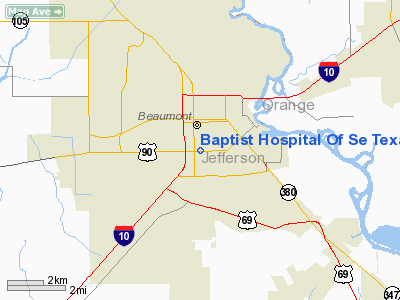
Baptist Hospital Of Se Texas Heliport |
Location & QuickFacts
| FAA Information Effective: | 2008-09-25 |
| Airport Identifier: | TS09 |
| Airport Status: | Operational |
| Longitude/Latitude: | 094-07-32.6490W/30-04-06.7660N
-94.125736/30.068546 (Estimated) |
| Elevation: | 20 ft / 6.10 m (Estimated) |
| Land: | 0 acres |
| From nearest city: | 0 nautical miles SE of Beaumont, TX |
| Location: | Jefferson County, TX |
| Magnetic Variation: | 05E (1985) |
Owner & Manager
| Ownership: | Privately owned |
| Owner: | Baptist Hospital Of Se Texas |
| Address: | Po Drawer 1591
Beaumont, TX 77704 |
| Phone number: | 409 839 5616 |
| Manager: | David N. Parmer |
| Address: | Po Box 1591
Beaumont, TX 77704 |
| Phone number: | 409-835-3781 |
Airport Operations and Facilities
| Airport Use: | Private
MEDICAL. |
| Wind indicator: | Yes |
| Segmented Circle: | No |
| Control Tower: | No |
| Lighting Schedule: | DUSK-DAWN |
| Beacon Color: | Clear-Green-Yellow (heliport) |
| Sectional chart: | Houston |
| Region: | ASW - Southwest |
| Boundary ARTCC: | ZHU - Houston |
| Tie-in FSS: | CXO - Montgomery County |
| FSS Toll Free: | 1-800-WX-BRIEF
FOR FP FILING CALL CXO FSS 1-800-833-5602. |
Runway Information
Helipad H1
| Dimension: | 40 x 40 ft / 12.2 x 12.2 m |
| Surface: | CONC, |
| |
Runway H1 |
Runway |
| Traffic Pattern: | Left | Left |
|
Radio Navigation Aids
| ID |
Type |
Name |
Ch |
Freq |
Var |
Dist |
| GDE | NDB | Goodhue | | 368.00 | 07E | 4.0 nm |
| ORG | NDB | Orange | | 211.00 | 05E | 17.2 nm |
| HRD | NDB | Hardin County | | 524.00 | 04E | 17.6 nm |
| CBC | NDB | Anahuac | | 413.00 | 05E | 33.1 nm |
| UX | NDB | Sulfy | | 278.00 | 04E | 37.5 nm |
| DQU | NDB | De Quincy | | 410.00 | 05E | 40.7 nm |
| BPT | VOR/DME | Beaumont | 092X | 114.50 | 07E | 9.3 nm |
| SBI | VOR/DME | Sabine Pass | 101X | 115.40 | 07E | 23.4 nm |
| MHF | VOR/DME | Trinity | 083X | 113.60 | 07E | 45.1 nm |
| DAS | VORTAC | Daisetta | 116X | 116.90 | 05E | 28.0 nm |
Remarks
- PRVDD INGRESS/EGRESS ROUTES ARE ESTABLISHED ONLY FROM THE WEST OR SW.
Images and information placed above are from
http://www.airport-data.com/airport/TS09/
We thank them for the data!
| General Info
|
| Country |
United States
|
| State |
TEXAS
|
| FAA ID |
TS09
|
| Latitude |
30-04-06.766N
|
| Longitude |
094-07-32.649W
|
| Elevation |
20 feet
|
| Near City |
BEAUMONT
|
We don't guarantee the information is fresh and accurate. The data may
be wrong or outdated.
For more up-to-date information please refer to other sources.
|
|


