 |
|
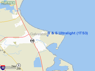
Location & QuickFacts
| FAA Information Effective: | 2008-09-25 |
| Airport Identifier: | 1TS3 |
| Airport Status: | Operational |
| Longitude/Latitude: | 094-57-01.7310W/29-29-45.8280N
-94.950481/29.496063 (Estimated) |
| Elevation: | 16 ft / 4.88 m (Estimated) |
| Land: | 5 acres |
| From nearest city: | 1 nautical miles E of San Leon, TX |
| Location: | Galveston County, TX |
| Magnetic Variation: | 06E (1985) |
Owner & Manager
| Ownership: | Privately owned |
| Owner: | Angel Brawner |
| Address: | Rt 1/box 725
Dickinson, TX 77539 |
| Phone number: | 713-339-1363 |
| Manager: | Mike Brawner |
| Address: | Rt 1/box 725
Dickinson, TX 77539 |
| Phone number: | 713-339-1363 |
Airport Operations and Facilities
| Airport Use: | Private |
| Wind indicator: | Yes |
| Segmented Circle: | No |
| Control Tower: | No |
| Sectional chart: | Houston |
| Region: | ASW - Southwest |
| Boundary ARTCC: | ZHU - Houston |
| Tie-in FSS: | CXO - Montgomery County |
| FSS Toll Free: | 1-800-WX-BRIEF
FOR FP FILING CALL CXO FSS 1-800-833-5602. |
Runway Information
Runway 01/19
| Dimension: | 450 x 30 ft / 137.2 x 9.1 m |
| Surface: | TURF, |
| |
Runway 01 |
Runway 19 |
| Traffic Pattern: | Left | Left |
| Obstruction: | 25 ft pline, 50.0 ft from runway | 15 ft bldg, 30.0 ft from runway |
|
Runway 12/30
| Dimension: | 425 x 30 ft / 129.5 x 9.1 m |
| Surface: | TURF, |
| |
Runway 12 |
Runway 30 |
| Traffic Pattern: | Left | Left |
| Obstruction: | 25 ft pline, 50.0 ft from runway | 15 ft bldg, 30.0 ft from runway |
|
Runway 16/34
| Dimension: | 475 x 30 ft / 144.8 x 9.1 m |
| Surface: | TURF, |
| |
Runway 16 |
Runway 34 |
| Traffic Pattern: | Left | Left |
| Obstruction: | 25 ft pline, 50.0 ft from runway | 15 ft bldg, 30.0 ft from runway |
|
Radio Navigation Aids
| ID |
Type |
Name |
Ch |
Freq |
Var |
Dist |
| JPA | NDB | Sanjac | | 347.00 | 05E | 12.1 nm |
| GLS | NDB | Galveston | | 206.00 | 08E | 14.1 nm |
| CBC | NDB | Anahuac | | 413.00 | 05E | 22.4 nm |
| SYG | NDB | Sandy Point | | 402.00 | 05E | 27.1 nm |
| BVP | NDB | Nixin | | 326.00 | 05E | 32.9 nm |
| SGR | NDB | Hull | | 388.00 | 05E | 37.8 nm |
| LYD | NDB | Lakeside | | 249.00 | 05E | 42.6 nm |
| EYQ | NDB | Weiser | | 286.00 | 06E | 44.6 nm |
| DWH | NDB | David Hooks | | 521.00 | 05E | 49.6 nm |
| EFD | TACAN | Ellington | 031X | | 05E | 12.8 nm |
| MHF | VOR/DME | Trinity | 083X | 113.60 | 07E | 11.0 nm |
| HUB | VOR/DME | Hobby | 118X | 117.10 | 05E | 19.6 nm |
| SBI | VOR/DME | Sabine Pass | 101X | 115.40 | 07E | 49.1 nm |
| VUH | VORTAC | Scholes | 077X | 113.00 | 06E | 14.3 nm |
| IAH | VORTAC | Humble | 113X | 116.60 | 05E | 34.5 nm |
| DAS | VORTAC | Daisetta | 116X | 116.90 | 05E | 44.6 nm |
| HOU | VOT | Houston Wm P Hobby | | 108.40 | | 19.4 nm |
Remarks
- PRVDD OPERATING CONDITIONS OF LETTER OF AGREEMENT WITH B & S FLIGHT PARK & ELLIS ARPT ARE MAINTAINED.
Images and information placed above are from
http://www.airport-data.com/airport/1TS3/
We thank them for the data!
| General Info
|
| Country |
United States
|
| State |
TEXAS
|
| FAA ID |
1TS3
|
| Latitude |
29-29-45.828N
|
| Longitude |
094-57-01.731W
|
| Elevation |
16 feet
|
| Near City |
SAN LEON
|
We don't guarantee the information is fresh and accurate. The data may
be wrong or outdated.
For more up-to-date information please refer to other sources.
|
|


