 |
|
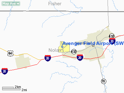
Location & QuickFacts
| FAA Information Effective: | 2008-09-25 |
| Airport Identifier: | SWW |
| Airport Status: | Operational |
| Longitude/Latitude: | 100-27-59.6317W/32-28-02.5067N
-100.466564/32.467363 (Estimated) |
| Elevation: | 2380 ft / 725.42 m (Surveyed) |
| Land: | 896 acres |
| From nearest city: | 3 nautical miles W of Sweetwater, TX |
| Location: | Nolan County, TX |
| Magnetic Variation: | 08E (1990) |
Owner & Manager
| Ownership: | Publicly owned |
| Owner: | City Of Sweetwater |
| Address: | Po Box 450
Sweetwater, TX 79556 |
| Phone number: | 325-236-6313 |
| Manager: | John Howard |
| Address: | 317 College Dr
Sweetwater, TX 79556 |
| Phone number: | 325-235-8478 |
Airport Operations and Facilities
| Airport Use: | Open to public |
| Wind indicator: | Yes |
| Segmented Circle: | Yes |
| Control Tower: | No |
| Lighting Schedule: | DUSK-DAWN |
| Beacon Color: | Clear-Green (lighted land airport) |
| Landing fee charge: | No |
| Sectional chart: | Dallas-ft Worth |
| Region: | ASW - Southwest |
| Boundary ARTCC: | ZFW - Fort Worth |
| Tie-in FSS: | FTW - Fort Worth |
| FSS on Airport: | No |
| FSS Phone: | 817-541-3474 |
| FSS Toll Free: | 1-800-WX-BRIEF |
| NOTAMs Facility: | SWW (NOTAM-d service avaliable) |
| Federal Agreements: | NGRY3 |
Airport Communications
| CTAF: | 122.800 |
| Unicom: | 122.800 |
Airport Services
| Fuel available: | 100LLA1+
FOR FUEL AFT HRS CALL 325-235-8478. |
| Airframe Repair: | MAJOR |
| Power Plant Repair: | MAJOR |
Runway Information
Runway 04/22
| Dimension: | 5659 x 75 ft / 1724.9 x 22.9 m |
| Surface: | ASPH, Good Condition |
| Weight Limit: | Single wheel: 30000 lbs. |
| Edge Lights: | Medium |
| |
Runway 04 |
Runway 22 |
| Longitude: | 100-28-15.4460W | 100-27-30.0526W |
| Latitude: | 32-27-39.5426N | 32-28-20.2081N |
| Elevation: | 2380.00 ft | 2337.00 ft |
| Alignment: | 43 | 127 |
| Traffic Pattern: | Left | Left |
| Markings: | Non-precision instrument, Good Condition | Non-precision instrument, Good Condition |
| Crossing Height: | 40.00 ft | 40.00 ft |
| VASI: | 2-light PAPI on left side | 2-light PAPI on left side |
| Visual Glide Angle: | 3.00° | 3.00° |
| Obstruction: | 32 ft pole, 960.0 ft from runway, 285 ft left of centerline, 23:1 slope to clear | 15 ft road, 200.0 ft from runway, 235 ft left of centerline
+15 FT GRVL ROAD 199 FT FM THLD 236 FT L OF CNTRLN. |
|
Runway 17/35
| Dimension: | 5840 x 100 ft / 1780.0 x 30.5 m |
| Surface: | ASPH, Good Condition |
| Weight Limit: | Single wheel: 30000 lbs. |
| Edge Lights: | Medium |
| |
Runway 17 |
Runway 35 |
| Longitude: | 100-28-10.0694W | 100-28-02.5313W |
| Latitude: | 32-28-33.7658N | 32-27-36.3466N |
| Elevation: | 2341.00 ft | 2369.00 ft |
| Alignment: | 127 | 127 |
| Traffic Pattern: | Left | Left |
| Markings: | Non-precision instrument, Good Condition | Non-precision instrument, Good Condition |
| Crossing Height: | 40.00 ft | 40.00 ft |
| VASI: | 4-light PAPI on left side | 4-light PAPI on left side |
| Visual Glide Angle: | 3.00° | 3.00° |
| Runway End Identifier: | Yes | Yes |
| Obstruction: | , 50:1 slope to clear | 25 ft tree, 810.0 ft from runway, 140 ft right of centerline, 24:1 slope to clear |
|
Radio Navigation Aids
| ID |
Type |
Name |
Ch |
Freq |
Var |
Dist |
| SWW | NDB | Sweetwater | | 275.00 | 08E | 0.3 nm |
| SDR | NDB | Snyder | | 359.00 | 08E | 28.1 nm |
| IEW | NDB | Winters | | 396.00 | 08E | 39.7 nm |
| TMV | NDB | Stamford | | 290.00 | 08E | 44.2 nm |
| DYS | TACAN | Dyess | 063X | | 08E | 31.1 nm |
| TQA | VOR/DME | Tuscola | 053X | 111.60 | 10E | 35.8 nm |
| ABI | VORTAC | Abilene | 084X | 113.70 | 10E | 30.6 nm |
Images and information placed above are from
http://www.airport-data.com/airport/SWW/
We thank them for the data!
| General Info
|
| Country |
United States
|
| State |
TEXAS
|
| FAA ID |
SWW
|
| Latitude |
32-28-02.507N
|
| Longitude |
100-27-59.632W
|
| Elevation |
2380 feet
|
| Near City |
SWEETWATER
|
We don't guarantee the information is fresh and accurate. The data may
be wrong or outdated.
For more up-to-date information please refer to other sources.
|
|


