 |
|
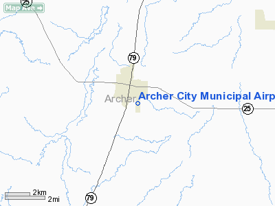
Location & QuickFacts
| FAA Information Effective: | 2008-09-25 |
| Airport Identifier: | T39 |
| Airport Status: | Operational |
| Longitude/Latitude: | 098-37-07.2050W/33-34-56.3740N
-98.618668/33.582326 (Estimated) |
| Elevation: | 1065 ft / 324.61 m (Estimated) |
| Land: | 122 acres |
| From nearest city: | 1 nautical miles SE of Archer City, TX |
| Location: | Archer County, TX |
| Magnetic Variation: | 07E (1985) |
Owner & Manager
| Ownership: | Privately owned |
| Owner: | Valter Delle-nebbia |
| Address: | P.o. Box 734
Archer City, TX 76351 |
| Phone number: | 940-574-4990 |
| Manager: | Valter Delle-nebbia |
| Address: | P.o. Box 734
Archer City, TX 76351 |
| Phone number: | 940-574-4990 |
Airport Operations and Facilities
| Airport Use: | Open to public |
| Wind indicator: | Yes |
| Segmented Circle: | Yes |
| Control Tower: | No |
| Landing fee charge: | No |
| Sectional chart: | Dallas-ft Worth |
| Region: | ASW - Southwest |
| Boundary ARTCC: | ZFW - Fort Worth |
| Tie-in FSS: | FTW - Fort Worth |
| FSS on Airport: | No |
| FSS Phone: | 817-541-3474 |
| FSS Toll Free: | 1-800-WX-BRIEF |
| NOTAMs Facility: | FTW (NOTAM-d service avaliable) |
Airport Communications
Airport Services
| Airframe Repair: | NONE |
| Power Plant Repair: | NONE |
| Bottled Oxygen: | NONE |
| Bulk Oxygen: | NONE |
Runway Information
Runway 17/35
| Dimension: | 3200 x 60 ft / 975.4 x 18.3 m |
| Surface: | ASPH, Poor Condition
LOOSE GRVL, TALL GRASS AND POT HOLES ON RY. |
| Weight Limit: | Single wheel: 12500 lbs. |
| |
Runway 17 |
Runway 35 |
| Traffic Pattern: | Left | Left |
| Markings: | Basic, Poor Condition
RY MARKINGS FADED. | Basic, Poor Condition
RY MARKINGS FADED. |
| Obstruction: | 15 ft road, 500.0 ft from runway, 20:1 slope to clear | , 50:1 slope to clear |
|
Radio Navigation Aids
| ID |
Type |
Name |
Ch |
Freq |
Var |
Dist |
| SKB | NDB | Scotland | | 344.00 | 08E | 14.1 nm |
| ONY | NDB | Olney | | 272.00 | 07E | 17.1 nm |
| GHX | NDB | Graham | | 371.00 | 07E | 25.8 nm |
| GZV | NDB | Brazos River | | 280.00 | 07E | 39.3 nm |
| GMZ | NDB | Grindstone Mountain | | 356.00 | 07E | 42.3 nm |
| SHP | TACAN | Sheppard | 045X | | 10E | 24.9 nm |
| SPS | VORTAC | Wichita Falls | 074X | 112.70 | 10E | 24.4 nm |
| UKW | VORTAC | Bowie | 071X | 112.40 | 06E | 40.0 nm |
Remarks
- 70 FT AGL DRILLING RIG 700 FT NW OF RY 17/35.
Images and information placed above are from
http://www.airport-data.com/airport/T39/
We thank them for the data!
| General Info
|
| Country |
United States
|
| State |
TEXAS
|
| FAA ID |
T39
|
| Latitude |
33-34-56.374N
|
| Longitude |
098-37-07.205W
|
| Elevation |
1065 feet
|
| Near City |
ARCHER CITY
|
We don't guarantee the information is fresh and accurate. The data may
be wrong or outdated.
For more up-to-date information please refer to other sources.
|
|


