 |
|
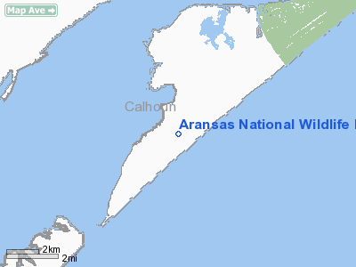
Aransas National Wildlife Refuge Airport |
Location & QuickFacts
| FAA Information Effective: | 2008-09-25 |
| Airport Identifier: | XS10 |
| Airport Status: | Operational |
| Longitude/Latitude: | 096-48-00.9480W/28-07-01.0480N
-96.800263/28.116958 (Estimated) |
| Elevation: | 10 ft / 3.05 m (Estimated) |
| Land: | 0 acres |
| From nearest city: | 14 nautical miles NE of Matagorda Island, TX |
| Location: | Calhoun County, TX |
| Magnetic Variation: | 06E (1985) |
Owner & Manager
| Ownership: | Publicly owned |
| Owner: | Us Fish & Wildlife |
| Address: |
|
| Phone number: | 512-286-3559 |
| Manager: | Aransas Nat'l Wildlife Refuge |
| Address: | Box 100
Austwell, TX 77950 |
| Phone number: | 512-286-3533 |
Airport Operations and Facilities
| Airport Use: | Private |
| Wind indicator: | Yes |
| Segmented Circle: | No |
| Control Tower: | No |
| Landing fee charge: | No |
| Sectional chart: | Houston |
| Region: | ASW - Southwest |
| Boundary ARTCC: | ZHU - Houston |
| Tie-in FSS: | SJT - San Angelo |
| FSS on Airport: | No |
| FSS Toll Free: | 1-800-WX-BRIEF |
Airport Services
| Airframe Repair: | NONE |
| Power Plant Repair: | NONE |
Runway Information
Runway 05/23
| Dimension: | 3700 x 60 ft / 1127.8 x 18.3 m |
| Surface: | ASPH, |
| |
Runway 05 |
Runway 23 |
| Traffic Pattern: | Left | Left |
|
Runway 15/33
| Dimension: | 4600 x 60 ft / 1402.1 x 18.3 m |
| Surface: | ASPH, |
| |
Runway 15 |
Runway 33 |
| Traffic Pattern: | Left | Left |
|
Radio Navigation Aids
| ID |
Type |
Name |
Ch |
Freq |
Var |
Dist |
| RKP | NDB | Rockport | | 391.00 | 06E | 13.2 nm |
| MNO | NDB | Mellon Ranch | | 375.00 | 06E | 23.6 nm |
| PKV | NDB | Port Lavaca | | 515.00 | 05E | 32.7 nm |
| VCT | VOR/DME | Victoria | 027X | 109.00 | 06E | 48.0 nm |
| CRP | VORTAC | Corpus Christi | 102X | 115.50 | 09E | 36.5 nm |
| NGP | VORTAC | Truax | 087X | 114.00 | 06E | 36.9 nm |
| PSX | VORTAC | Palacios | 120X | 117.30 | 08E | 46.9 nm |
Remarks
Images and information placed above are from
http://www.airport-data.com/airport/XS10/
We thank them for the data!
| General Info
|
| Country |
United States
|
| State |
TEXAS
|
| FAA ID |
XS10
|
| Latitude |
28-07-01.048N
|
| Longitude |
096-48-00.948W
|
| Elevation |
10 feet
|
| Near City |
MATAGORDA ISLAND
|
We don't guarantee the information is fresh and accurate. The data may
be wrong or outdated.
For more up-to-date information please refer to other sources.
|
|


