 |
|
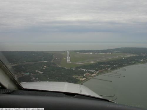 |
(Click on the photo to enlarge) |
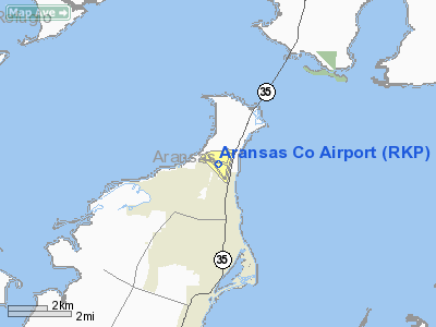
Location & QuickFacts
| FAA Information Effective: | 2008-09-25 |
| Airport Identifier: | RKP |
| Airport Status: | Operational |
| Longitude/Latitude: | 097-02-40.6000W/28-05-12.4000N
-97.044611/28.086778 (Estimated) |
| Elevation: | 24 ft / 7.32 m (Surveyed) |
| Land: | 600 acres |
| From nearest city: | 4 nautical miles N of Rockport, TX |
| Location: | Aransas County, TX |
| Magnetic Variation: | 06E (2000) |
Owner & Manager
| Ownership: | Publicly owned |
| Owner: | Aransas County |
| Address: | Aransas County Courthouse
Rockport, TX 78382 |
| Phone number: | 361-790-0100 |
| Manager: | Gene Johnson |
| Address: | Po Box 1270
Rockport, TX 78382 |
| Phone number: | 361-790-0141 |
Airport Operations and Facilities
| Airport Use: | Open to public |
| Wind indicator: | Yes |
| Segmented Circle: | Yes |
| Control Tower: | No |
| Lighting Schedule: | DUSK-DAWN
MIRL RY 14/32 PRESET LOW INTST DUSK-DAWN; TO INCR INTST & ACTVT REIL RY 14 - CTAF. |
| Beacon Color: | Clear-Green (lighted land airport) |
| Landing fee charge: | No |
| Sectional chart: | San Antonio |
| Region: | ASW - Southwest |
| Boundary ARTCC: | ZHU - Houston |
| Tie-in FSS: | SJT - San Angelo |
| FSS on Airport: | No |
| FSS Toll Free: | 1-800-WX-BRIEF |
| NOTAMs Facility: | RKP (NOTAM-d service avaliable) |
| Federal Agreements: | NGRY3 |
Airport Communications
| CTAF: | 123.050 |
| Unicom: | 123.050 |
Airport Services
| Fuel available: | 100LLA |
| Airframe Repair: | MAJOR |
| Power Plant Repair: | MAJOR |
Runway Information
Runway 14/32
| Dimension: | 5608 x 100 ft / 1709.3 x 30.5 m |
| Surface: | ASPH, Good Condition |
| Weight Limit: | Single wheel: 45000 lbs.
Dual wheel: 80000 lbs.
Dual tandem wheel: 140000 lbs. |
| Edge Lights: | Medium |
| |
Runway 14 |
Runway 32 |
| Longitude: | 097-03-05.6670W | 097-02-30.1640W |
| Latitude: | 28-05-33.5550N | 28-04-47.8160N |
| Elevation: | 14.00 ft | 24.00 ft |
| Alignment: | 127 | 127 |
| Traffic Pattern: | Left | Right |
| Markings: | Non-precision instrument, Good Condition | Non-precision instrument, Good Condition |
| Crossing Height: | 35.00 ft | 25.00 ft |
| Displaced threshold: | 0.00 ft | 560.00 ft |
| VASI: | 4-light PAPI on left side | 4-light PAPI on left side |
| Visual Glide Angle: | 3.00° | 3.00° |
| Runway End Identifier: | Yes | Yes |
| Obstruction: | , 50:1 slope to clear | 23 ft pline, 960.0 ft from runway, 210 ft left of centerline, 33:1 slope to clear
APCH SLOPE 50:1 FM DSPLCD THLD. |
|
Runway 18/36
| Dimension: | 4498 x 100 ft / 1371.0 x 30.5 m |
| Surface: | ASPH, Fair Condition |
| Weight Limit: | Single wheel: 45000 lbs.
Dual wheel: 80000 lbs.
Dual tandem wheel: 140000 lbs. |
| Edge Lights: | Medium |
| |
Runway 18 |
Runway 36 |
| Longitude: | 097-02-19.5240W | 097-02-28.6470W |
| Latitude: | 28-05-31.9020N | 28-04-48.1020N |
| Elevation: | 20.00 ft | 22.00 ft |
| Alignment: | 127 | 10 |
| Traffic Pattern: | Right | Left |
| Markings: | Non-precision instrument, Good Condition | Non-precision instrument, Good Condition |
| Crossing Height: | 38.00 ft | 42.00 ft |
| VASI: | 2-light PAPI on left side | 2-light PAPI on left side |
| Visual Glide Angle: | 3.00° | 3.00° |
| Obstruction: | 33 ft trees, 1015.0 ft from runway, 150 ft left of centerline, 24:1 slope to clear | 28 ft tree, 680.0 ft from runway, 250 ft left of centerline, 17:1 slope to clear |
|
Radio Navigation Aids
| ID |
Type |
Name |
Ch |
Freq |
Var |
Dist |
| RKP | NDB | Rockport | | 391.00 | 06E | 0.2 nm |
| MNO | NDB | Mellon Ranch | | 375.00 | 06E | 14.4 nm |
| PKV | NDB | Port Lavaca | | 515.00 | 05E | 39.0 nm |
| BEA | NDB | Beeville | | 284.00 | 07E | 43.2 nm |
| VCT | VOR/DME | Victoria | 027X | 109.00 | 06E | 49.0 nm |
| CRP | VORTAC | Corpus Christi | 102X | 115.50 | 09E | 23.9 nm |
| NGP | VORTAC | Truax | 087X | 114.00 | 06E | 27.5 nm |
Images and information placed above are from
http://www.airport-data.com/airport/RKP/
We thank them for the data!
| General Info
|
| Country |
United States
|
| State |
TEXAS
|
| FAA ID |
RKP
|
| Latitude |
28-05-12.400N
|
| Longitude |
097-02-40.600W
|
| Elevation |
24 feet
|
| Near City |
ROCKPORT
|
We don't guarantee the information is fresh and accurate. The data may
be wrong or outdated.
For more up-to-date information please refer to other sources.
|
|


