 |
|
| Angelina County Airport |
| IATA: LFK – ICAO: KLFK – FAA LID: LFK |
| Summary |
| Airport type |
Public |
| Owner |
Angelina County |
| Serves |
Lufkin, Texas |
| Elevation AMSL |
296 ft / 90 m |
| Coordinates |
31°14′02″N 094°45′00″W / 31.23389°N 94.75°W / 31.23389; -94.75 |
| Website |
www.angelinacounty.net/... |
| Runways |
| Direction |
Length |
Surface |
| ft |
m |
| 7/25 |
5,398 |
1,645 |
Asphalt |
| 15/33 |
4,309 |
1,313 |
Asphalt |
| Statistics (2008) |
| Aircraft operations |
18,500 |
| Based aircraft |
72 |
| Source: Federal Aviation Administration |
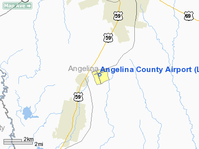
Angelina County Airport (IATA: LFK, ICAO: KLFK, FAA LID: LFK) is a county-owned, public-use airport in Angelina County, Texas, United States. The airport is located seven nautical miles (13 km) southwest of the central business district of Lufkin, Texas.
Facilities and aircraft
Angelina County Airport covers an area of 385 acres (156 ha) at an elevation of 296 feet (90 m) above mean sea level. It has two asphalt paved runways: 7/25 is 5,398 by 100 feet (1,645 x 30 m) and 15/33 is 4,309 by 100 feet (1,313 x 30 m).
For the 12-month period ending July 11, 2008, the airport had 18,500 aircraft operations, an average of 50 per day: 97% general aviation and 3% military. At that time there were 72 aircraft based at this airport: 75% single-engine, 17% multi-engine, 6% jet, 1% helicopter and 1% ultralight.
The above content comes from Wikipedia and is published under free licenses – click here to read more.
Location & QuickFacts
| FAA Information Effective: | 2008-09-25 |
| Airport Identifier: | LFK |
| Airport Status: | Operational |
| Longitude/Latitude: | 094-45-00.0000W/31-14-02.4500N
-94.750000/31.234014 (Estimated) |
| Elevation: | 296 ft / 90.22 m (Surveyed) |
| Land: | 385 acres |
| From nearest city: | 7 nautical miles SW of Lufkin, TX |
| Location: | Angelina County, TX |
| Magnetic Variation: | 05E (1995) |
Owner & Manager
| Ownership: | Publicly owned |
| Owner: | Angelina County |
| Address: | County Courthouse
Lufkin, TX 75901 |
| Phone number: | 936-634-5413 |
| Manager: | Randy Carswell |
| Address: | 800 Airport Blvd.
Diboll, TX 75941 |
| Phone number: | 936-634-7511 |
Airport Operations and Facilities
| Airport Use: | Open to public |
| Wind indicator: | Yes |
| Segmented Circle: | Yes |
| Control Tower: | No |
| Lighting Schedule: | DUSK-DAWN
MIRL RYS 07/25 & 15/33 PRESET MED INTST; TO INCR INTST ACTVT CTAF. ACTVT MALSR RY 07 - CTAF. PAPI RY 25; VASI RYS 15 & 33 OPER CONTINOUSLY. |
| Beacon Color: | Clear-Green (lighted land airport) |
| Landing fee charge: | No |
| Sectional chart: | Houston |
| Region: | ASW - Southwest |
| Boundary ARTCC: | ZHU - Houston |
| Tie-in FSS: | CXO - Montgomery County |
| FSS on Airport: | No |
| FSS Toll Free: | 1-800-WX-BRIEF |
| NOTAMs Facility: | LFK (NOTAM-d service avaliable) |
| Federal Agreements: | NGY |
Airport Communications
| CTAF: | 123.000 |
| Unicom: | 123.000
UNICOM MONITORED FM 0600-2000. |
Airport Services
| Fuel available: | 100LLA+
SVC FEE CHARGED FOR FUEL AFT 1900. |
| Airframe Repair: | MAJOR |
| Power Plant Repair: | MAJOR |
| Bottled Oxygen: | NONE |
| Bulk Oxygen: | HIGH |
Runway Information
Runway 07/25
| Dimension: | 5398 x 100 ft / 1645.3 x 30.5 m
296 FT PAVED STOPWAY NW END. |
| Surface: | ASPH, Good Condition |
| Weight Limit: | Single wheel: 30000 lbs. |
| Edge Lights: | Medium |
| |
Runway 07 |
Runway 25 |
| Longitude: | 094-45-26.7840W | 094-44-26.6600W |
| Latitude: | 31-14-03.3930N | 31-14-16.9910N |
| Elevation: | 284.00 ft | 296.00 ft |
| Alignment: | 75 | 127 |
| ILS Type: | ILS
| |
| Traffic Pattern: | Left | Left |
| Markings: | Precision instrument, Good Condition | Non-precision instrument, Good Condition |
| Crossing Height: | 0.00 ft | 45.00 ft |
| VASI: | | 4-light PAPI on left side |
| Visual Glide Angle: | 0.00° | 3.00° |
| Approach lights: | MALSR | |
| Obstruction: | , 50:1 slope to clear | 56 ft trees, 900.0 ft from runway, 385 ft right of centerline, 12:1 slope to clear |
|
Runway 15/33
| Dimension: | 4309 x 100 ft / 1313.4 x 30.5 m
296 FT PAVED STOPWAY NW END. |
| Surface: | ASPH, Good Condition |
| Weight Limit: | Single wheel: 30000 lbs. |
| Edge Lights: | Medium |
| |
Runway 15 |
Runway 33 |
| Longitude: | 094-45-12.4290W | 094-44-55.6570W |
| Latitude: | 31-14-12.8530N | 31-13-32.7150N |
| Elevation: | 289.00 ft | 274.00 ft |
| Alignment: | 127 | 127 |
| Traffic Pattern: | Left | Left |
| Markings: | Non-precision instrument, Good Condition | Non-precision instrument, Good Condition |
| Crossing Height: | 48.00 ft | 55.00 ft |
| Displaced threshold: | 0.00 ft | 105.00 ft |
| VASI: | 4-box on left side | 4-box on left side |
| Visual Glide Angle: | 3.00° | 3.00° |
| Runway End Identifier: | No | No |
| Obstruction: | 38 ft tree, 625.0 ft from runway, 294 ft right of centerline, 11:1 slope to clear | 40 ft trees, 775.0 ft from runway, 330 ft right of centerline, 14:1 slope to clear |
|
Radio Navigation Aids
| ID |
Type |
Name |
Ch |
Freq |
Var |
Dist |
| OC | NDB | Nados | | 253.00 | 05E | 15.2 nm |
| GXD | NDB | Nacogdoches | | 391.00 | 05E | 25.0 nm |
| JAS | NDB | Jasper | | 344.00 | 04E | 40.5 nm |
| JSO | NDB | Cherokee County | | 263.00 | 05E | 45.1 nm |
| CZJ | NDB | Amason | | 341.00 | 04E | 47.2 nm |
| LFK | VORTAC | Lufkin | 058X | 112.10 | 05E | 4.6 nm |
Remarks
- RY 33 100 FT BY 199 FT PAVED SAFETY AREA.
Images and information placed above are from
http://www.airport-data.com/airport/LFK/
We thank them for the data!
| General Info
|
| Country |
United States
|
| State |
TEXAS
|
| FAA ID |
LFK
|
| Latitude |
31-14-02.450N
|
| Longitude |
094-45-00.000W
|
| Elevation |
296 feet
|
| Near City |
LUFKIN
|
We don't guarantee the information is fresh and accurate. The data may
be wrong or outdated.
For more up-to-date information please refer to other sources.
|
|


