 |
|
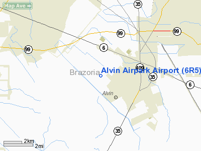
Location & QuickFacts
| FAA Information Effective: | 2008-09-25 |
| Airport Identifier: | 6R5 |
| Airport Status: | Operational |
| Longitude/Latitude: | 095-17-20.7680W/29-24-55.8520N
-95.289102/29.415514 (Estimated) |
| Elevation: | 43 ft / 13.11 m (Estimated) |
| Land: | 8 acres |
| From nearest city: | 3 nautical miles W of Alvin, TX |
| Location: | Brazoria County, TX |
| Magnetic Variation: | 06E (1985) |
Owner & Manager
| Ownership: | Privately owned |
| Owner: | Robert D. Hering |
| Address: | Rt 1 Box 239
Alvin, TX 77511 |
| Phone number: | 281-331-3701 |
| Manager: | Robert D. Hering |
| Address: | Rt 1 Box 239
Alvin, TX 77511 |
| Phone number: | 281-331-3701 |
Airport Operations and Facilities
| Airport Use: | Open to public |
| Wind indicator: | Yes |
| Segmented Circle: | No |
| Control Tower: | No |
| Landing fee charge: | No |
| Sectional chart: | Houston |
| Region: | ASW - Southwest |
| Boundary ARTCC: | ZHU - Houston |
| Tie-in FSS: | CXO - Montgomery County |
| FSS on Airport: | No |
| FSS Toll Free: | 1-800-WX-BRIEF
FOR FP FILING CALL CXO FSS 1-800-992-7433. |
| NOTAMs Facility: | CXO (NOTAM-d service avaliable) |
Airport Communications
Airport Services
Runway Information
Runway 03/21
| Dimension: | 1420 x 75 ft / 432.8 x 22.9 m |
| Surface: | TURF, Good Condition |
| |
Runway 03 |
Runway 21 |
| Traffic Pattern: | Left | Left |
| Obstruction: | 15 ft trees, 35 ft right of centerline | 30 ft trees, 0.0 ft from runway, 40 ft left of centerline |
|
Runway 06/24
| Dimension: | 1500 x 80 ft / 457.2 x 24.4 m |
| Surface: | TURF, Good Condition |
| |
Runway 06 |
Runway 24 |
| Traffic Pattern: | Left | Left |
| Obstruction: | 34 ft plines, 55 ft left of centerline | 30 ft trees, 0.0 ft from runway |
|
Runway 12/30
| Dimension: | 830 x 60 ft / 253.0 x 18.3 m |
| Surface: | TURF, Good Condition |
| |
Runway 12 |
Runway 30 |
| Traffic Pattern: | Left | Left |
| Obstruction: | 34 ft pline | 20 ft trees, 0.0 ft from runway |
|
Radio Navigation Aids
| ID |
Type |
Name |
Ch |
Freq |
Var |
Dist |
| SYG | NDB | Sandy Point | | 402.00 | 05E | 10.7 nm |
| JPA | NDB | Sanjac | | 347.00 | 05E | 19.0 nm |
| SGR | NDB | Hull | | 388.00 | 05E | 23.2 nm |
| GLS | NDB | Galveston | | 206.00 | 08E | 28.3 nm |
| LYD | NDB | Lakeside | | 249.00 | 05E | 31.5 nm |
| BVP | NDB | Nixin | | 326.00 | 05E | 34.9 nm |
| EYQ | NDB | Weiser | | 286.00 | 06E | 36.2 nm |
| CBC | NDB | Anahuac | | 413.00 | 05E | 39.2 nm |
| BYY | NDB | Bay City | | 344.00 | 06E | 40.0 nm |
| DWH | NDB | David Hooks | | 521.00 | 05E | 45.1 nm |
| ARM | NDB | Wharton | | 245.00 | 06E | 46.2 nm |
| EFD | TACAN | Ellington | 031X | | 05E | 13.3 nm |
| HUB | VOR/DME | Hobby | 118X | 117.10 | 05E | 14.4 nm |
| MHF | VOR/DME | Trinity | 083X | 113.60 | 07E | 29.4 nm |
| VUH | VORTAC | Scholes | 077X | 113.00 | 06E | 23.8 nm |
| IAH | VORTAC | Humble | 113X | 116.60 | 05E | 32.7 nm |
| HOU | VOT | Houston Wm P Hobby | | 108.40 | | 13.8 nm |
Remarks
- RY 03 +5 FT FENCE 40 FT SE OF CNTRLN ALONG SOUTHEAST EDGE. +30 FT TREES ALONG RY 03 RIGHT OF CNTRLN.
- RY 21 +5 FT FENCE 20 FT FM THLD 0B. +30 FT TREES ALONG RY 21 LEFT OF CNTRLN.
Images and information placed above are from
http://www.airport-data.com/airport/6R5/
We thank them for the data!
| General Info
|
| Country |
United States
|
| State |
TEXAS
|
| FAA ID |
6R5
|
| Latitude |
29-24-55.852N
|
| Longitude |
095-17-20.768W
|
| Elevation |
43 feet
|
| Near City |
ALVIN
|
We don't guarantee the information is fresh and accurate. The data may
be wrong or outdated.
For more up-to-date information please refer to other sources.
|
|


