 |
|
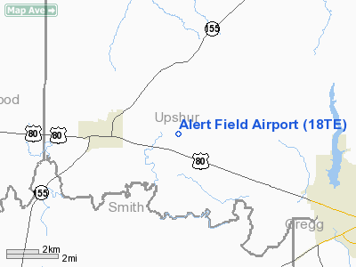
Location & QuickFacts
| FAA Information Effective: | 2008-09-25 |
| Airport Identifier: | 18TE |
| Airport Status: | Operational |
| Longitude/Latitude: | 095-03-50.0920W/32-35-06.7080N
-95.063914/32.585197 (Estimated) |
| Elevation: | 390 ft / 118.87 m (Surveyed) |
| Land: | 24 acres |
| From nearest city: | 2 nautical miles E of Big Sandy, TX |
| Location: | Upshur County, TX |
| Magnetic Variation: | 08E (1965) |
Owner & Manager
| Ownership: | Privately owned |
| Owner: | Ambassador College |
| Address: | Po Box 111
Big Sandy, TX 75755 |
| Phone number: | 903-636-2000 |
| Manager: | V. L. Stolley, Jr.
ASST MGR/DANIEL STOLLEY. |
| Address: | Box 111
Big Sandy, TX 75755 |
| Phone number: | 903-636-2020
EXT 3333. |
Airport Operations and Facilities
| Airport Use: | Private |
| Wind indicator: | Yes |
| Segmented Circle: | No |
| Control Tower: | No |
| Lighting Schedule: | DUSK-DAWN
FOR DSPLCD PORTION OF LIRL RY 08/26 CALL 214-636-2020. |
| Landing fee charge: | No |
| Sectional chart: | Dallas-ft Worth |
| Region: | ASW - Southwest |
| Boundary ARTCC: | ZFW - Fort Worth |
| Tie-in FSS: | FTW - Fort Worth |
| FSS on Airport: | No |
| FSS Phone: | 817-541-3474 |
| FSS Toll Free: | 1-800-WX-BRIEF |
Airport Communications
Airport Services
| Airframe Repair: | NONE |
| Power Plant Repair: | NONE |
Runway Information
Runway 08/26
| Dimension: | 5093 x 40 ft / 1552.3 x 12.2 m |
| Surface: | ASPH, Good Condition |
| Edge Lights: | Low |
| |
Runway 08 |
Runway 26 |
| Longitude: | 095-04-19.8870W | 095-03-20.3680W |
| Latitude: | 32-35-07.0940N | 32-35-06.3040N |
| Elevation: | 359.00 ft | 349.00 ft |
| Alignment: | 91 | 127 |
| Traffic Pattern: | Left | Left |
| Markings: | Basic, Good Condition | Basic, Good Condition |
| Displaced threshold: | 0.00 ft | 2879.00 ft |
| Obstruction: | 30 ft trees, 200.0 ft from runway, 100 ft right of centerline
+30' TREES AT THRS; 100' RIGHT. | 50 ft trees, 203.0 ft from runway
APCH RATIO 50:1 FROM DSPLCD THR; ROAD 300' FROM DSPLCD THR.
+10' ROAD AT 146' ACROSS APCH. |
|
Radio Navigation Aids
| ID |
Type |
Name |
Ch |
Freq |
Var |
Dist |
| ABG | NDB | Ambassador | | 404.00 | 07E | 2.5 nm |
| TY | NDB | Tyler | | 320.00 | 06E | 23.0 nm |
| HNO | NDB | Henderson | | 371.00 | 06E | 26.0 nm |
| LST | NDB | Lone Star | | 305.00 | 05E | 26.2 nm |
| JSO | NDB | Cherokee County | | 263.00 | 05E | 43.7 nm |
| RPF | NDB | Carthage | | 332.00 | 04E | 45.9 nm |
| AHX | NDB | Athens | | 269.00 | 06E | 46.6 nm |
| TYR | VOR/DME | Tyler | 089X | 114.20 | 06E | 22.1 nm |
| UIM | VOR/DME | Quitman | 087X | 114.00 | 08E | 23.4 nm |
| FZT | VOR/DME | Frankston | 051X | 111.40 | 06E | 38.8 nm |
| SLR | VOR/DME | Sulphur Springs | 027X | 109.00 | 08E | 44.1 nm |
| GGG | VORTAC | Gregg County | 070X | 112.30 | 07E | 18.7 nm |
Remarks
- CAUTION: ROAD INTERSECTS CENTER OF RWY.
Images and information placed above are from
http://www.airport-data.com/airport/18TE/
We thank them for the data!
| General Info
|
| Country |
United States
|
| State |
TEXAS
|
| FAA ID |
18TE
|
| Latitude |
32-35-06.708N
|
| Longitude |
095-03-50.092W
|
| Elevation |
390 feet
|
| Near City |
BIG SANDY
|
We don't guarantee the information is fresh and accurate. The data may
be wrong or outdated.
For more up-to-date information please refer to other sources.
|
|


