 |
|
Location & QuickFacts
| FAA Information Effective: | 2008-09-25 |
| Airport Identifier: | TE54 |
| Airport Status: | Operational |
| Longitude/Latitude: | 095-33-53.0000W/32-43-46.0000N
-95.564722/32.729444 (Estimated) |
| Elevation: | 425 ft / 129.54 m (Estimated) |
| Land: | 0 acres |
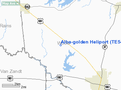
| From nearest city: | 0 nautical miles W of Golden, TX |
| Location: | Wood County, TX |
| Magnetic Variation: | 05E (1995) |
Owner & Manager
| Ownership: | Privately owned |
| Owner: | Golden Sweet Potato Festival Inc |
| Address: | Po Box 128
Golden, TX 75444 |
| Phone number: | 903-768-2770 |
| Manager: | Ben Bowdoin |
| Address: | Rt 3 Box 332
Mineola, TX 75773 |
| Phone number: | 903-768-2770 |
Airport Operations and Facilities
| Airport Use: | Private |
| Wind indicator: | Yes |
| Segmented Circle: | No |
| Control Tower: | No |
| Lighting Schedule: | DUSK-DAWN |
| Sectional chart: | Dallas-ft Worth |
| Region: | ASW - Southwest |
| Boundary ARTCC: | ZFW - Fort Worth |
| Tie-in FSS: | FTW - Fort Worth |
| FSS Phone: | 817-541-3474 |
| FSS Toll Free: | 1-800-WX-BRIEF |
Runway Information
Helipad H1
| Dimension: | 40 x 40 ft / 12.2 x 12.2 m |
| Surface: | CONC, |
| |
Runway H1 |
Runway |
| Traffic Pattern: | Left | Left |
|
Radio Navigation Aids
| ID |
Type |
Name |
Ch |
Freq |
Var |
Dist |
| TY | NDB | Tyler | | 320.00 | 06E | 19.5 nm |
| ABG | NDB | Ambassador | | 404.00 | 07E | 24.4 nm |
| SYW | NDB | Cash | | 428.00 | 05E | 29.6 nm |
| AVZ | NDB | Travis | | 260.00 | 06E | 34.7 nm |
| AHX | NDB | Athens | | 269.00 | 06E | 36.8 nm |
| MII | NDB | Caddo Mills | | 316.00 | 06E | 39.3 nm |
| LST | NDB | Lone Star | | 305.00 | 05E | 43.2 nm |
| CSZ | NDB | Crossroads | | 215.00 | 08E | 44.7 nm |
| LIQ | NDB | Lochridge Ranch | | 335.00 | 09E | 47.5 nm |
| HNO | NDB | Henderson | | 371.00 | 06E | 48.3 nm |
| PQF | NDB | Mesquite | | 248.00 | 06E | 49.0 nm |
| JUG | NDB | Jecca | | 388.00 | 06E | 49.1 nm |
| MJF | TACAN | Arvilla | 033X | | 05E | 32.2 nm |
| UIM | VOR/DME | Quitman | 087X | 114.00 | 08E | 13.5 nm |
| TYR | VOR/DME | Tyler | 089X | 114.20 | 06E | 23.9 nm |
| SLR | VOR/DME | Sulphur Springs | 027X | 109.00 | 08E | 28.2 nm |
| FZT | VOR/DME | Frankston | 051X | 111.40 | 06E | 39.4 nm |
| PRX | VOR/DME | Paris | 083X | 113.60 | 07E | 49.2 nm |
| GGG | VORTAC | Gregg County | 070X | 112.30 | 07E | 45.2 nm |
| CQY | VORTAC | Cedar Creek | 095X | 114.80 | 06E | 46.5 nm |
Images and information placed above are from
http://www.airport-data.com/airport/TE54/
We thank them for the data!
| General Info
|
| Country |
United States
|
| State |
TEXAS
|
| FAA ID |
TE54
|
| Latitude |
32-43-46.000N
|
| Longitude |
095-33-53.000W
|
| Elevation |
425 feet
|
| Near City |
GOLDEN
|
We don't guarantee the information is fresh and accurate. The data may
be wrong or outdated.
For more up-to-date information please refer to other sources.
|
|


