 |
|
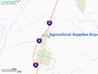
Agricultural Supplies Airport |
Location & QuickFacts
| FAA Information Effective: | 2008-09-25 |
| Airport Identifier: | XS42 |
| Airport Status: | Operational |
| Longitude/Latitude: | 099-04-49.1170W/28-55-45.8920N
-99.080310/28.929414 (Estimated) |
| Elevation: | 651 ft / 198.42 m (Estimated) |
| Land: | 0 acres |
| From nearest city: | 3 nautical miles N of Pearsall, TX |
| Location: | Frio County, TX |
| Magnetic Variation: | 07E (1985) |
Owner & Manager
| Ownership: | Privately owned |
| Owner: | Mrs. J.b. Smyth |
| Address: | P.o. Box 487
Uvaloe, TX 73301 |
| Phone number: | 512-334-3373 |
| Manager: | Walt Fitch |
| Address: | P.o. Brawer
Pearsall, TX 78061 |
| Phone number: | 512-334-3373 |
Airport Operations and Facilities
| Airport Use: | Private |
| Wind indicator: | Yes |
| Segmented Circle: | No |
| Control Tower: | No |
| Landing fee charge: | No |
| Sectional chart: | San Antonio |
| Region: | ASW - Southwest |
| Boundary ARTCC: | ZHU - Houston |
| Tie-in FSS: | SJT - San Angelo |
| FSS on Airport: | No |
| FSS Toll Free: | 1-800-WX-BRIEF |
Airport Services
| Airframe Repair: | MINOR |
| Power Plant Repair: | MINOR |
Runway Information
Runway 14/32
| Dimension: | 2100 x 50 ft / 640.1 x 15.2 m |
| Surface: | TURF, |
| |
Runway 14 |
Runway 32 |
| Traffic Pattern: | Left | Left |
|
Radio Navigation Aids
| ID |
Type |
Name |
Ch |
Freq |
Var |
Dist |
| HHH | NDB | Devine | | 359.00 | 07E | 14.6 nm |
| HMA | NDB | Hondo | | 329.00 | 08E | 27.1 nm |
| CVB | NDB | Castroville | | 338.00 | 08E | 27.8 nm |
| PEZ | NDB | Pleasanton | | 275.00 | 07E | 29.6 nm |
| UVA | NDB | Uvalde | | 281.00 | 07E | 37.1 nm |
| LKX | NDB | La Pryor | | 223.00 | 09E | 40.7 nm |
| DMD | NDB | Dimmit County | | 343.00 | 07E | 46.4 nm |
| CPZ | NDB | Chaparrosa Ranch | | 385.00 | 10E | 48.7 nm |
| KSY | TACAN | Kelly | 057X | | 07E | 38.2 nm |
| SSF | VOR | Stinson | | 108.40 | 09E | 38.9 nm |
| HDO | VOR/DME | Hondo | 31X | 109.40 | 08E | 25.7 nm |
| COT | VORTAC | Cotulla | 105X | 115.80 | 09E | 28.2 nm |
| SAT | VOT | San Antonio Intl | | 110.40 | | 48.4 nm |
Remarks
Images and information placed above are from
http://www.airport-data.com/airport/XS42/
We thank them for the data!
| General Info
|
| Country |
United States
|
| State |
TEXAS
|
| FAA ID |
XS42
|
| Latitude |
28-55-45.892N
|
| Longitude |
099-04-49.117W
|
| Elevation |
651 feet
|
| Near City |
PEARSALL
|
We don't guarantee the information is fresh and accurate. The data may
be wrong or outdated.
For more up-to-date information please refer to other sources.
|
|


