 |
|
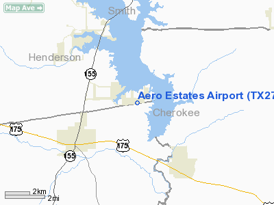
Location & QuickFacts
| FAA Information Effective: | 2008-09-25 |
| Airport Identifier: | TX27 |
| Airport Status: | Operational |
| Longitude/Latitude: | 095-27-09.0100W/32-04-54.3000N
-95.452503/32.081750 (Estimated) |
| Elevation: | 440 ft / 134.11 m (Estimated) |
| Land: | 112 acres |
| From nearest city: | 1 nautical miles E of Berryville, TX |
| Location: | Henderson County, TX |
| Magnetic Variation: | () |
Owner & Manager
| Ownership: | Privately owned |
| Owner: | Robert Huber |
| Address: | 11643 Snaproll Dr
Frankston, TX 75763 |
| Phone number: | 903-876-5151 |
| Manager: | Michael A. Raichle |
| Address: | 1105 Snaproll Dr
Frankston, TX 75763 |
| Phone number: | 903-876-5151 |
Airport Operations and Facilities
| Airport Use: | Private |
| Wind indicator: | Yes |
| Segmented Circle: | Yes |
| Control Tower: | No |
| Lighting Schedule: | RDO-CTL
ACTVT LIRL RY 09/27 - 122.9. |
| Sectional chart: | Dallas-ft Worth |
| Region: | ASW - Southwest |
| Traffic Pattern Alt: | 1010 ft |
| Boundary ARTCC: | ZFW - Fort Worth |
| Tie-in FSS: | FTW - Fort Worth |
| FSS Phone: | 817-541-3474 |
| FSS Toll Free: | 1-800-WX-BRIEF |
Runway Information
Runway 09/27
| Dimension: | 3200 x 60 ft / 975.4 x 18.3 m |
| Surface: | TURF, |
| Edge Lights: | Low |
| |
Runway 09 |
Runway 27 |
| Traffic Pattern: | Right | Left |
|
Helipad H1
| Dimension: | 50 x 50 ft / 15.2 x 15.2 m |
| Surface: | TURF, |
| |
Runway H1 |
Runway |
| Traffic Pattern: | Left | Left |
|
Radio Navigation Aids
| ID |
Type |
Name |
Ch |
Freq |
Var |
Dist |
| JSO | NDB | Cherokee County | | 263.00 | 05E | 17.5 nm |
| AHX | NDB | Athens | | 269.00 | 06E | 19.8 nm |
| TY | NDB | Tyler | | 320.00 | 06E | 20.1 nm |
| PSN | NDB | Palestine | | 375.00 | 04E | 22.1 nm |
| CSZ | NDB | Crossroads | | 215.00 | 08E | 25.8 nm |
| LIQ | NDB | Lochridge Ranch | | 335.00 | 09E | 25.8 nm |
| HNO | NDB | Henderson | | 371.00 | 06E | 30.8 nm |
| ABG | NDB | Ambassador | | 404.00 | 07E | 34.8 nm |
| PYF | NDB | Pyramid | | 418.00 | 06E | 40.2 nm |
| GXD | NDB | Nacogdoches | | 391.00 | 05E | 46.2 nm |
| CRS | NDB | Corsicana | | 396.00 | 06E | 48.1 nm |
| CGQ | NDB | Powell | | 344.00 | 06E | 49.7 nm |
| FZT | VOR/DME | Frankston | 051X | 111.40 | 06E | 4.0 nm |
| TYR | VOR/DME | Tyler | 089X | 114.20 | 06E | 16.7 nm |
| UIM | VOR/DME | Quitman | 087X | 114.00 | 08E | 48.2 nm |
| CQY | VORTAC | Cedar Creek | 095X | 114.80 | 06E | 39.5 nm |
| GGG | VORTAC | Gregg County | 070X | 112.30 | 07E | 40.9 nm |
Remarks
- ALL ACFT MONITOR FREQ 122.9 DUE TO PROXIMITY TO PARADISE POINT ARPT.
- UNMKD & UNLGTD PLINE AND TREES RUNNING PARALLEL TO THE RY AND LCTD ON RY 27 APCH AT THREE O'CLOCK.
- PRVDD THE TRAFFIC PATTERN IS ON THE SOUTH SIDE OF THE RY; ACFT MONITOR CTAF FREQ 122.9; THE TPA IS 1450 FT MSL; DALGT VFR-USE ONLY.
Images and information placed above are from
http://www.airport-data.com/airport/TX27/
We thank them for the data!
| General Info
|
| Country |
United States
|
| State |
TEXAS
|
| FAA ID |
TX27
|
| Latitude |
27-51-25.053N
|
| Longitude |
099-04-46.094W
|
| Elevation |
480 feet
|
| Near City |
ENCINAL
|
We don't guarantee the information is fresh and accurate. The data may
be wrong or outdated.
For more up-to-date information please refer to other sources.
|
|


