 |
|
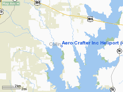
Aero Crafter Inc Heliport |
Location & QuickFacts
| FAA Information Effective: | 2008-09-25 |
| Airport Identifier: | 44TA |
| Airport Status: | Operational |
| Longitude/Latitude: | 096-31-19.0000W/33-07-29.0000N
-96.521944/33.124722 (Estimated) |
| Elevation: | 520 ft / 158.50 m (Estimated) |
| Land: | 0 acres |
| From nearest city: | 7 nautical miles SW of Princeton, TX |
| Location: | Collin County, TX |
| Magnetic Variation: | 06E (1990) |
Owner & Manager
| Ownership: | Privately owned |
| Owner: | Aero Crafter Inc |
| Address: | 1010 Fm 546
Princeton, TX 75407 |
| Phone number: | 214-736-3491 |
| Manager: | Richard Serkland |
| Address: | 1010 Fm 546
Princeton, TX 75407 |
| Phone number: | 214-736-3491 |
Airport Operations and Facilities
| Airport Use: | Private |
| Wind indicator: | Yes |
| Segmented Circle: | No |
| Control Tower: | No |
| Sectional chart: | Dallas-ft Worth |
| Region: | ASW - Southwest |
| Boundary ARTCC: | ZFW - Fort Worth |
| Tie-in FSS: | FTW - Fort Worth |
| FSS on Airport: | No |
| FSS Phone: | 817-541-3474 |
| FSS Toll Free: | 1-800-WX-BRIEF |
Runway Information
Helipad H1
| Dimension: | 20 x 20 ft / 6.1 x 6.1 m |
| Surface: | TURF, |
| |
Runway H1 |
Runway |
| Traffic Pattern: | Left | Left |
|
Radio Navigation Aids
| ID |
Type |
Name |
Ch |
Freq |
Var |
Dist |
| MII | NDB | Caddo Mills | | 316.00 | 06E | 14.7 nm |
| PQF | NDB | Mesquite | | 248.00 | 06E | 19.0 nm |
| SYW | NDB | Cash | | 428.00 | 05E | 24.5 nm |
| AVZ | NDB | Travis | | 260.00 | 06E | 25.9 nm |
| JUG | NDB | Jecca | | 388.00 | 06E | 27.5 nm |
| RBD | NDB | Redbird | | 287.00 | 06E | 32.2 nm |
| HJM | NDB | Rayburn | | 415.00 | 06E | 34.2 nm |
| LNC | NDB | Lancaster | | 239.00 | 06E | 34.4 nm |
| XQH | NDB | Cedar Hill | | 353.00 | 08E | 39.4 nm |
| DNI | NDB | Denison | | 341.00 | 06E | 42.7 nm |
| GLE | NDB | Gainesville | | 330.00 | 06E | 49.3 nm |
| DUA | NDB | Durant | | 359.00 | 05E | 49.5 nm |
| MJF | TACAN | Arvilla | 033X | | 05E | 23.5 nm |
| CVE | VOR/DME | Cowboy | 109X | 116.20 | 06E | 23.9 nm |
| TTT | VOR/DME | Maverick | 078X | 113.10 | 06E | 30.3 nm |
| SLR | VOR/DME | Sulphur Springs | 027X | 109.00 | 08E | 49.5 nm |
| URH | VOR/DME | Texoma | 090X | 114.30 | 05E | 49.7 nm |
| BYP | VORTAC | Bonham | 093X | 114.60 | 06E | 28.7 nm |
| FUZ | VORTAC | Ranger | 104X | 115.70 | 06E | 36.0 nm |
| DAL | VOT | Dallas Love Field | | 113.30 | | 23.6 nm |
| FTW | VOT | Fort Worth Meacham | | 108.20 | | 46.0 nm |
Remarks
- (E111-1) A SAFETY BARRIER IS PLACED AROUND THE HELI TO PREVENT PEDESTRIANS FM ENTERING THE HELI; & A SIGN IS PLACED NEAR THE ENTRANCE TO THE HELI WARNING PEOPLE THAT THEY ARE ENTERING A HEL OPS AREA.
- PRVDD HEL OPS ARE CONDUCTED IN VFR COND ONLY; A WINDCONE OR SIMILAR DEVICE IS PLACED NEAR THE HELI BUT AWAY FM APCH/DEP PATHS THAT IS VISIBLE TO THE PILOTS IN FLIGHT AS WELL AS ON THE HELI.
Images and information placed above are from
http://www.airport-data.com/airport/44TA/
We thank them for the data!
| General Info
|
| Country |
United States
|
| State |
TEXAS
|
| FAA ID |
44TA
|
| Latitude |
33-07-29.000N
|
| Longitude |
096-31-19.000W
|
| Elevation |
520 feet
|
| Near City |
PRINCETON
|
We don't guarantee the information is fresh and accurate. The data may
be wrong or outdated.
For more up-to-date information please refer to other sources.
|
|


