 |
|
Coordinates: 32°24′41″N 099°40′55″W / 32.41139°N 99.68194°W / 32.41139; -99.68194
| Abilene Regional Airport |
| IATA: ABI – ICAO: KABI – FAA LID: ABI |
| Summary |
| Airport type |
Public |
| Owner/Operator |
City of Abilene |
| Serves |
Abilene, Texas |
| Elevation AMSL |
1,791 ft / 546 m |
| Website |
www.AbileneTX.com/Airport/ |
| Runways |
| Direction |
Length |
Surface |
| ft |
m |
| 4/22 |
3,678 |
1,121 |
Asphalt |
| 17L/35R |
7,198 |
2,194 |
Asphalt |
| 17R/35L |
7,202 |
2,195 |
Asphalt |
| Statistics (2006) |
| Aircraft operations |
78,462 |
| Based aircraft |
98 |
| Sources: airport web site and FAA |
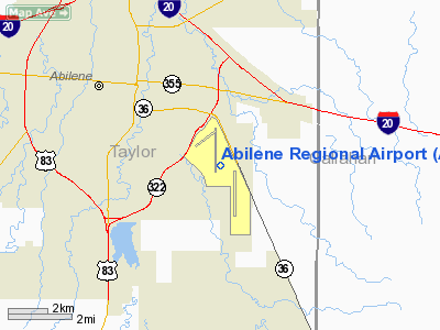
Abilene Regional Airport (IATA: ABI, ICAO: KABI, FAA LID: ABI) is a public airport located three statute miles (5 km) southeast of the central business district of Abilene, a city in Taylor County, Texas, United States. It is within the Abilene city limits and owned and operated by the City of Abilene.
The majority of aircraft operations at the airport are general aviation and military training. However, ABI is most visible as the commercial airline and air freight hub for the Abilene region. Abilene Regional is currently served by just one commercial airline, American Eagle Airlines, with 7 daily regional jet flights to Dallas-Ft. Worth. Continental Connection ceased operations to-from Houston in October 2008, citing high fuel prices as a factor. Allegiant Airlines operated twice-weekly flights to Las Vegas from 2006-07, but the service was discontinued due to low passenger loads on the airline's MD-80 aircraft. Charter airlines such as Sun Country continue to serve ABI with frequent large-jet flights to Las Vegas, however.
The acquisition of new airline service, especially to west-bound airline hubs such as Phoenix or Denver, is a top priority for airport management. Due to Abilene's relatively close driving distance to Dallas-Ft. Worth, many area residents have historically chosen to drive to DFW rather than fly out of ABI. Thus, airlines have always had trouble making a profit flying traditional jetliners out of ABI. The advent of 50-seat regional jets, which fly as high and as fast as larger planes, has the potential to provide air service from Abilene to cities that were previously out of the question.
Overnight air freight service is provided primarily by FedEx; DHL ceased operations at the airport in late 2008 as part of the company's exit from the domestic U.S. market. Other air freight subcontractors also provide service to ABI, though both UPS and USPS primarily truck their overnight packages in from Dallas-Fort Worth. In addition, Southwest Medevac houses a medical helicopter and crew at the airport, available for emergency response 24/7. The city's other emergency medical helicopter service is provided by Lifeteam Air Evac, with its aircraft and crew stationed at Hendrick Medical Center.
Abilene Regional is also home to Eagle Aviation Services, Inc., which is a heavy-maintenance base for all American Eagle aircraft. Basically every plane in the airline's fleet is maintained at ABI. Texas State Technical College provides aviation maintenance training at its on-field hangar base.
Historically, Trans-Texas Airways, which later became Texas International, had prop-jet service from Amarillo and Lubbock as well as DC-9 jet service to Dallas Love Field and then DFW. The original Frontier Airlines served Abilene via Midland for a short time in 1985 with a 737. Facilities and aircraft
Abilene Regional Airport covers an area of 1,686 acres (682 ha) which contains three asphalt paved runways: 4/22 measuring 3,678 x 100 ft (1,121 x 30 m), 17L/35R measuring 7,198 x 150 ft (2,194 x 46 m), and 17R/35L measuring 7,202 x 150 ft (2,195 x 46 m).
The terminal building has seen many expansions and improvements over the past decade. The upper level houses the airline ticket counters, restaurant, gift shop, airport offices, and two departure gates, each equipped with Jetway boarding bridges. The lower level has two baggage carousels, and car-rental agencies.
The most recent improvements include the reconstruction of the airline ramps near the terminal, and the construction of a new, expanded public parking lot. The new parking lot features 731 covered parking spaces, with direct escalator access to the upper level.
Construction of the airport's new 130-foot (40 m)-tall control tower began in August 2010 and is expected to be completed no later than January 2012. This new, modern tower will replace the current tower, a 65-foot (20 m) structure built in 1959.
For the 12-month period ending December 31, 2006, the airport had 78,462 aircraft operations, an average of 214 per day: 50% general aviation, 32% military, 18% air taxi and <1% scheduled commercial. There are 98 aircraft based at this airport: 78% single-engine, 16% multi-engine, 5% jet and 1% helicopter.
Airlines and destinations
| Airlines |
Destinations |
| American Eagle |
Dallas/Fort Worth |
The above content comes from Wikipedia and is published under free licenses – click here to read more.
Location & QuickFacts
| FAA Information Effective: | 2008-09-25 |
| Airport Identifier: | ABI |
| Airport Status: | Operational |
| Longitude/Latitude: | 099-40-54.8000W/32-24-40.7000N
-99.681889/32.411306 (Estimated) |
| Elevation: | 1791 ft / 545.90 m (Surveyed) |
| Land: | 1686 acres |
| From nearest city: | 3 nautical miles SE of Abilene, TX |
| Location: | Taylor County, TX |
| Magnetic Variation: | 08E (1985) |
Owner & Manager
| Ownership: | Publicly owned |
| Owner: | City Of Abilene |
| Address: | Po Box 60
Abilene, TX 79604 |
| Phone number: | 325-676-6206 |
| Manager: | Don Green |
| Address: | 2933 Airport Blvd Suite 200
Abilene, TX 79602 |
| Phone number: | 325-676-6367 |
Airport Operations and Facilities
| Airport Use: | Open to public |
| Wind indicator: | Yes
WINDSOCK LGTS OTS INDEFLY. |
| Segmented Circle: | Yes |
| Control Tower: | Yes |
| Lighting Schedule: | DUSK-DAWN |
| Beacon Color: | Clear-Green (lighted land airport) |
| Landing fee charge: | No |
| Sectional chart: | Dallas-ft Worth |
| Region: | ASW - Southwest |
| Boundary ARTCC: | ZFW - Fort Worth |
| Tie-in FSS: | FTW - Fort Worth |
| FSS on Airport: | No |
| FSS Phone: | 817-541-3474 |
| FSS Toll Free: | 1-800-WX-BRIEF |
| NOTAMs Facility: | ABI (NOTAM-d service avaliable) |
| Certification type/date: | I A S 05/1973 |
| Federal Agreements: | NGY |
Airport Communications
Airport Services
| Fuel available: | 100LLA A1+ |
| Airframe Repair: | MAJOR |
| Power Plant Repair: | MAJOR |
| Bottled Oxygen: | NONE |
| Bulk Oxygen: | HIGH/LOW |
Runway Information
Runway 04/22
| Dimension: | 3675 x 100 ft / 1120.1 x 30.5 m |
| Surface: | ASPH, Good Condition |
| Weight Limit: | Single wheel: 30000 lbs.
Dual wheel: 60000 lbs. |
| Edge Lights: | Medium |
| |
Runway 04 |
Runway 22 |
| Longitude: | 099-41-41.3205W | 099-41-07.4106W |
| Latitude: | 32-25-10.5698N | 32-25-32.8203N |
| Elevation: | 1752.00 ft | 1763.00 ft |
| Alignment: | 52 | 127 |
| Traffic Pattern: | Left | Right |
| Markings: | Non-precision instrument, Good Condition | Non-precision instrument, Good Condition |
| Decleard distances: | Take off run available 3678.00 ft
Take off distance available 3678.00 ft
Actual stop distance available 3678.00 ft
Landing distance available 3678.00 ft
| Take off run available 3678.00 ft
Take off distance available 3678.00 ft
Actual stop distance available 3678.00 ft
Landing distance available 3678.00 ft
|
|
Runway 17L/35R
| Dimension: | 7198 x 150 ft / 2194.0 x 45.7 m |
| Surface: | ASPH, Good Condition |
| Surface Treatment: | Saw-cut or plastic Grooved
FIRST 250 FT RYS 17L & 35R UNGROOVED. |
| Weight Limit: | Single wheel: 75000 lbs.
Dual wheel: 130000 lbs.
Dual tandem wheel: 160000 lbs. |
| Edge Lights: | High |
| |
Runway 17L |
Runway 35R |
| Longitude: | 099-40-29.2139W | 099-40-28.8588W |
| Latitude: | 32-24-30.7116N | 32-23-19.4932N |
| Elevation: | 1790.00 ft | 1776.00 ft |
| Alignment: | 127 | 127 |
| ILS Type: | | ILS/DME
|
| Traffic Pattern: | Left | Right |
| Markings: | Precision instrument, Good Condition | Precision instrument, Poor Condition |
| Crossing Height: | 43.00 ft | 0.00 ft |
| VASI: | 4-light PAPI on left side | |
| Visual Glide Angle: | 3.00° | 0.00° |
| Approach lights: | | MALSR |
| Obstruction: | 2 ft gnd, 200.0 ft from runway | , 50:1 slope to clear |
| Decleard distances: | Take off run available 7198.00 ft
Take off distance available 7198.00 ft
Actual stop distance available 7198.00 ft
Landing distance available 7198.00 ft
| Take off run available 7198.00 ft
Take off distance available 7198.00 ft
Actual stop distance available 7198.00 ft
Landing distance available 7198.00 ft
|
|
Runway 17R/35L
| Dimension: | 7202 x 150 ft / 2195.2 x 45.7 m |
| Surface: | ASPH, Good Condition |
| Surface Treatment: | Saw-cut or plastic Grooved
FIRST 250 FT RYS 17L & 35R UNGROOVED. |
| Weight Limit: | Single wheel: 85000 lbs.
Dual wheel: 160000 lbs.
Dual tandem wheel: 160000 lbs. |
| Edge Lights: | Medium |
| |
Runway 17R |
Runway 35L |
| Longitude: | 099-41-05.7115W | 099-41-05.3559W |
| Latitude: | 32-25-41.0910N | 32-24-29.8374N |
| Elevation: | 1759.00 ft | 1786.00 ft |
| Alignment: | 127 | 127 |
| Traffic Pattern: | Right | Left |
| Markings: | Nonstandard, Good Condition
RY 17R/35L NSTD PIR MARKINGS - NO EDGE STRIPES. | Nonstandard, Good Condition |
| Crossing Height: | 58.00 ft | 49.00 ft |
| VASI: | 4-box on left side | 4-box on left side |
| Visual Glide Angle: | 3.00° | 3.00° |
| RVR Equipment: | | touchdown |
| Runway End Identifier: | | Yes |
| Decleard distances: | Take off run available 7202.00 ft
Take off distance available 7202.00 ft
Actual stop distance available 7202.00 ft
Landing distance available 7202.00 ft
| Take off run available 7202.00 ft
Take off distance available 7202.00 ft
Actual stop distance available 7202.00 ft
Landing distance available 7202.00 ft
|
|
Radio Navigation Aids
| ID |
Type |
Name |
Ch |
Freq |
Var |
Dist |
| TMV | NDB | Stamford | | 290.00 | 08E | 27.6 nm |
| IEW | NDB | Winters | | 396.00 | 08E | 32.0 nm |
| COM | NDB | Coleman | | 385.00 | 07E | 37.0 nm |
| SWW | NDB | Sweetwater | | 275.00 | 08E | 39.9 nm |
| OIP | NDB | Old Rip | | 410.00 | 07E | 44.2 nm |
| BKD | NDB | Breckenridge | | 245.00 | 07E | 44.9 nm |
| UBC | NDB | Ballinger | | 239.00 | 08E | 46.4 nm |
| AKL | NDB | Haskell | | 407.00 | 08E | 46.9 nm |
| DYS | TACAN | Dyess | 063X | | 08E | 8.9 nm |
| TQA | VOR/DME | Tuscola | 053X | 111.60 | 10E | 12.6 nm |
| BWD | VOR/DME | Brownwood | 023X | 108.60 | 08E | 48.3 nm |
| ABI | VORTAC | Abilene | 084X | 113.70 | 10E | 10.1 nm |
Remarks
- UNCTLD ARPT 2 NM NE OF ARPT PATTERN ALT 2300 FT.
- TWY D BTN TWYS M AND D1 NOT VISIBLE FROM ATCT.
- MILITARY AVIATION SERVICES AVBL AT ARPT.
- RY 04/22 NOT AVBL FOR AIR CARRIER OPNS WITH OVER 9 PSGR SEATS.
- TWY D LGTS SOUTH OF TWY M OTS INDEFLY.
Images and information placed above are from
http://www.airport-data.com/airport/ABI/
We thank them for the data!
| General Info
|
| Country |
United States
|
| State |
TEXAS
|
| FAA ID |
ABI
|
| Latitude |
32-24-40.752N
|
| Longitude |
099-40-54.830W
|
| Elevation |
1791 feet
|
| Near City |
ABILENE
|
We don't guarantee the information is fresh and accurate. The data may
be wrong or outdated.
For more up-to-date information please refer to other sources.
|
|


