 |
|
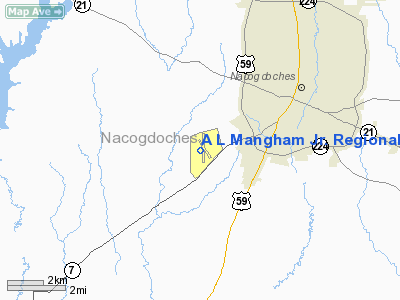
A L Mangham Jr. Rgnl Airport |
Location & QuickFacts
| FAA Information Effective: | 2008-09-25 |
| Airport Identifier: | OCH |
| Airport Status: | Operational |
| Longitude/Latitude: | 094-42-36.4000W/31-34-39.9500N
-94.710111/31.577764 (Estimated) |
| Elevation: | 355 ft / 108.20 m (Surveyed) |
| Land: | 650 acres |
| From nearest city: | 3 nautical miles SW of Nacogdoches, TX |
| Location: | Nacogdoches County, TX |
| Magnetic Variation: | 05E (1995) |
Owner & Manager
| Ownership: | Publicly owned |
| Owner: | City Of Nacogdoches |
| Address: | Po Box 635030
Nacogdoches, TX 75963-0648 |
| Phone number: | 936-559-2533 |
| Manager: | Mary Uresti |
| Address: | P O Box 635030
Nacogdoches, TX 75963 |
| Phone number: | 936-560-9567 |
Airport Operations and Facilities
| Airport Use: | Open to public |
| Wind indicator: | Yes |
| Segmented Circle: | Yes |
| Control Tower: | No |
| Lighting Schedule: | DUSK-DAWN
MIRL RY 18/36 PRESET LOW INTST; TO INCR INTST & ACTVT REIL RY 18 & MALSR RY 36 - CTAF. |
| Beacon Color: | Clear-Green (lighted land airport) |
| Landing fee charge: | No |
| Sectional chart: | Houston |
| Region: | ASW - Southwest |
| Boundary ARTCC: | ZFW - Fort Worth |
| Responsible ARTCC: | ZHU - Houston |
| Tie-in FSS: | CXO - Montgomery County |
| FSS on Airport: | No |
| FSS Toll Free: | 1-800-WX-BRIEF
FOR FP FILING CALL CXO FSS 1-800-992-7433. |
| NOTAMs Facility: | OCH (NOTAM-d service avaliable) |
| Federal Agreements: | NGY |
Airport Communications
| CTAF: | 123.000 |
| Unicom: | 123.000 |
Airport Services
| Fuel available: | 100LLA
24 HR SELF SERVICE WITH MAJOR CREDIT CARD; 100LL & JET A AVBL FROM TRUCK. FOR FUEL AFT HRS CALL 936-645-4105; OTHER NRS POSTED AT ARPT. |
| Airframe Repair: | MAJOR |
| Power Plant Repair: | MAJOR |
| Bottled Oxygen: | NONE |
| Bulk Oxygen: | NONE |
Runway Information
Runway 18/36
| Dimension: | 5000 x 75 ft / 1524.0 x 22.9 m |
| Surface: | ASPH, Good Condition |
| Weight Limit: | Single wheel: 23600 lbs. |
| Edge Lights: | Medium |
| |
Runway 18 |
Runway 36 |
| Longitude: | 094-42-34.1980W | 094-42-38.7280W |
| Latitude: | 31-35-04.6370N | 31-34-15.3060N |
| Elevation: | 337.00 ft | 327.00 ft |
| Alignment: | 127 | 4 |
| ILS Type: | | ILS/DME
|
| Traffic Pattern: | Left | Left |
| Markings: | Non-precision instrument, Good Condition | Non-precision instrument, Good Condition |
| Crossing Height: | 37.00 ft | 0.00 ft |
| VASI: | 2-light PAPI on left side | |
| Visual Glide Angle: | 3.00° | 0.00° |
| Approach lights: | | MALSR |
| Runway End Identifier: | Yes | No |
| Obstruction: | 28 ft trees, 540.0 ft from runway, 350 ft right of centerline, 12:1 slope to clear | 18 ft trees, 200.0 ft from runway, 228 ft left of centerline
10-40 FT TREES 85-200 FT FM THLD 490 FT L. |
|
Radio Navigation Aids
| ID |
Type |
Name |
Ch |
Freq |
Var |
Dist |
| GXD | NDB | Nacogdoches | | 391.00 | 05E | 4.3 nm |
| OC | NDB | Nados | | 253.00 | 05E | 5.6 nm |
| JSO | NDB | Cherokee County | | 263.00 | 05E | 31.3 nm |
| CZJ | NDB | Amason | | 341.00 | 04E | 32.3 nm |
| HNO | NDB | Henderson | | 371.00 | 06E | 37.5 nm |
| RPF | NDB | Carthage | | 332.00 | 04E | 41.9 nm |
| LFK | VORTAC | Lufkin | 058X | 112.10 | 05E | 25.0 nm |
Remarks
- 35 FT AGL ANT 400 FT WEST OF CNTRLN RY 18/36.
- BIRDS ON AND IN VICINITY OF ARPT.
Images and information placed above are from
http://www.airport-data.com/airport/OCH/
We thank them for the data!
| General Info
|
| Country |
United States
|
| State |
TEXAS
|
| FAA ID |
OCH
|
| Latitude |
31-34-40.900N
|
| Longitude |
094-42-34.350W
|
| Elevation |
355 feet
|
| Near City |
NACOGDOCHES
|
We don't guarantee the information is fresh and accurate. The data may
be wrong or outdated.
For more up-to-date information please refer to other sources.
|
|


