 |
|
- For the military use of this facility prior to 1971, see Sewart Air Force Base
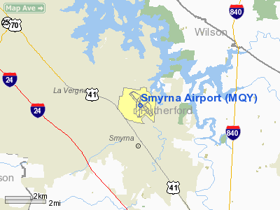
Smyrna Airport (IATA: MQY, ICAO: KMQY) is a public joint civil-military airport in the town of Smyrna in Rutherford County, Tennessee, USA. It is the "reliever" airport for Nashville International Airport, located twelve nautical miles (22 km) to the north. Smyrna Airport is the third largest airport in Tennessee and is the state's busiest general aviation airport. Prior to March 1971, the facility was an active military installation known as Sewart Air Force Base.
Smyrna Airport currently operates as a joint use training facility with a Tennessee Army National Guard helicopter unit, Army Aviation Support Facility #1 (AASF#1), which operates 60 helicopters with 300 full time Army National Guard personnel. The airport also serves as an outlying Air National Guard training facility for C-130 Hercules aircraft of the 118th Airlift Wing of the Tennessee Air National Guard at Nashville International Airport, and C-5 Galaxy aircraft of the Tennessee Air National Guard's 164th Airlift Wing at the Memphis International Airport. The Tennessee Army National Guard also leases part of the airport to maintain the Grubbs/Kyle Training Center. This facility supports 24 different units and 1,270 assigned Army National Guard personnel, 162 of which are full time, as well as numerous military aircraft.
Facilities
Smyrna Airport covers 1,700 acres (688 ha) and has two runways and one helipad:
- Runway 14/32: 8,037 x 150 ft. (2,450 x 46 m), Surface: Asphalt
- Runway 1/19: 5,546 x 100 ft. (1,690 x 30 m), Surface: Asphalt
- Helipad H1: 40 x 40 ft. (12 x 12 m), Surface: Concrete
The airport has an operational control tower twelve (12) hours a day, precision instrument landing system (ILS) approaches to Runway 14 and Runway 32, and DoD Into-Plane Contract jet fuel for military and other US Government aircraft provided by the on-site civilian Fixed Base Operator (FBO), Smyrna Air Center.
The above content comes from Wikipedia and is published under free licenses – click here to read more.
Location & QuickFacts
| FAA Information Effective: | 2008-09-25 |
| Airport Identifier: | MQY |
| Airport Status: | Operational |
| Longitude/Latitude: | 086-31-12.2760W/36-00-32.3260N
-86.520077/36.008979 (Estimated) |
| Elevation: | 543 ft / 165.51 m (Surveyed) |
| Land: | 1700 acres |
| From nearest city: | 2 nautical miles N of Smyrna, TN |
| Location: | Rutherford County, TN |
| Magnetic Variation: | 02W (1995) |
Owner & Manager
| Ownership: | Publicly owned |
| Owner: | Smyrna/rutherford Arpt Auth
ARPT AUTHORITY: JOHN BLACK; EXECUTIVE DIRECTOR |
| Address: | 278 Doug Warpoole Rd.
Smyrna, TN 37167 |
| Phone number: | 615-459-2651 |
| Manager: | Lois Vallance |
| Address: | 278 Doug Warpoole Rd.
Smyrna, TN 37167 |
| Phone number: | 615-459-2651 |
Airport Operations and Facilities
| Airport Use: | Open to public |
| Wind indicator: | Yes |
| Segmented Circle: | Yes |
| Control Tower: | Yes |
| Lighting Schedule: | DUSK-DAWN
ACTVT MIRL RY 01/19, HIRL RY 14/32, REIL RY 14 & MALSR RY 32 - CTAF. |
| Beacon Color: | Clear-Green (lighted land airport) |
| Landing fee charge: | No |
| Sectional chart: | Atlanta |
| Region: | ASO - Southern |
| Traffic Pattern Alt: | 957 ft |
| Boundary ARTCC: | ZME - Memphis |
| Tie-in FSS: | BNA - Nashville |
| FSS on Airport: | No |
| FSS Toll Free: | 1-800-WX-BRIEF |
| NOTAMs Facility: | MQY (NOTAM-d service avaliable) |
| Certification type/date: | IV A U 01/200 |
| Federal Agreements: | NGPY |
Airport Communications
| CTAF: | 118.500 |
| Unicom: | 122.950 |
Airport Services
| Fuel available: | 100LLA |
| Airframe Repair: | MAJOR |
| Power Plant Repair: | MAJOR |
| Bottled Oxygen: | LOW |
| Bulk Oxygen: | HIGH/LOW |
Runway Information
Runway 01/19
| Dimension: | 5546 x 100 ft / 1690.4 x 30.5 m |
| Surface: | ASPH, Good Condition |
| Weight Limit: | Single wheel: 30000 lbs.
Dual wheel: 44000 lbs.
Dual tandem wheel: 70000 lbs. |
| Edge Lights: | Medium
PERIMETER LIGHTS OTS INDEFLY. |
| |
Runway 01 |
Runway 19 |
| Longitude: | 086-31-16.1280W | 086-31-11.2610W |
| Latitude: | 36-00-02.2550N | 36-00-56.9590N |
| Elevation: | 519.00 ft | 521.00 ft |
| Alignment: | 4 | 127 |
| Traffic Pattern: | Left | Right |
| Markings: | Non-precision instrument, Good Condition
BADLY FADED, SCHEDULED TO BE REMARKED SPRING 2005 | Non-precision instrument, Good Condition |
| VASI: | 4-light PAPI on left side | 4-light PAPI on left side |
| Runway End Identifier: | Yes | Yes |
| Obstruction: | 74 ft tree, 1800.0 ft from runway, 143 ft right of centerline, 21:1 slope to clear | , 34:1 slope to clear |
|
Runway 14/32
| Dimension: | 8037 x 150 ft / 2449.7 x 45.7 m |
| Surface: | ASPH, Good Condition |
| Weight Limit: | Single wheel: 95000 lbs.
Dual wheel: 112000 lbs.
Dual tandem wheel: 170000 lbs. |
| Edge Lights: | High
PERIMETER LIGHTS OTS INDEFLY. |
| |
Runway 14 |
Runway 32 |
| Longitude: | 086-31-43.3790W | 086-30-39.3810W |
| Latitude: | 36-01-04.2100N | 36-00-04.1020N |
| Elevation: | 543.00 ft | 517.00 ft |
| Alignment: | 127 | 127 |
| ILS Type: | | ILS
|
| Traffic Pattern: | Right | Left |
| Markings: | Precision instrument, Good Condition | Precision instrument, Good Condition |
| Crossing Height: | 25.00 ft | 21.00 ft |
| VASI: | 2-box SAVASI on left side | 2-box SAVASI on left side |
| Visual Glide Angle: | 3.00° | 3.00° |
| Approach lights: | | MALSR |
| Runway End Identifier: | Yes | Yes |
| Centerline Lights: | No | No |
| Touchdown Lights: | No | No |
| Obstruction: | 35 ft tree, 1500.0 ft from runway, 485 ft right of centerline, 37:1 slope to clear | , 50:1 slope to clear |
|
Helipad H1
| Dimension: | 40 x 40 ft / 12.2 x 12.2 m |
| Surface: | CONC, Fair Condition |
| |
Runway H1 |
Runway |
| Traffic Pattern: | Left | Left |
|
Radio Navigation Aids
| ID |
Type |
Name |
Ch |
Freq |
Var |
Dist |
| SYI | FAN MARKER | Bomar | | | 01W | 31.7 nm |
| SWZ | NDB | Sewart | | 391.00 | 02W | 4.2 nm |
| FQW | NDB | Walter Hill | | 371.00 | 02W | 7.8 nm |
| VI | NDB | Opery | | 344.00 | 02W | 13.4 nm |
| JUE | NDB | Lebanon | | 414.00 | 02W | 14.9 nm |
| LUG | NDB | Verona | | 251.00 | 00W | 33.7 nm |
| SKN | NDB | Hurricane | | 256.00 | 02W | 34.7 nm |
| ON | NDB | Music | | 279.00 | 03W | 35.0 nm |
| ULH | NDB | Burwi | | 332.00 | 03W | 35.6 nm |
| PBC | NDB | Maury County | | 365.00 | 01W | 36.8 nm |
| PED | NDB | Needmore | | 221.00 | 01W | 37.1 nm |
| LFB | NDB | Lafayette | | 245.00 | 02W | 37.7 nm |
| RN | NDB | Warri | | 209.00 | 02W | 39.9 nm |
| DMZ | NDB | Dickson | | 203.00 | 01W | 44.9 nm |
| HEM | NDB | Huchn | | 233.00 | 02W | 45.4 nm |
| UXM | VOR | Tullahoma Regional | | 109.65 | 03W | 40.1 nm |
| SYI | VOR/DME | Shelbyville | 027X | 109.00 | 01W | 27.2 nm |
| BNA | VORTAC | Nashville | 088X | 114.10 | 02W | 11.1 nm |
| GHM | VORTAC | Graham | 053X | 111.60 | 03E | 46.6 nm |
| MQY | VOT | Smyrna | | 110.20 | | 0.6 nm |
| BNA | VOT | Nashville Metropoln | | 108.60 | | 10.6 nm |
Remarks
- NASHVILLE INTL ARPT TFC TRANSITS SMYRNA ARPT TFC AREA AT 2500' MSL & ABV.
- NG BASE OPS OPERS 0630-1600 MON-FRI. PPR DSN 683-3611.
- 24 HOUR PPR REQUIRED FOR AIR CARRIERS OVER 30 PAX. CONTACT ARPT MGR 615-459-2651.
Images and information placed above are from
http://www.airport-data.com/airport/MQY/
We thank them for the data!
| General Info
|
| Country |
United States
|
| State |
TENNESSEE
|
| FAA ID |
MQY
|
| Latitude |
36-00-32.326N
|
| Longitude |
086-31-12.276W
|
| Elevation |
543 feet
|
| Near City |
SMYRNA
|
We don't guarantee the information is fresh and accurate. The data may
be wrong or outdated.
For more up-to-date information please refer to other sources.
|
|


