|
 |
|
||||
|
Coordinates: 35°12′02.5″N 090°03′14.3″W / 35.200694°N 90.053972°W
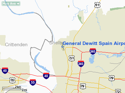
General DeWitt Spain Airport (FAA LID: M01) is a civil, public airport located five miles (8 km) northwest of the central business district of Memphis, a city in Shelby County, Tennessee, United States. It is owned and operated by the Memphis - Shelby County Airport Authority. HistoryGeneral DeWitt Spain Airport began as an idea in 1928 when the Memphis Chamber of Commerce Engineering Committee suggested turning Mud Island into Memphis’ Airport. They decided against that location for a main airport and moved Memphis International Airport to its current location in South Memphis. However, the idea apparently did not fade. In 1959, Memphis Downtown Airport was put into service about where Mud Island Park is today to service the general aviation community. It had the slogan: “You’re strictly uptown when you land downtown.” A ferry boat took travelers from the Island to the cobblestones, and then it was just a short walk to the offices of Memphis’ city center. Private pilots who worked downtown and business travelers had the perfect arrangement. By 1961, 30 planes were landing per day, according to newspaper reports. By the mid 1960’s Interstate 40 was scheduled to cross the Island. Airport owners fought the I-40 Bridge, but in August, 1970, the last plane departed the island airport. Quickly the airport authority purchased available land just to the north of the island so downtown commuters could once again have their landing strip back. The following May, Memphis Downtown Airport was replaced by General DeWitt Spain Airport, honoring local war hero General DeWitt Spain who died in 1969. It has been and still is an active general aviation airport. Facilities and aircraftRunway 17/35 is a 3,800 x 75 ft. (1,158 x 23 m) asphalt runway. Its weight limitation for a single wheel is 25,000 lbs. The pattern for runway 17 is a right hand pattern due to some 649 ft. (AMSL) towers to the northeast of the field. General DeWitt Spain Airport is home to Downtown Aviation. Downtown Aviation is both a flight school that trains pilots from the private license level to the flight instructor license level and an aircraft rental service. They also have courses in learning aerobatics and flying tail-wheel airplanes. Downtown Aviation has a sizable fleet of Cessna aircraft. They also have two Piper Arrows, a Boeing Stearman, a Beechcraft Dutchess, and a Super Decathlon. Downtown Aviation provides both fuel service and extensive maintenance service to all aircraft on airport property. General DeWitt Spain Airport is home to Helicopters Inc, a Part 91 helicopter service. Helicopters Inc does aerial imaging, tours, pipeline/power line inspections, and video around the Mid-South. They operate one Enstrom F28A helicopter. General DeWitt Spain Airport does not have a control tower, but pilots operating out of the airport can receive radar service from Memphis International Airport. Airlines and destinationsNo regular service operates to or from General DeWitt Spain Airport. The above content comes from Wikipedia and is published under free licenses – click here to read more.
Location & QuickFacts
Owner & Manager
Airport Operations and Facilities
Airport Communications
Airport Services
Runway InformationRunway 17/35
Radio Navigation Aids
Remarks
Images and information placed above are from We thank them for the data!
We don't guarantee the information is fresh and accurate. The data may
be wrong or outdated.
|
|||||||||||||||||||||||||||||||||||||||||||||||||||||||||||||||||||||||||||||||||||||||||||||||||||||||||||||||||||||||||||||||||||||||||||||||||||||||||||||||||||||||||||||||||||||||||||||||||||||||||||||||||||||||||||||||||||||||||||||||||||||||||||||||||||||||||||||||||||||||||||||||||||||||||||||||||||||||||||||||||||||||||||||||||||||||||||||||||||||||||||||||||||||||||||||||||||||||||||||||||||

 |
|
Copyright 2004-2024 © by Airports-Worldwide.com, Vyshenskoho st. 36, Lviv 79010, Ukraine Legal Disclaimer |