 |
|
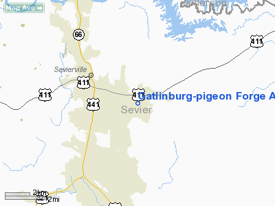
Gatlinburg-pigeon Forge Airport |
| Gatlinburg-Pigeon Forge Airport |
| IATA: GKT – ICAO: KGKT – FAA LID: GKT |
| Summary |
| Airport type |
Public |
| Owner |
Sevier County |
| Serves |
Gatlinburg / Pigeon Forge |
| Location |
Sevierville, Tennessee |
| Elevation AMSL |
1,014 ft / 309 m |
| Coordinates |
35°51′28″N 083°31′43″W / 35.85778°N 83.52861°W / 35.85778; -83.52861 |
| Runways |
| Direction |
Length |
Surface |
| ft |
m |
| 10/28 |
5,506 |
1,678 |
Asphalt |
| Statistics (2008) |
| Aircraft operations |
70,780 |
| Based aircraft |
102 |
| Sources: Tennessee DOT, FAA |
Gatlinburg-Pigeon Forge Airport (IATA: GKT, ICAO: KGKT, FAA LID: GKT) is a county-owned public-use airport in Sevier County, Tennessee, United States. It is located two nautical miles (3.7 km) southeast of the central business district of Sevierville, Tennessee. The airport is also north of the cities of Gatlinburg and Pigeon Forge.
Facilities and aircraft
Gatlinburg-Pigeon Forge Airport covers an area of 110 acres (45 ha) at an elevation of 1,014 feet (309 m) above mean sea level. It has one runway designated 10/28 with an asphalt surface measuring 5,506 by 75 feet (1,678 x 23 m).
For the 12-month period ending April 30, 2008, the airport had 70,780 aircraft operations, an average of 193 per day: 92% general aviation, 7% air taxi and 1% military. At that time there were 102 aircraft based at this airport: 77% single-engine, 14% multi-engine, 7% jet and 2% helicopter.
The above content comes from Wikipedia and is published under free licenses – click here to read more.
Location & QuickFacts
| FAA Information Effective: | 2008-09-25 |
| Airport Identifier: | GKT |
| Airport Status: | Operational |
| Longitude/Latitude: | 083-31-43.3370W/35-51-27.9320N
-83.528705/35.857759 (Estimated) |
| Elevation: | 1014 ft / 309.07 m (Surveyed) |
| Land: | 110 acres |
| From nearest city: | 2 nautical miles SE of Sevierville, TN |
| Location: | Sevier County, TN |
| Magnetic Variation: | 03W (1985) |
Owner & Manager
| Ownership: | Publicly owned |
| Owner: | Sevier County |
| Address: | Court House
Sevierville, TN 37862 |
| Phone number: | 865-453-6136 |
| Manager: | Don Baker |
| Address: | 1255 Airport Rd
Sevierville, TN 37862 |
| Phone number: | 865-453-8393 |
Airport Operations and Facilities
| Airport Use: | Open to public |
| Wind indicator: | Yes |
| Segmented Circle: | Yes |
| Control Tower: | No |
| Lighting Schedule: | DUSK-DAWN
MIRL RY 10/28 PRESET LOW INTST; TO INCREASE INTST ACTVT - CTAF. PAPI RYS 10 & 28 OPER CONT. |
| Beacon Color: | Clear-Green (lighted land airport) |
| Landing fee charge: | No |
| Sectional chart: | Atlanta |
| Region: | ASO - Southern |
| Boundary ARTCC: | ZTL - Atlanta |
| Tie-in FSS: | BNA - Nashville |
| FSS on Airport: | No |
| FSS Toll Free: | 1-800-WX-BRIEF |
| NOTAMs Facility: | BNA (NOTAM-d service avaliable) |
| Federal Agreements: | NGY |
Airport Communications
| CTAF: | 123.000 |
| Unicom: | 123.000 |
Airport Services
| Fuel available: | 100LLA |
| Airframe Repair: | MAJOR |
| Power Plant Repair: | MAJOR |
| Bottled Oxygen: | NONE |
| Bulk Oxygen: | NONE |
Runway Information
Runway 10/28
| Dimension: | 5506 x 75 ft / 1678.2 x 22.9 m |
| Surface: | ASPH, Good Condition |
| Weight Limit: | Single wheel: 40000 lbs.
Dual wheel: 54000 lbs. |
| Edge Lights: | Medium |
| |
Runway 10 |
Runway 28 |
| Longitude: | 083-32-16.3800W | 083-31-10.2850W |
| Latitude: | 35-51-32.0936N | 35-51-23.7663N |
| Elevation: | 1014.00 ft | 1006.00 ft |
| Alignment: | 99 | 127 |
| Traffic Pattern: | Left | Left |
| Markings: | Non-precision instrument, Good Condition | Non-precision instrument, Good Condition |
| Crossing Height: | 31.00 ft | 40.00 ft |
| Displaced threshold: | 0.00 ft | 339.00 ft |
| VASI: | 4-light PAPI on left side | 4-light PAPI on left side |
| Visual Glide Angle: | 3.00° | 4.00° |
| Runway End Identifier: | Yes | Yes |
| Obstruction: | 48 ft trees, 1250.0 ft from runway, 21:1 slope to clear | 113 ft hill, 200.0 ft from runway, 272 ft right of centerline
RY 28 APCH RATIO 20:1 TO DSPLCD THLD.
STEEP RISE IN GND 50 FT FM THLD EAST END OF PAVEMENT. |
|
Radio Navigation Aids
| ID |
Type |
Name |
Ch |
Freq |
Var |
Dist |
| JXT | NDB | Jefferson | | 346.00 | 04W | 15.4 nm |
| DYQ | NDB | Dulaney | | 263.00 | 04W | 35.3 nm |
| JAU | NDB | Jacksboro | | 204.00 | 03W | 42.1 nm |
| MNV | NDB | Madisonville | | 361.00 | 04W | 45.7 nm |
| RVN | NDB | Rogersville | | 329.00 | 04W | 47.7 nm |
| TTQ | NDB | Tomotla | | 335.00 | 01W | 49.2 nm |
| VXV | VORTAC | Volunteer | 111X | 116.40 | 03W | 18.0 nm |
| SOT | VORTAC | Snowbird | 025X | 108.80 | 04W | 23.6 nm |
| TYS | VOT | Knoxville | | 112.00 | | 22.8 nm |
Remarks
Images and information placed above are from
http://www.airport-data.com/airport/GKT/
We thank them for the data!
| General Info
|
| Country |
United States
|
| State |
TENNESSEE
|
| FAA ID |
GKT
|
| Latitude |
35-51-27.932N
|
| Longitude |
083-31-43.337W
|
| Elevation |
1014 feet
|
| Near City |
SEVIERVILLE
|
We don't guarantee the information is fresh and accurate. The data may
be wrong or outdated.
For more up-to-date information please refer to other sources.
|
|


