 |
|
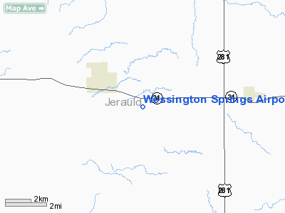
Wessington Springs Airport |
Location & QuickFacts
| FAA Information Effective: | 2008-09-25 |
| Airport Identifier: | 4X4 |
| Airport Status: | Operational |
| Longitude/Latitude: | 098-31-51.2090W/44-03-39.7420N
-98.530891/44.061039 (Estimated) |
| Elevation: | 1546 ft / 471.22 m (Estimated) |
| Land: | 270 acres |
| From nearest city: | 2 nautical miles E of Wessington Springs, SD |
| Location: | Jerauld County, SD |
| Magnetic Variation: | 10E () |
Owner & Manager
| Ownership: | Publicly owned |
| Owner: | City Of Wessington Springs |
| Address: | Box 443
Wessington Springs, SD 57382 |
| Phone number: | 605-539-1691 |
| Manager: | Dave Bender |
| Address: | Box 443
Wessington Springs, SD 57382 |
| Phone number: | 605-539-1691 |
Airport Operations and Facilities
| Airport Use: | Open to public |
| Wind indicator: | Yes |
| Segmented Circle: | No |
| Control Tower: | No |
| Lighting Schedule: | RDO-CTL
ACTVT LIRL RY 12/30 AND ROTG BCN - CTAF. |
| Beacon Color: | Clear-Green (lighted land airport) |
| Sectional chart: | Omaha |
| Region: | AGL - Great Lakes |
| Boundary ARTCC: | ZMP - Minneapolis |
| Tie-in FSS: | HON - Huron |
| FSS Toll Free: | 1-800-WX-BRIEF |
| NOTAMs Facility: | HON |
| Federal Agreements: | NGY |
Airport Communications
Airport Services
Runway Information
Runway 12/30
| Dimension: | 3600 x 60 ft / 1097.3 x 18.3 m |
| Surface: | ASPH, Fair Condition |
| Edge Lights: | Low |
| |
Runway 12 |
Runway 30 |
| Traffic Pattern: | Left | Left |
| Markings: | Non-precision instrument, Good Condition | Non-precision instrument, Good Condition |
| Obstruction: | 25 ft pline, 832.0 ft from runway, 390 ft left of centerline, 25:1 slope to clear | , 50:1 slope to clear |
|
Radio Navigation Aids
| ID |
Type |
Name |
Ch |
Freq |
Var |
Dist |
| MHE | VOR/DME | Mitchell | 029X | 109.20 | 07E | 27.3 nm |
| HON | VORTAC | Huron | 123X | 117.60 | 10E | 24.7 nm |
Remarks
- SEE ALP LTR DATED JUNE 6, 1996.
Images and information placed above are from
http://www.airport-data.com/airport/4X4/
We thank them for the data!
| General Info
|
| Country |
United States
|
| State |
SOUTH DAKOTA
|
| FAA ID |
4X4
|
| Latitude |
44.061039
44° 03' 39.74" N
|
| Longitude |
-98.530892
098° 31' 51.21" W
|
| Elevation |
1546 feet
471 meters
|
| Magnetic Variation |
005° E (01/06)
|
| Beacon |
Yes
|
| Operating Agency |
U.S.CIVIL AIRPORT WHEREIN PERMIT COVERS USE BY TRANSIT MILITARY AIRCRAFT
|
We don't guarantee the information is fresh and accurate. The data may
be wrong or outdated.
For more up-to-date information please refer to other sources.
|
|


