|
|
 |
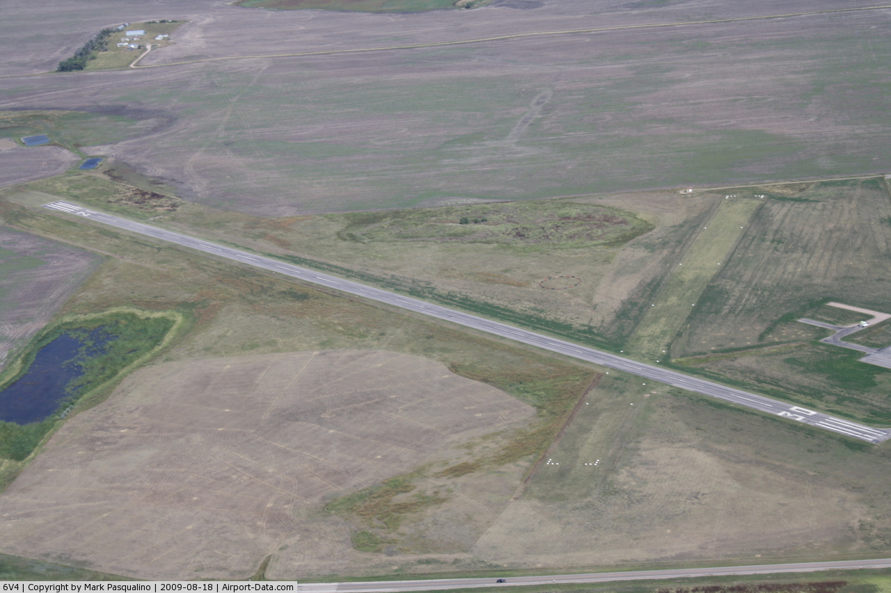
(Click on the photo to enlarge) |
Location & QuickFacts
| FAA Information Effective: | 2008-09-25 |
| Airport Identifier: | 6V4 |
| Airport Status: | Operational |
| Longitude/Latitude: | 102-15-16.5880W/43-59-58.1840N
-102.254608/43.999496 (Estimated) |
| Elevation: | 2813 ft / 857.40 m (Surveyed) |
| Land: | 153 acres |
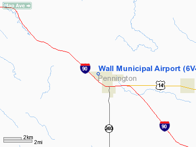
| From nearest city: | 1 nautical miles NW of Wall, SD |
| Location: | Pennington County, SD |
| Magnetic Variation: | 10E (1985) |
Owner & Manager
| Ownership: | Publicly owned |
| Owner: | City Of Wall |
| Address: | P.o. Box 314
Wall, SD 57790 |
| Phone number: | 605-279-2663 |
| Manager: | Dave Hahn, Mayor |
| Address: | P O Box 314
Wall, SD 57790 |
| Phone number: | 605-279-2666 |
Airport Operations and Facilities
| Airport Use: | Open to public |
| Wind indicator: | Yes |
| Segmented Circle: | Yes |
| Control Tower: | No |
| Lighting Schedule: | DUSK-DAWN
LIRL RY 12/30 & PAPI RYS 12 & 30 OPER DUSK-2100. AFTER 2100 ACTVT CTAF. |
| Beacon Color: | Clear-Green (lighted land airport) |
| Landing fee charge: | No |
| Sectional chart: | Cheyenne |
| Region: | AGL - Great Lakes |
| Traffic Pattern Alt: | 1000 ft |
| Boundary ARTCC: | ZDV - Denver |
| Tie-in FSS: | HON - Huron |
| FSS on Airport: | No |
| FSS Toll Free: | 1-800-WX-BRIEF |
| NOTAMs Facility: | HON (NOTAM-d service avaliable) |
| Federal Agreements: | NGY |
Airport Communications
Airport Services
| Fuel available: | 100LL
FUEL AVBL BY REQUEST, CALL 605-279-2666. |
Runway Information
Runway 12/30
| Dimension: | 3500 x 60 ft / 1066.8 x 18.3 m |
| Surface: | ASPH, Good Condition |
| Weight Limit: | Single wheel: 12000 lbs. |
| Edge Lights: | Low |
| |
Runway 12 |
Runway 30 |
| Longitude: | 102-15-33.4780W | 102-14-59.6980W |
| Latitude: | 44-00-10.4260N | 43-59-45.9430N |
| Elevation: | 2800.00 ft | 2812.00 ft |
| Alignment: | 127 | 127 |
| Traffic Pattern: | Left | Left |
| Markings: | Basic, Good Condition | Basic, Good Condition |
| Crossing Height: | 0.00 ft | 29.00 ft |
| VASI: | 4-light PAPI on left side | 4-light PAPI on left side |
| Visual Glide Angle: | 3.00° | 3.00° |
| Obstruction: | , 50:1 slope to clear | 46 ft ant, 1250.0 ft from runway, 28 ft left of centerline, 22:1 slope to clear |
|
Radio Navigation Aids
| ID |
Type |
Name |
Ch |
Freq |
Var |
Dist |
| RA | NDB | Ranch | | 254.00 | 11E | 32.3 nm |
| RCA | TACAN | Ellsworth | 025X | | 11E | 37.5 nm |
| PHP | VOR/DME | Philip | 021X | 108.40 | 12E | 25.8 nm |
| RAP | VORTAC | Rapid City | 070X | 112.30 | 13E | 32.8 nm |
Remarks
- DEER/ANTELOPE/WATERFOWL ON & INVOF ARPT.
Images and information placed above are from
http://www.airport-data.com/airport/6V4/
We thank them for the data!
| General Info
|
| Country |
United States
|
| State |
SOUTH DAKOTA
|
| FAA ID |
6V4
|
| Latitude |
43-59-58.184N
|
| Longitude |
102-15-16.588W
|
| Elevation |
2813 feet
|
| Near City |
WALL
|
We don't guarantee the information is fresh and accurate. The data may
be wrong or outdated.
For more up-to-date information please refer to other sources.
|
|