 |
|
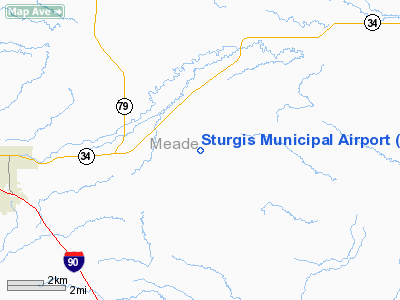
Location & QuickFacts
| FAA Information Effective: | 2008-09-25 |
| Airport Identifier: | 49B |
| Airport Status: | Operational |
| Longitude/Latitude: | 103-22-31.6200W/44-25-04.8250N
-103.375450/44.418007 (Estimated) |
| Elevation: | 3243 ft / 988.47 m (Surveyed) |
| Land: | 275 acres |
| From nearest city: | 4 nautical miles E of Sturgis, SD |
| Location: | Meade County, SD |
| Magnetic Variation: | 11E (1995) |
Owner & Manager
| Ownership: | Publicly owned |
| Owner: | City Of Sturgis |
| Address: | 1147 Sherman
Sturgis, SD 57785 |
| Phone number: | 605-347-4422 |
| Manager: | Jerry Burnham |
| Address: | P O Box 508
Sturgis, SD 57785 |
| Phone number: | 605-347-3356 |
Airport Operations and Facilities
| Airport Use: | Open to public |
| Wind indicator: | Yes |
| Segmented Circle: | No |
| Control Tower: | No |
| Lighting Schedule: | DUSK-DAWN
ACTVT MIRL RY 11/29 & PAPI RYS 11 & 29 - CTAF. |
| Beacon Color: | Clear-Green (lighted land airport) |
| Sectional chart: | Cheyenne |
| Region: | AGL - Great Lakes |
| Boundary ARTCC: | ZDV - Denver |
| Tie-in FSS: | HON - Huron |
| FSS Toll Free: | 1-800-WX-BRIEF |
| NOTAMs Facility: | HON (NOTAM-d service avaliable) |
| Federal Agreements: | NGY |
Airport Communications
| CTAF: | 122.800 |
| Unicom: | 122.800 |
Airport Services
| Fuel available: | 100LLA |
| Airframe Repair: | MAJOR |
| Power Plant Repair: | MAJOR |
Runway Information
Runway 11/29
| Dimension: | 5100 x 60 ft / 1554.5 x 18.3 m |
| Surface: | ASPH, Fair Condition |
| Weight Limit: | Single wheel: 12500 lbs. |
| Edge Lights: | Medium |
| |
Runway 11 |
Runway 29 |
| Longitude: | 103-23-01.2700W | 103-22-01.9700W |
| Latitude: | 44-25-18.4000N | 44-24-51.3700N |
| Elevation: | 3243.00 ft | 3207.00 ft |
| Alignment: | 123 | 127 |
| Traffic Pattern: | Left | Left |
| Markings: | Non-precision instrument, Good Condition | Non-precision instrument, Good Condition |
| VASI: | 2-light PAPI on left side | 2-light PAPI on left side |
|
Radio Navigation Aids
| ID |
Type |
Name |
Ch |
Freq |
Var |
Dist |
| SPF | NDB | Black Hills | | 300.00 | 11E | 18.0 nm |
| EFC | NDB | Belle Fourche | | 269.00 | 11E | 28.2 nm |
| RA | NDB | Ranch | | 254.00 | 11E | 31.7 nm |
| RCA | TACAN | Ellsworth | 025X | | 11E | 20.5 nm |
| RAP | VORTAC | Rapid City | 070X | 112.30 | 13E | 30.8 nm |
Remarks
- WILDLIFE ON AND INVOF ARPT.
Images and information placed above are from
http://www.airport-data.com/airport/49B/
We thank them for the data!
| General Info
|
| Country |
United States
|
| State |
SOUTH DAKOTA
|
| FAA ID |
49B
|
| Latitude |
44-25-03.400N
|
| Longitude |
103-22-29.200W
|
| Elevation |
3239 feet
|
| Near City |
STURGIS
|
We don't guarantee the information is fresh and accurate. The data may
be wrong or outdated.
For more up-to-date information please refer to other sources.
|
|


