 |
|
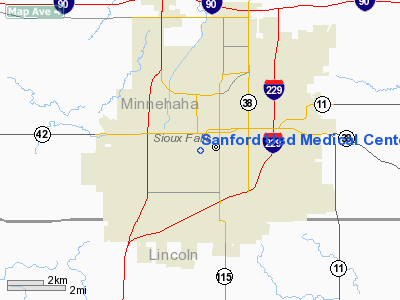
Sanford Usd Medical Center Heliport |
Location & QuickFacts
| FAA Information Effective: | 2008-09-25 |
| Airport Identifier: | 1SD9 |
| Airport Status: | Operational |
| Longitude/Latitude: | 096-44-39.1820W/43-32-07.9100N
-96.744217/43.535531 (Estimated) |
| Elevation: | 1708 ft / 520.60 m (Estimated) |
| Land: | 0 acres |
| From nearest city: | 1 nautical miles SW of Sioux Falls, SD |
| Location: | Minnehaha County, SD |
| Magnetic Variation: | 07E (1985) |
Owner & Manager
| Ownership: | Privately owned |
| Owner: | Sanford Usd Medical Center |
| Address: | 1305 W. 18th St
Sioux Falls, SD 57117-5039 |
| Phone number: | 605-333-1000 |
| Manager: | Tom Lien |
| Address: | 1305 W. 18th St.
Sioux Falls, SD 57117-5039 |
| Phone number: | 605-333-2903 |
Airport Operations and Facilities
| Airport Use: | Private |
| Wind indicator: | Yes |
| Segmented Circle: | No |
| Control Tower: | No |
| Lighting Schedule: | DUSK-DAWN |
| Beacon Color: | Clear-Green-Yellow (heliport) |
| Sectional chart: | Omaha |
| Region: | AGL - Great Lakes |
| Boundary ARTCC: | ZMP - Minneapolis |
| Tie-in FSS: | HON - Huron |
| FSS Toll Free: | 1-800-WX-BRIEF |
Airport Services
Runway Information
Helipad H1
| Dimension: | 67 x 52 ft / 20.4 x 15.8 m |
| Surface: | CONC, |
| |
Runway H1 |
Runway |
| Traffic Pattern: | Left | Left |
|
Radio Navigation Aids
| ID |
Type |
Name |
Ch |
Freq |
Var |
Dist |
| FS | NDB | Rokky | | 245.00 | 06E | 4.4 nm |
| MDS | NDB | Wentworth | | 400.00 | 05E | 32.4 nm |
| SOY | NDB | Sioux Center | | 368.00 | 06E | 34.2 nm |
| SHL | NDB | Sheldon | | 338.00 | 05E | 44.2 nm |
| ORC | NDB | Orange City | | 521.00 | 05E | 44.3 nm |
| ISB | NDB | Sibley | | 269.00 | 05E | 44.4 nm |
| VMR | NDB | Vermillion | | 375.00 | 06E | 47.2 nm |
| PQN | NDB/DME | Pipestone | 028X | 284.00 | 06E | 33.3 nm |
| DDL | VOR/DME | Sheldon | 023X | 108.60 | 05E | 44.3 nm |
| BKX | VOR/DME | Brookings | 025X | 108.80 | 06E | 46.2 nm |
| YKN | VOR/DME | Yankton | 051X | 111.40 | 07E | 46.5 nm |
| FSD | VORTAC | Sioux Falls | 097X | 115.00 | 09E | 7.0 nm |
Remarks
- LOAD BEARING CAPACITY OF PAD WILL ACCOMODATE ALL 10000 LB MGW HELICOPTERS.
- APCH/DEP ROUTES ARE CONDUCTED FROM 360 DEG TO 020 DEG & FROM 180 DEG TO 200 DEG; OBSTRUCTIONS BE REMOVED/LOWERED OR OBSTRUCTION MKD; AREA IS MKD; WIND INDICATOR IS MAINTAINED; RADIO CONTACT WITH SIOUX FALLS ATCT.
Images and information placed above are from
http://www.airport-data.com/airport/1SD9/
We thank them for the data!
| General Info
|
| Country |
United States
|
| State |
SOUTH DAKOTA
|
| FAA ID |
1SD9
|
| Latitude |
43-32-07.910N
|
| Longitude |
096-44-39.182W
|
| Elevation |
1708 feet
|
| Near City |
SIOUX FALLS
|
We don't guarantee the information is fresh and accurate. The data may
be wrong or outdated.
For more up-to-date information please refer to other sources.
|
|


