 |
|
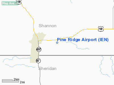
Location & QuickFacts
| FAA Information Effective: | 2008-09-25 |
| Airport Identifier: | IEN |
| Airport Status: | Operational |
| Longitude/Latitude: | 102-30-39.6420W/43-01-21.0430N
-102.511012/43.022512 (Estimated) |
| Elevation: | 3333 ft / 1015.90 m (Surveyed) |
| Land: | 315 acres |
| From nearest city: | 2 nautical miles E of Pine Ridge, SD |
| Location: | Shannon County, SD |
| Magnetic Variation: | 10E (1995) |
Owner & Manager
| Ownership: | Publicly owned |
| Owner: | Oglala Sioux Tribe |
| Address: | Po Box H
Pine Ridge, SD 57770 |
| Phone number: | 605-867-5821 |
| Manager: | Dave Kelly |
| Address: | P.o. Box 1203
Pine Ridge, SD 57770 |
| Phone number: | 605-867-5376
ADDNL PHONE 605-867-5143. |
Airport Operations and Facilities
| Airport Use: | Open to public |
| Wind indicator: | Yes |
| Segmented Circle: | No |
| Control Tower: | No |
| Lighting Schedule: | DUSK-DAWN
ROTG BCN OTS INDEFLY. |
| Beacon Color: | Clear-Green (lighted land airport) |
| Landing fee charge: | No |
| Sectional chart: | Cheyenne |
| Region: | AGL - Great Lakes |
| Boundary ARTCC: | ZDV - Denver |
| Tie-in FSS: | HON - Huron |
| FSS on Airport: | No |
| FSS Toll Free: | 1-800-WX-BRIEF |
| NOTAMs Facility: | IEN (NOTAM-d service avaliable) |
| Federal Agreements: | NGY |
Airport Communications
Airport Services
Runway Information
Runway 06/24
| Dimension: | 3003 x 50 ft / 915.3 x 15.2 m |
| Surface: | ASPH, Poor Condition |
| Weight Limit: | Single wheel: 12000 lbs.
SDAK AERO COMSN ADZS 23.
SDAK AERO COMSN ADZS 23. |
| |
Runway 06 |
Runway 24 |
| Longitude: | 102-31-25.7430W | 102-30-46.3680W |
| Latitude: | 43-01-25.1160N | 43-01-31.8200N |
| Elevation: | 3281.00 ft | 3302.00 ft |
| Alignment: | 77 | 127 |
| Traffic Pattern: | Left | Left |
| Markings: | Basic, Good Condition | Basic, Good Condition |
| Runway End Identifier: | No | No |
| Centerline Lights: | No | No |
| Touchdown Lights: | No | No |
| Obstruction: | , 50:1 slope to clear | 4 ft fence, 285.0 ft from runway, 83 ft left of centerline, 21:1 slope to clear |
|
Runway 12/30
| Dimension: | 5000 x 60 ft / 1524.0 x 18.3 m |
| Surface: | ASPH, Fair Condition |
| Weight Limit: | Single wheel: 12000 lbs.
SDAK AERO COMSN ADZS 23.
SDAK AERO COMSN ADZS 23. |
| Edge Lights: | Medium |
| |
Runway 12 |
Runway 30 |
| Longitude: | 102-30-50.0638W | 102-29-57.4944W |
| Latitude: | 43-01-32.0042N | 43-01-01.1637N |
| Elevation: | 3300.00 ft | 3332.00 ft |
| Alignment: | 127 | 127 |
| Traffic Pattern: | Left | Left |
| Markings: | Non-precision instrument, Good Condition
MARKINGS FADED. | Non-precision instrument, Good Condition
MARKINGS FADED. |
| Crossing Height: | 27.00 ft | 26.00 ft |
| VASI: | 2-box on left side | 2-box on left side |
| Visual Glide Angle: | 3.00° | 3.00° |
| Runway End Identifier: | No | No |
| Centerline Lights: | No | No |
| Touchdown Lights: | No | No |
| Obstruction: | 29 ft pline, 641.0 ft from runway, 15:1 slope to clear | 3 ft fence, 300.0 ft from runway, 33:1 slope to clear |
|
Radio Navigation Aids
| ID |
Type |
Name |
Ch |
Freq |
Var |
Dist |
| GRN | NDB | Gordon | | 414.00 | 09E | 19.8 nm |
| HIN | NDB | Whitney | | 275.00 | 11E | 28.2 nm |
| CDR | VOR/DME | Chadron | 081X | 113.40 | 13E | 45.0 nm |
Remarks
- WILDLIFE ON AND INVOF ARPT
Images and information placed above are from
http://www.airport-data.com/airport/IEN/
We thank them for the data!
| General Info
|
| Country |
United States
|
| State |
SOUTH DAKOTA
|
| FAA ID |
IEN
|
| Latitude |
43-01-21.043N
|
| Longitude |
102-30-39.642W
|
| Elevation |
3333 feet
|
| Near City |
PINE RIDGE
|
We don't guarantee the information is fresh and accurate. The data may
be wrong or outdated.
For more up-to-date information please refer to other sources.
|
|


