 |
|
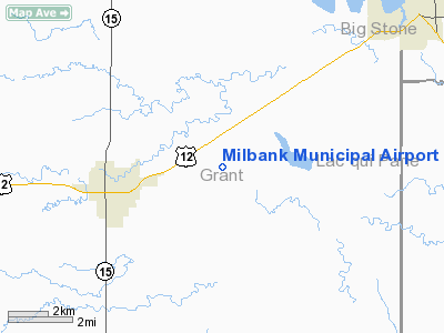
Location & QuickFacts
| FAA Information Effective: | 2008-09-25 |
| Airport Identifier: | 1D1 |
| Airport Status: | Operational |
| Longitude/Latitude: | 096-33-57.4760W/45-13-49.9370N
-96.565966/45.230538 (Estimated) |
| Elevation: | 1116 ft / 340.16 m (Surveyed) |
| Land: | 170 acres |
| From nearest city: | 3 nautical miles E of Milbank, SD |
| Location: | Grant County, SD |
| Magnetic Variation: | 05E (2000) |
Owner & Manager
| Ownership: | Publicly owned |
| Owner: | City Of Milbank |
| Address: | P O Box 472
Milbank, SD 57252 |
| Phone number: | 605-432-9575 |
| Manager: | Jason Kettwig |
| Address: | 14871 482nd Ave..
Milbank, SD 57252-6034 |
| Phone number: | 605-432-9575 |
Airport Operations and Facilities
| Airport Use: | Open to public |
| Wind indicator: | Yes |
| Segmented Circle: | Yes |
| Control Tower: | No |
| Lighting Schedule: | DUSK-DAWN
ACTVT MIRL RY 13/31 - CTAF. |
| Beacon Color: | Clear-Green (lighted land airport) |
| Landing fee charge: | No |
| Sectional chart: | Twin Cities |
| Region: | AGL - Great Lakes |
| Boundary ARTCC: | ZMP - Minneapolis |
| Tie-in FSS: | HON - Huron |
| FSS on Airport: | No |
| FSS Toll Free: | 1-800-WX-BRIEF |
| NOTAMs Facility: | HON (NOTAM-d service avaliable) |
| Federal Agreements: | NGY |
Airport Communications
| CTAF: | 122.800 |
| Unicom: | 122.800 |
Airport Services
| Fuel available: | 100LL
FUEL AVBL 24 HRS WITH CREDIT CARD. |
| Airframe Repair: | MINOR |
| Power Plant Repair: | MINOR |
| Bottled Oxygen: | NONE |
| Bulk Oxygen: | NONE |
Runway Information
Runway 07/25
| Dimension: | 3600 x 150 ft / 1097.3 x 45.7 m |
| Surface: | TURF, Good Condition |
| |
Runway 07 |
Runway 25 |
| Longitude: | 096-34-26.0360W | 096-33-38.2430W |
| Latitude: | 45-13-38.3590N | 45-13-49.4400N |
| Elevation: | 1112.00 ft | 1113.00 ft |
| Alignment: | 72 | 127 |
| Traffic Pattern: | Left | Left |
| Markings: | None,
RY 07/25 MKS WITH BLACK & ORANGE 'A' FRAMES. | None, |
| Runway End Identifier: | No | No |
| Centerline Lights: | No | No |
| Touchdown Lights: | No | No |
| Obstruction: | 5 ft fence, 200.0 ft from runway, 40:1 slope to clear | , 50:1 slope to clear |
|
Runway 13/31
| Dimension: | 4000 x 60 ft / 1219.2 x 18.3 m |
| Surface: | CONC, |
| Weight Limit: | Single wheel: 12500 lbs. |
| Edge Lights: | Medium |
| |
Runway 13 |
Runway 31 |
| Longitude: | 096-34-12.2480W | 096-33-34.3100W |
| Latitude: | 45-14-09.8690N | 45-13-40.8740N |
| Elevation: | 1113.00 ft | 1114.00 ft |
| Alignment: | 127 | 127 |
| Traffic Pattern: | Left | Left |
| Markings: | Non-precision instrument, Good Condition | Non-precision instrument, Good Condition |
| Crossing Height: | 37.00 ft | 36.00 ft |
| VASI: | 2-light PAPI on left side | 2-light PAPI on left side |
| Visual Glide Angle: | 3.00° | 3.00° |
| Runway End Identifier: | No | No |
| Centerline Lights: | No | No |
| Touchdown Lights: | No | No |
| Obstruction: | , 50:1 slope to clear | 15 ft road, 525.0 ft from runway, 21:1 slope to clear |
|
Radio Navigation Aids
| ID |
Type |
Name |
Ch |
Freq |
Var |
Dist |
| VVV | NDB | Ortonville | | 332.00 | 05E | 7.5 nm |
| DXX | NDB | Dawson/madison | | 341.00 | 06E | 22.1 nm |
| AQP | NDB | Appleton | | 356.00 | 05E | 23.6 nm |
| ETH | NDB | Wheaton | | 326.00 | 05E | 33.2 nm |
| BBB | NDB | Benson | | 239.00 | 05E | 39.2 nm |
| MOX | VOR/DME | Morris | 033X | 109.60 | 05E | 32.3 nm |
| MVE | VOR/DME | Montevideo | 053X | 111.60 | 05E | 39.4 nm |
| ATY | VORTAC | Watertown | 113X | 116.60 | 09E | 28.7 nm |
Remarks
- RY 31 +4' FENCE 600' FM THR & 10' R FM CNTRLN & 350' FM THR & 250' R FM CNTRLN.
- RY 13 +4' FENCE 450' FM THR.
- ULTRALIGHT ACT ON AND INVOF ARPT.
Images and information placed above are from
http://www.airport-data.com/airport/1D1/
We thank them for the data!
| General Info
|
| Country |
United States
|
| State |
SOUTH DAKOTA
|
| FAA ID |
1D1
|
| Latitude |
45-13-49.937N
|
| Longitude |
096-33-57.476W
|
| Elevation |
1116 feet
|
| Near City |
MILBANK
|
We don't guarantee the information is fresh and accurate. The data may
be wrong or outdated.
For more up-to-date information please refer to other sources.
|
|


