 |
|
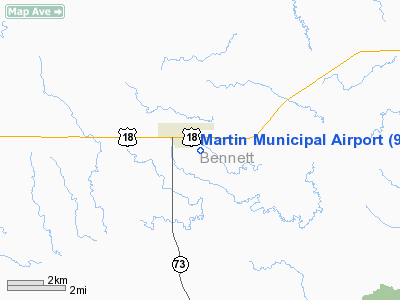
Location & QuickFacts
| FAA Information Effective: | 2008-09-25 |
| Airport Identifier: | 9V6 |
| Airport Status: | Operational |
| Longitude/Latitude: | 101-42-45.7030W/43-09-56.3070N
-101.712695/43.165641 (Estimated) |
| Elevation: | 3293 ft / 1003.71 m (Surveyed) |
| Land: | 183 acres |
| From nearest city: | 1 nautical miles SE of Martin, SD |
| Location: | Bennett County, SD |
| Magnetic Variation: | 09E (2000) |
Owner & Manager
| Ownership: | Publicly owned |
| Owner: | City Of Martin |
| Address: | Po Box 687
Martin, SD 57551 |
| Phone number: | 605-685-6525 |
| Manager: | Jack Audiss, Jr |
| Address: | Po Box 456
Martin, SD 57551 |
| Phone number: | 605-685-6197 |
Airport Operations and Facilities
| Airport Use: | Open to public |
| Wind indicator: | Yes |
| Segmented Circle: | No |
| Control Tower: | No |
| Lighting Schedule: | DUSK-DAWN
ACTVT MIRL RY 14/32 & PAPI 14 & 32 - 122.900. |
| Beacon Color: | Clear-Green (lighted land airport) |
| Landing fee charge: | No |
| Sectional chart: | Cheyenne |
| Region: | AGL - Great Lakes |
| Boundary ARTCC: | ZDV - Denver |
| Tie-in FSS: | HON - Huron |
| FSS on Airport: | No |
| FSS Toll Free: | 1-800-WX-BRIEF |
| NOTAMs Facility: | HON (NOTAM-d service avaliable) |
| Federal Agreements: | NGY |
Airport Communications
| CTAF: | 123.000 |
| Unicom: | 123.000 |
Airport Services
| Airframe Repair: | MAJOR |
| Power Plant Repair: | MAJOR |
| Bottled Oxygen: | NONE |
| Bulk Oxygen: | NONE |
Runway Information
Runway 14/32
| Dimension: | 3709 x 60 ft / 1130.5 x 18.3 m |
| Surface: | ASPH, Fair Condition |
| Weight Limit: | Single wheel: 9000 lbs. |
| Edge Lights: | Medium |
| |
Runway 14 |
Runway 32 |
| Longitude: | 101-42-59.6670W | 101-42-31.7420W |
| Latitude: | 43-10-11.5010N | 43-09-41.1110N |
| Elevation: | 3293.00 ft | 3276.00 ft |
| Alignment: | 127 | 127 |
| Traffic Pattern: | Left | Left |
| Markings: | Non-precision instrument, Good Condition | Non-precision instrument, Good Condition |
| VASI: | 2-light PAPI on left side | 2-light PAPI on left side |
| Runway End Identifier: | No | No |
| Centerline Lights: | No | No |
| Touchdown Lights: | No | No |
| Obstruction: | 17 ft road, 825.0 ft from runway, 36:1 slope to clear | , 50:1 slope to clear |
|
Radio Navigation Aids
| ID |
Type |
Name |
Ch |
Freq |
Var |
Dist |
| GRN | NDB | Gordon | | 414.00 | 09E | 30.0 nm |
Images and information placed above are from
http://www.airport-data.com/airport/9V6/
We thank them for the data!
| General Info
|
| Country |
United States
|
| State |
SOUTH DAKOTA
|
| FAA ID |
9V6
|
| Latitude |
43-09-56.307N
|
| Longitude |
101-42-45.703W
|
| Elevation |
3293 feet
|
| Near City |
MARTIN
|
We don't guarantee the information is fresh and accurate. The data may
be wrong or outdated.
For more up-to-date information please refer to other sources.
|
|


