 |
|
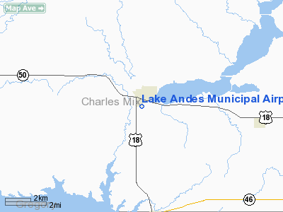
Location & QuickFacts
| FAA Information Effective: | 2008-09-25 |
| Airport Identifier: | 8D8 |
| Airport Status: | Operational |
| Longitude/Latitude: | 098-32-25.2930W/43-08-52.9760N
-98.540359/43.148049 (Estimated) |
| Elevation: | 1475 ft / 449.58 m (Surveyed) |
| Land: | 46 acres |
| From nearest city: | 1 nautical miles S of Lake Andes, SD |
| Location: | Charles Mix County, SD |
| Magnetic Variation: | 07E (1985) |
Owner & Manager
| Ownership: | Publicly owned |
| Owner: | City Of Lake Andes |
| Address: | Po Box 783
Lake Andes, SD 57356 |
| Phone number: | 605-487-7694 |
| Manager: | Cindy Mengenhauser |
| Address: | Po Box 783
Lake Andes, SD 57356 |
| Phone number: | 605-487-7952 |
Airport Operations and Facilities
| Airport Use: | Open to public |
| Wind indicator: | Yes |
| Segmented Circle: | Yes |
| Control Tower: | No |
| Landing fee charge: | No |
| Sectional chart: | Omaha |
| Region: | AGL - Great Lakes |
| Boundary ARTCC: | ZMP - Minneapolis |
| Tie-in FSS: | HON - Huron |
| FSS on Airport: | No |
| FSS Toll Free: | 1-800-WX-BRIEF |
| NOTAMs Facility: | HON (NOTAM-d service avaliable) |
| Federal Agreements: | Y1 |
Airport Communications
Airport Services
| Airframe Repair: | NONE |
| Power Plant Repair: | NONE |
| Bottled Oxygen: | NONE |
| Bulk Oxygen: | NONE |
Runway Information
Runway 12/30
| Dimension: | 2600 x 250 ft / 792.5 x 76.2 m |
| Surface: | TURF, Good Condition |
| |
Runway 12 |
Runway 30 |
| Longitude: | 098-32-38.2900W | 098-32-12.8500W |
| Latitude: | 43-09-03.9800N | 43-08-46.3000N |
| Elevation: | 1475.00 ft | 1471.00 ft |
| Traffic Pattern: | Left | Left |
| Runway End Identifier: | No | No |
| Centerline Lights: | No | No |
| Touchdown Lights: | No | No |
| Obstruction: | 17 ft road, 410.0 ft from runway, 24:1 slope to clear | 115 ft pline, 4000.0 ft from runway, 34:1 slope to clear |
|
Radio Navigation Aids
| ID |
Type |
Name |
Ch |
Freq |
Var |
Dist |
| AGZ | NDB | Wagner | | 392.00 | 08E | 12.0 nm |
| MHE | VOR/DME | Mitchell | 029X | 109.20 | 07E | 43.7 nm |
| ONL | VORTAC | O'neill | 086X | 113.90 | 10E | 41.2 nm |
Remarks
- ARPT CLSD FOR NIGHT OPNS.
- WILDLIFE ON AND INVOF ARPT.
Images and information placed above are from
http://www.airport-data.com/airport/8D8/
We thank them for the data!
| General Info
|
| Country |
United States
|
| State |
SOUTH DAKOTA
|
| FAA ID |
8D8
|
| Latitude |
43-08-52.976N
|
| Longitude |
098-32-25.293W
|
| Elevation |
1475 feet
|
| Near City |
LAKE ANDES
|
We don't guarantee the information is fresh and accurate. The data may
be wrong or outdated.
For more up-to-date information please refer to other sources.
|
|


