 |
|
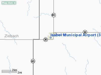
Location & QuickFacts
| FAA Information Effective: | 2008-09-25 |
| Airport Identifier: | 3Y7 |
| Airport Status: | Operational |
| Longitude/Latitude: | 101-26-14.9600W/45-23-22.3300N
-101.437489/45.389536 (Estimated) |
| Elevation: | 2398 ft / 730.91 m (Estimated) |
| Land: | 139 acres |
| From nearest city: | 0 nautical miles SW of Isabel, SD |
| Location: | Dewey County, SD |
| Magnetic Variation: | 10E (1985) |
Owner & Manager
| Ownership: | Publicly owned |
| Owner: | City Of Isabel |
| Address: | Po Box 245
Isabel, SD 57633 |
| Phone number: | 605-466-2177 |
| Manager: | Larry Simpson |
| Address: | Box 268
Isabel, SD 57633 |
| Phone number: | 605-466-2317 |
Airport Operations and Facilities
| Airport Use: | Open to public |
| Wind indicator: | Yes |
| Segmented Circle: | No |
| Control Tower: | No |
| Lighting Schedule: | DUSK-DAWN
ACTVT LIRL RY 13/31 - CTAF 5 TIMES. |
| Beacon Color: | Clear-Green (lighted land airport) |
| Landing fee charge: | No |
| Sectional chart: | Billings |
| Region: | AGL - Great Lakes |
| Boundary ARTCC: | ZMP - Minneapolis |
| Tie-in FSS: | HON - Huron |
| FSS on Airport: | No |
| FSS Toll Free: | 1-800-WX-BRIEF |
| NOTAMs Facility: | HON (NOTAM-d service avaliable) |
| Federal Agreements: | 1 |
Airport Communications
Airport Services
| Airframe Repair: | NONE |
| Power Plant Repair: | NONE |
| Bottled Oxygen: | NONE |
| Bulk Oxygen: | NONE |
Runway Information
Runway 13/31
| Dimension: | 3000 x 150 ft / 914.4 x 45.7 m |
| Surface: | TURF, Good Condition |
| Edge Lights: | Low |
| |
Runway 13 |
Runway 31 |
| Longitude: | 101-26-28.3800W | 101-26-01.5400W |
| Latitude: | 45-23-33.7300N | 45-23-10.9300N |
| Elevation: | 2386.00 ft | 2383.00 ft |
| Traffic Pattern: | Left | Left |
| Runway End Identifier: | No | No |
| Centerline Lights: | No | No |
| Touchdown Lights: | No | No |
| Obstruction: | 38 ft trees, 1216.0 ft from runway, 32:1 slope to clear
+23' POLE 200' LEFT OF EXTNDD CNTRLN. | 24 ft trees, 501.0 ft from runway, 81 ft left of centerline, 20:1 slope to clear |
|
Radio Navigation Aids
| ID |
Type |
Name |
Ch |
Freq |
Var |
Dist |
| RVB | NDB | Riverbend | | 407.00 | 09E | 44.4 nm |
| LEM | VOR | Lemmon | | 111.40 | 13E | 42.4 nm |
| DPR | VORTAC | Dupree | 115X | 116.80 | 10E | 22.1 nm |
Images and information placed above are from
http://www.airport-data.com/airport/3Y7/
We thank them for the data!
| General Info
|
| Country |
United States
|
| State |
SOUTH DAKOTA
|
| FAA ID |
3Y7
|
| Latitude |
45-23-14.929N
|
| Longitude |
101-26-31.536W
|
| Elevation |
2398 feet
|
| Near City |
ISABEL
|
We don't guarantee the information is fresh and accurate. The data may
be wrong or outdated.
For more up-to-date information please refer to other sources.
|
|


