 |
|
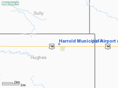
Location & QuickFacts
| FAA Information Effective: | 2008-09-25 |
| Airport Identifier: | 5G3 |
| Airport Status: | Operational |
| Longitude/Latitude: | 099-44-50.8200W/44-31-51.3550N
-99.747450/44.530932 (Estimated) |
| Elevation: | 1787 ft / 544.68 m (Estimated) |
| Land: | 80 acres |
| From nearest city: | 1 nautical miles NW of Harrold, SD |
| Location: | Hughes County, SD |
| Magnetic Variation: | 08E (1985) |
Owner & Manager
| Ownership: | Publicly owned |
| Owner: | Town Of Harrold |
| Address: | Harrold, Sd 57536
Harrold, SD 57536 |
| Phone number: | 605-875-3412 |
| Manager: | Mike Bollweg |
| Address: | P.o. Box 46
Harrold, SD 57536 |
| Phone number: | 605-875-3375 |
Airport Operations and Facilities
| Airport Use: | Open to public |
| Wind indicator: | Yes |
| Segmented Circle: | No |
| Control Tower: | No |
| Landing fee charge: | No |
| Sectional chart: | Twin Cities |
| Region: | AGL - Great Lakes |
| Boundary ARTCC: | ZMP - Minneapolis |
| Tie-in FSS: | HON - Huron |
| FSS on Airport: | No |
| FSS Toll Free: | 1-800-WX-BRIEF |
| NOTAMs Facility: | HON (NOTAM-d service avaliable) |
| Federal Agreements: | 1 |
Airport Communications
Airport Services
| Fuel available: | 100LLMOGAS
FOR FUEL PHONE 605-875-3375. |
| Airframe Repair: | MINOR |
| Power Plant Repair: | MINOR |
Runway Information
Runway 15/33
| Dimension: | 2250 x 200 ft / 685.8 x 61.0 m |
| Surface: | ASPH-TURF, Good Condition
RY 15/33 CNTR 24 FT IS CHIP SEAL. |
| Surface Treatment: | Aggregate Friction Seal Coat |
| |
Runway 15 |
Runway 33 |
| Longitude: | 099-44-56.2200W | 099-44-45.4200W |
| Latitude: | 44-32-01.7700N | 44-31-40.9400N |
| Elevation: | 1775.00 ft | 1787.00 ft |
| Alignment: | 127 | 127 |
| Traffic Pattern: | Left | Left |
| Obstruction: | 3 ft crops, 118.0 ft from runway, 39:1 slope to clear | 30 ft trees, 728.0 ft from runway, 39 ft right of centerline, 24:1 slope to clear |
|
Radio Navigation Aids
| ID |
Type |
Name |
Ch |
Freq |
Var |
Dist |
| PIR | VORTAC | Pierre | 072X | 112.50 | 11E | 19.6 nm |
Remarks
- RY 15/33 HAS CULTIVATION 105 FT BOTH SIDES OF CNTRLN OF RY.
- WILDLIFE ON AND INVOF ARPT.
Images and information placed above are from
http://www.airport-data.com/airport/5G3/
We thank them for the data!
| General Info
|
| Country |
United States
|
| State |
SOUTH DAKOTA
|
| FAA ID |
5G3
|
| Latitude |
44-31-52.939N
|
| Longitude |
099-44-51.421W
|
| Elevation |
1787 feet
|
| Near City |
HARROLD
|
We don't guarantee the information is fresh and accurate. The data may
be wrong or outdated.
For more up-to-date information please refer to other sources.
|
|


