 |
|
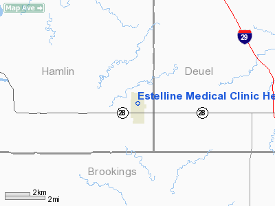
Estelline Medical Clinic Heliport |
Location & QuickFacts
| FAA Information Effective: | 2008-09-25 |
| Airport Identifier: | SD64 |
| Airport Status: | Operational |
| Longitude/Latitude: | 096-54-03.0000W/44-34-47.0000N
-96.900833/44.579722 (Estimated) |
| Elevation: | 1659 ft / 505.66 m (Estimated) |
| Land: | 0 acres |
| From nearest city: | 4 nautical miles NW of Estelline, SD |
| Location: | Hamlin County, SD |
| Magnetic Variation: | 06E (1995) |
Owner & Manager
| Ownership: | Publicly owned |
| Owner: | City Of Estelline |
| Address: | Box 129 North Main
Estelline, SD 57234 |
| Phone number: | 605-873-2231 |
| Manager: | Sanford-estelline |
| Address: | P.o. Box 196 305 N. Main
Estelline, SD 57234 |
| Phone number: | 605-873-2222 |
Airport Operations and Facilities
| Airport Use: | Private
MEDICAL USE |
| Segmented Circle: | No |
| Control Tower: | No |
| Lighting Schedule: | PHONE REQ
FOR PERIMETER LGTS CALL 605-873-2231. |
| Sectional chart: | Twin Cities |
| Region: | AGL - Great Lakes |
| Boundary ARTCC: | ZMP - Minneapolis |
| Tie-in FSS: | HON - Huron |
| FSS on Airport: | No |
| FSS Toll Free: | 1-800-WX-BRIEF |
Runway Information
Helipad H1
| Dimension: | 40 x 40 ft / 12.2 x 12.2 m |
| Surface: | ASPH, |
| |
Runway H1 |
Runway |
| Traffic Pattern: | Left | Left |
|
Radio Navigation Aids
| ID |
Type |
Name |
Ch |
Freq |
Var |
Dist |
| MDS | NDB | Wentworth | | 400.00 | 05E | 35.0 nm |
| DXX | NDB | Dawson/madison | | 341.00 | 06E | 39.2 nm |
| VVV | NDB | Ortonville | | 332.00 | 05E | 47.9 nm |
| PQN | NDB/DME | Pipestone | 028X | 284.00 | 06E | 44.2 nm |
| BKX | VOR/DME | Brookings | 025X | 108.80 | 06E | 17.0 nm |
| MML | VOR/DME | Marshall | 047X | 111.00 | 05E | 46.8 nm |
| ATY | VORTAC | Watertown | 113X | 116.60 | 09E | 26.1 nm |
Remarks
- PRVDD APCH/DEP FM 360-270; TAKEOFF/LANDING AREA MKD & LGTD FOR NIGHT OPNS; LANDING AREA LEVELED/GRADED; WIND INDICATOR MAINTAINED; LINES N OF HELI MKD & LGTD; TWO TREES E REMOVED OR TRIMED 20 FT.
Images and information placed above are from
http://www.airport-data.com/airport/SD64/
We thank them for the data!
| General Info
|
| Country |
United States
|
| State |
SOUTH DAKOTA
|
| FAA ID |
SD64
|
| Latitude |
44-34-47.000N
|
| Longitude |
096-54-03.000W
|
| Elevation |
1659 feet
|
| Near City |
ESTELLINE
|
We don't guarantee the information is fresh and accurate. The data may
be wrong or outdated.
For more up-to-date information please refer to other sources.
|
|


